GROUND WATER ATLAS of the UNITED STATES
Oklahoma, Texas
HA 730-E
Edwards-Trinity aquifer system
There are two different files for each illustration
- A 72 ppi GIF file, suitable for screen viewing is accessed through
the thumbnail image
- An eps file, suitable for downloading to be printed or edited is accessed
through the "eps file" link. Most files are Adobe Illustrator
6.0, exceptions are noted. These files have been compressed with GNU's
gzip utility. If your web browser defaults to a screen display of the file,
turn on the "Load to local disk" option before downloading. Download
and process these eps files as ascii, not binary.
Introduction
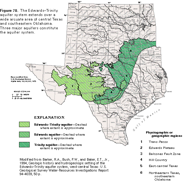
Figure 78 Map showing extent of the Edwards-Trinity aquifer system
(50K)
 editable eps file E078.eps.gz
(380K compressed)
editable eps file E078.eps.gz
(380K compressed)
Figure 79 Cross section of aquifer system (17K)
 editable eps file E079.eps.gz
(33K compressed)
editable eps file E079.eps.gz
(33K compressed)
Figure 80 Correlation chart (33K)
 editable eps file E080.eps.gz
(33K compressed)
editable eps file E080.eps.gz
(33K compressed)
Figure 81 Map showing base-of-aquifer system contour
(33K)
 editable eps file E081.eps.gz
(132K compressed)
editable eps file E081.eps.gz
(132K compressed)
Figure 82 Chart showing use of fresh ground-water withdrawals
during 1985 (17K)
 editable eps file E082.eps.gz
(17K compressed)
editable eps file E082.eps.gz
(17K compressed)
Figure 83 Map showing pumpage for irrigation from aquifer
system (33K)
 editable eps file E083.eps.gz
(132K compressed)
editable eps file E083.eps.gz
(132K compressed)
 editable eps file E078.eps.gz
(380K compressed)
editable eps file E078.eps.gz
(380K compressed) 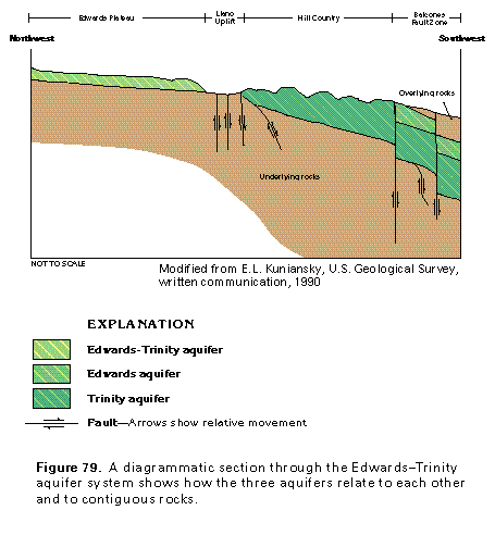 editable eps file E079.eps.gz
(33K compressed)
editable eps file E079.eps.gz
(33K compressed) 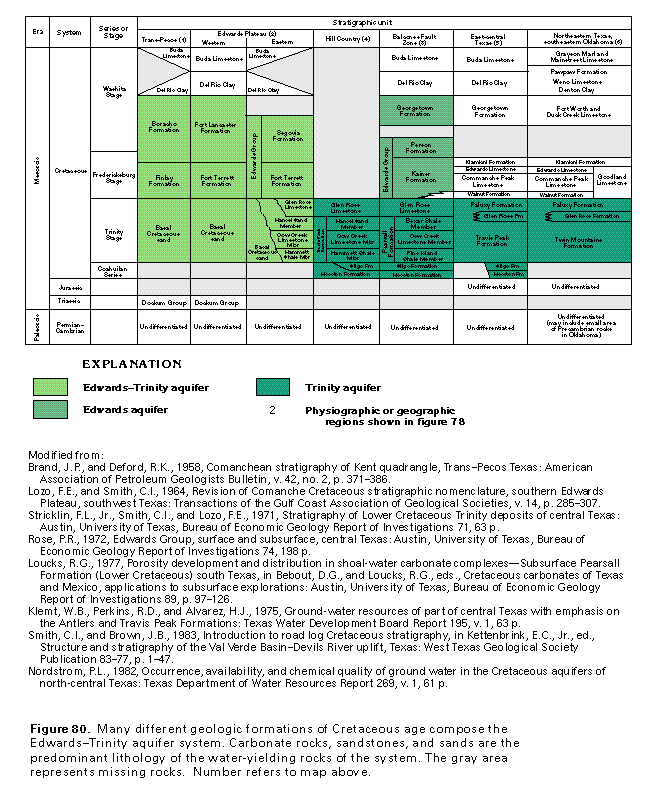 editable eps file E080.eps.gz
(33K compressed)
editable eps file E080.eps.gz
(33K compressed) 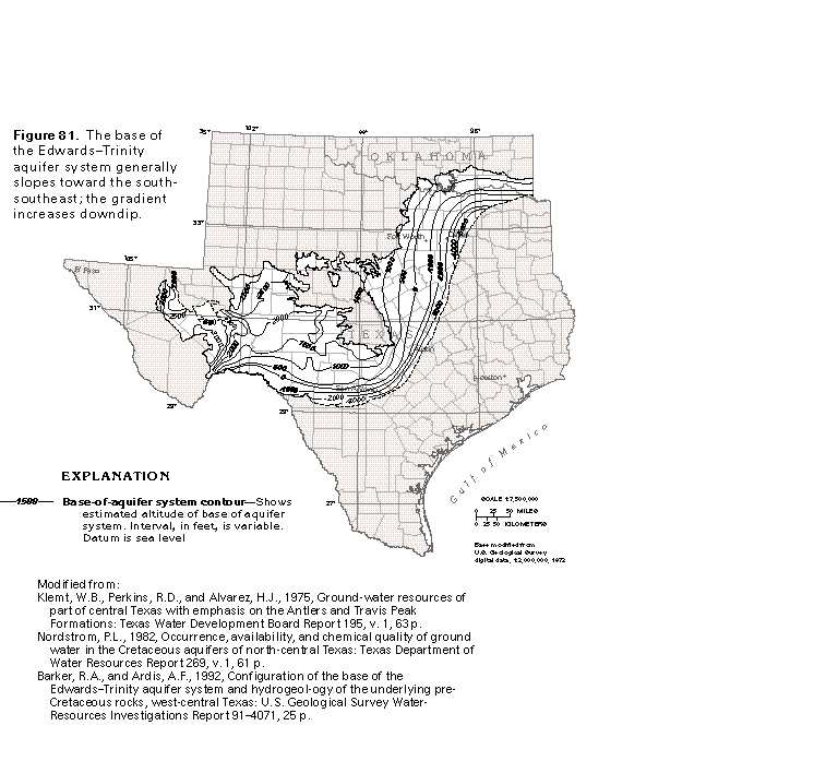 editable eps file E081.eps.gz
(132K compressed)
editable eps file E081.eps.gz
(132K compressed) 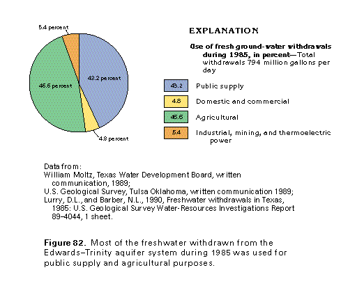 editable eps file E082.eps.gz
(17K compressed)
editable eps file E082.eps.gz
(17K compressed) 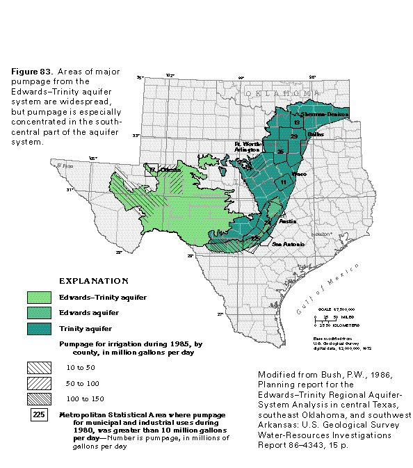 editable eps file E083.eps.gz
(132K compressed)
editable eps file E083.eps.gz
(132K compressed)