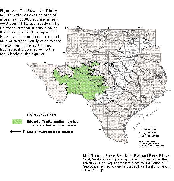
Figure 84 Map showing extent of the Edwards-Trinity aquifer (50K)
 editable eps file E084.eps.gz
(314K compressed)
editable eps file E084.eps.gz
(314K compressed)
Figure 84 Map showing extent of the Edwards-Trinity aquifer (50K)
editable eps file E084.eps.gz
(314K compressed)
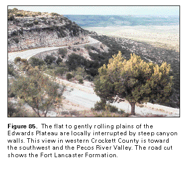 This illustration contains a placed image. Download the Adobe Illustrator
6 eps file E085.eps.gz (5.4M compressed)
which contains an imbedded Adobe Photoshop 3 (eps) file. You may also want
to download the editable Photoshop
file E085psh.eps.gz (5.4M compressed)
This illustration contains a placed image. Download the Adobe Illustrator
6 eps file E085.eps.gz (5.4M compressed)
which contains an imbedded Adobe Photoshop 3 (eps) file. You may also want
to download the editable Photoshop
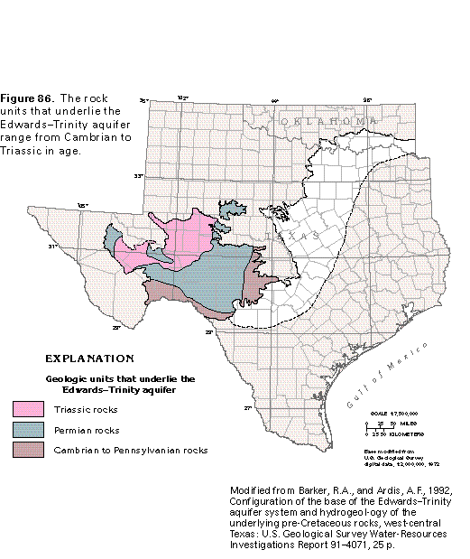
file E085psh.eps.gz (5.4M compressed) Figure 86 Map showing geologic units that underlie the aquifer (33K)
 editable eps file E086.eps.gz
(116K compressed)
editable eps file E086.eps.gz
(116K compressed)
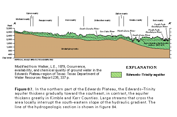 editable eps file E087.eps.gz
(50K compressed)
editable eps file E087.eps.gz
(50K compressed)  editable eps file E088.eps.gz
(281K compressed)
editable eps file E088.eps.gz
(281K compressed)  editable eps file E089.eps.gz
(281K compressed)
editable eps file E089.eps.gz
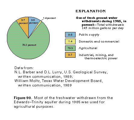
(281K compressed) Figure 90 Chart showing the use of fresh ground-water withdrawals during
1985 (17K)
 editable eps file E090.eps.gz
(17K compressed)
editable eps file E090.eps.gz
(17K compressed)