GROUND WATER ATLAS of the UNITED STATES
Oklahoma, Texas
HA 730-E
Pecos River Basin alluvial aquifer
There are two different files for each illustration
- A 72 ppi GIF file, suitable for screen viewing is accessed through
the thumbnail image
- An eps file, suitable for downloading to be printed or edited is accessed
through the "eps file" link. Most files are Adobe Illustrator
6.0, exceptions are noted. These files have been compressed with GNU's
gzip utility. If your web browser defaults to a screen display of the file,
turn on the "Load to local disk" option before downloading. Download
and process these eps files as ascii, not binary.
Hydrogeology
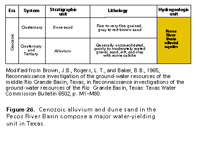
Figure 26 Correlation chart (17K)
 editable eps file E026.eps.gz
(17K compressed)
editable eps file E026.eps.gz
(17K compressed)
Figure 27 Cross section showing thickness of the Pecos River
Basin alluvial aquifer (17K)
 editable eps file E027.eps.gz
(33K compressed)
editable eps file E027.eps.gz
(33K compressed)
Figure 28 Map showing base-of-aquifer contour (33K)
 editable eps file E028.eps.gz
(50K compressed)
editable eps file E028.eps.gz
(50K compressed)
Figure 29 Map showing potentiometric contour (33K)
 editable eps file E029.eps.gz
(50K compressed)
editable eps file E029.eps.gz
(50K compressed)
Figure 30 Map showing saturated thickness of the aquifer
(33K)
 editable eps file E030.eps.gz
(50K compressed)
editable eps file E030.eps.gz
(50K compressed)
 editable eps file E026.eps.gz
(17K compressed)
editable eps file E026.eps.gz
(17K compressed) 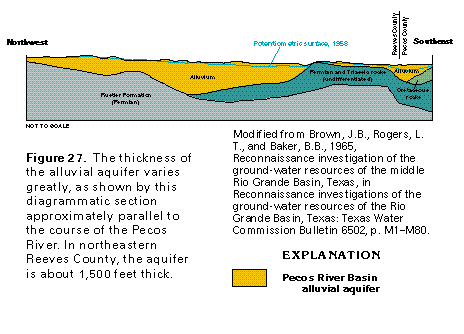 editable eps file E027.eps.gz
(33K compressed)
editable eps file E027.eps.gz
(33K compressed) 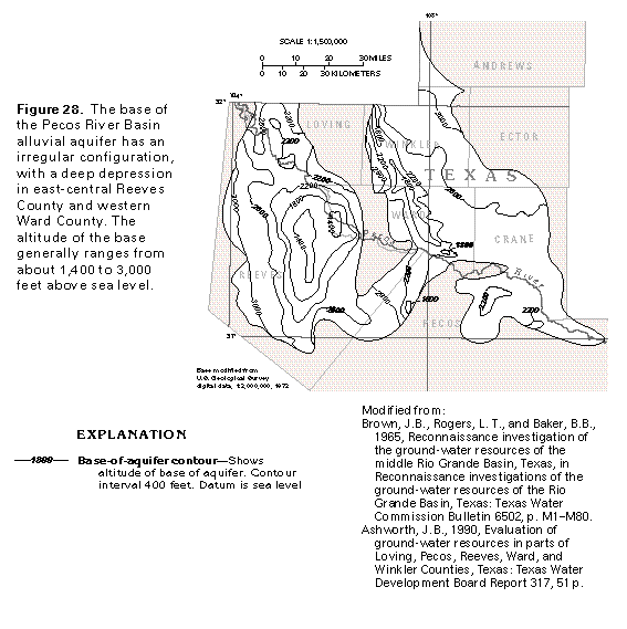 editable eps file E028.eps.gz
(50K compressed)
editable eps file E028.eps.gz
(50K compressed) 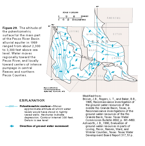 editable eps file E029.eps.gz
(50K compressed)
editable eps file E029.eps.gz
(50K compressed) 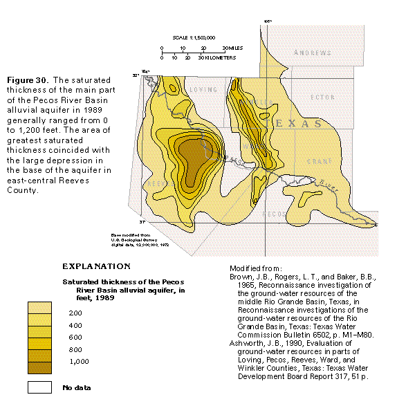 editable eps file E030.eps.gz
(50K compressed)
editable eps file E030.eps.gz
(50K compressed)