GROUND WATER ATLAS of the UNITED STATES
Arkansas, Louisiana, Mississippi
HA 730-F
Surficial aquifer system
There are two different files for each illustration
- A 72 ppi GIF file, suitable for screen viewing is accessed through
the thumbnail image
- An eps file, suitable for downloading to be printed or edited is accessed
through the "eps file" link. Most files are Adobe Illustrator
6.0, exceptions are noted. These files have been compressed with GNU's
gzip utility. If your web browser defaults to a screen display of the file,
turn on the "Load to local disk" option before downloading. Download
and process these eps files as ascii, not binary.
Well yield, pumpage, and long-term water-level decline
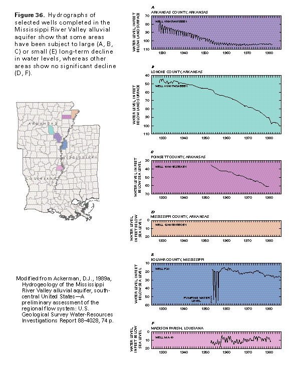
Figure 36 Hydrographs of selected wells (97K)
 editable eps file F036.eps.gz
(291K compressed)
editable eps file F036.eps.gz
(291K compressed)
Figure 37 Photo of well (97K)
 This illustration contains a placed image. Download the Adobe Illustrator
6 eps file F037.eps.gz (3.3M compressed)
which contains an imbedded Adobe Photoshop 3 (eps) file. You may also want
to download the editable Photoshop
file F037psh.eps.gz (3.3M compressed)
This illustration contains a placed image. Download the Adobe Illustrator
6 eps file F037.eps.gz (3.3M compressed)
which contains an imbedded Adobe Photoshop 3 (eps) file. You may also want
to download the editable Photoshop
file F037psh.eps.gz (3.3M compressed)
Figure 38 Graph showing rates of ground-water pumpage
for select counties (97K)
 editable eps file F038.eps.gz
(194K compressed)
editable eps file F038.eps.gz
(194K compressed)
Figure 39A Map showing pumpage from wells during 1940
(116K)
 editable eps
file F039A.eps.gz (347K compressed)
editable eps
file F039A.eps.gz (347K compressed)
Figure 39B Map showing water-level decline from 1900
to 1942 (116K)
editable eps
file F039B.eps.gz (347K compressed)
Figure 39C Map showing pumpage from wells during 1960
(116K)
editable eps
file F039C.eps.gz (347K compressed)
Figure 39D Map showing water-level decline from 1900
to 1962 (116K)
editable eps
file F039D.eps.gz (347K compressed)
Figure 39E Map showing pumpage from wells during 1980
(116K)
editable eps
file F039E.eps.gz (347K compressed)
Figure 39F Map showing water-level decline from 1900
to 1982 (116K)
editable eps
file F039F.eps.gz (347K compressed)
 editable eps file F036.eps.gz
(291K compressed)
editable eps file F036.eps.gz
(291K compressed) 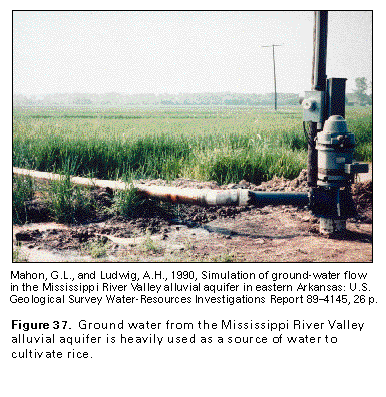 This illustration contains a placed image. Download the Adobe Illustrator
6 eps file F037.eps.gz (3.3M compressed)
which contains an imbedded Adobe Photoshop 3 (eps) file. You may also want
to download the editable Photoshop
file F037psh.eps.gz (3.3M compressed)
This illustration contains a placed image. Download the Adobe Illustrator
6 eps file F037.eps.gz (3.3M compressed)
which contains an imbedded Adobe Photoshop 3 (eps) file. You may also want
to download the editable Photoshop
file F037psh.eps.gz (3.3M compressed) 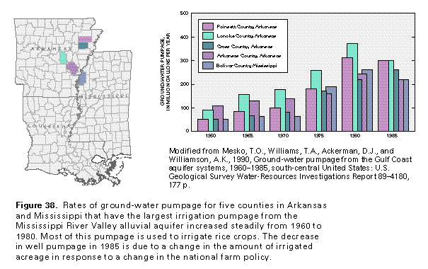 editable eps file F038.eps.gz
(194K compressed)
editable eps file F038.eps.gz
(194K compressed) 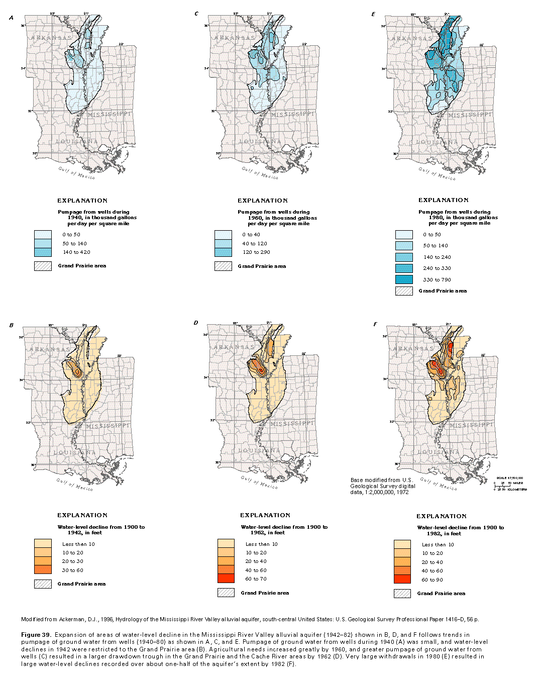 editable eps
file F039A.eps.gz (347K compressed)
editable eps
file F039A.eps.gz (347K compressed)