GROUND WATER ATLAS of the UNITED STATES
Idaho, Oregon, Washington
HA 730-H
Great Basin regional aquifer system
There are two different files for each illustration
- A 90 ppi JPEG file, suitable for screen viewing is accessed
through the thumbnail image.
- A tiff file is accessed through the "tiff file"
link. All files are Adobe Photoshop. These files have been compressed
with GNU's gzip utility. If your web browser defaults to a screen
display of the file, turn on the "Load to local disk"
option before downloading. Download and process these tiff files
as ascii, not binary.
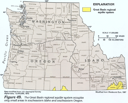
Figure 49 Map showing location of the
Great Basin regional aquifer system (248K)
 downloadable tiff file H049.tif.gz (1.8MB
compressed)
downloadable tiff file H049.tif.gz (1.8MB
compressed)
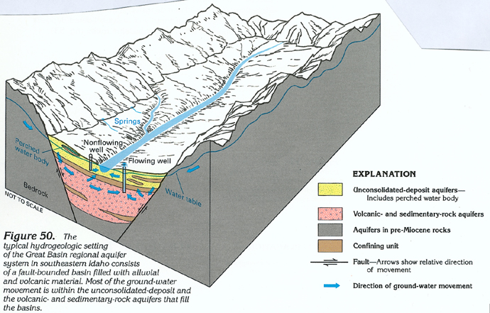
Figure 50 Cross section showing typical
hydrogeologic setting of the Great Basin regional aquifer system
(272K)
 downloadable tiff file H050.tif.gz (1.9MB
compressed)
downloadable tiff file H050.tif.gz (1.9MB
compressed)
Figure 51 Map showing development of the
Great Basin regional aquifer system in southeastern Idaho (436K)
 downloadable tiff file H051.tif.gz (3.7MB
compressed)
downloadable tiff file H051.tif.gz (3.7MB
compressed)
Table 1 Table showing ground water conditions
in the Great Basin aquifers (208K)
 downloadable tiff file Htab1.tif.gz (1.3MB
compressed)
downloadable tiff file Htab1.tif.gz (1.3MB
compressed)
Return to Great Basin regional
aquifer system text
Return to HA 730-H table of contents
Return to Ground Water Atlas home page
 downloadable tiff file H050.tif.gz (1.9MB
compressed)
downloadable tiff file H050.tif.gz (1.9MB
compressed) 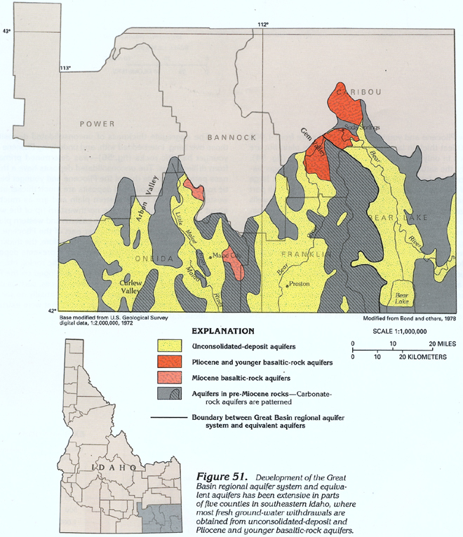 downloadable tiff file H051.tif.gz (3.7MB
compressed)
downloadable tiff file H051.tif.gz (3.7MB
compressed) 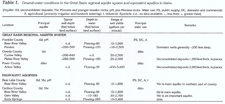 downloadable tiff file Htab1.tif.gz (1.3MB
compressed)
downloadable tiff file Htab1.tif.gz (1.3MB
compressed)