GROUND WATER ATLAS of the UNITED STATES
Idaho, Oregon, Washington
HA 730-H
Puget-Willamette Trough regional aquifer system
There are two different files for each illustration
- A 90 ppi JPEG file, suitable for screen viewing is accessed
through the thumbnail image.
- A tiff file is accessed through the "tiff file"
link. All files are Adobe Photoshop. These files have been compressed
with GNU's gzip utility. If your web browser defaults to a screen
display of the file, turn on the "Load to local disk"
option before downloading. Download and process these tiff files
as ascii, not binary.
Figure 83 Map showing location of the
Puget-Willamette Trough (272K)
 downloadable tiff file H083.tif.gz (2MB
compressed)
downloadable tiff file H083.tif.gz (2MB
compressed)
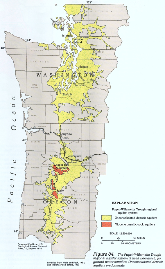
Figure 84 Map showing areal extent of the
Puget-Willamette Trough regional aquifer system (424K)
 downloadable tiff file H084.tif.gz (3.6MB
compressed)
downloadable tiff file H084.tif.gz (3.6MB
compressed)
Figure 85 Cross-section showing unconsolidated-deposits
in the Puget Sound lowland (284K)
 downloadable tiff file H085.tif.gz (2MB
compressed)
downloadable tiff file H085.tif.gz (2MB
compressed)
Figure 86 Cross-section showing well construction
on Camano Island in Puget Sound (164K)
 downloadable tiff file H086.tif.gz (1MB
compressed)
downloadable tiff file H086.tif.gz (1MB
compressed)
Figure 87 Map showing thickness of the unconsolidated-deposits
in Willamette River Valley (240K)
 downloadable tiff file H087.tif.gz (2.1MB
compressed)
downloadable tiff file H087.tif.gz (2.1MB
compressed)
Figure 88 Cross-section showing unconsolidated-deposit
aquifers located east of Portland, Oregon (228K)
 downloadable tiff file H088.tif.gz (1.7MB
compressed)
downloadable tiff file H088.tif.gz (1.7MB
compressed)
Table 5 Chart showing ground-water conditions
in the Puget-Willamette Trough (408K)
 downloadable tiff file Htab5.tif.gz (2.9MB
compressed)
downloadable tiff file Htab5.tif.gz (2.9MB
compressed)
Return to Puget-Willamette Trough
regional aquifer system text
Return to HA 730-H table of contents
Return to Ground Water Atlas home page

 downloadable tiff file H084.tif.gz (3.6MB
compressed)
downloadable tiff file H084.tif.gz (3.6MB
compressed) 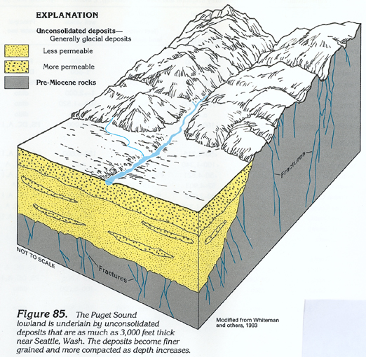 downloadable tiff file H085.tif.gz (2MB
compressed)
downloadable tiff file H085.tif.gz (2MB
compressed) 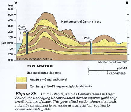 downloadable tiff file H086.tif.gz (1MB
compressed)
downloadable tiff file H086.tif.gz (1MB
compressed) 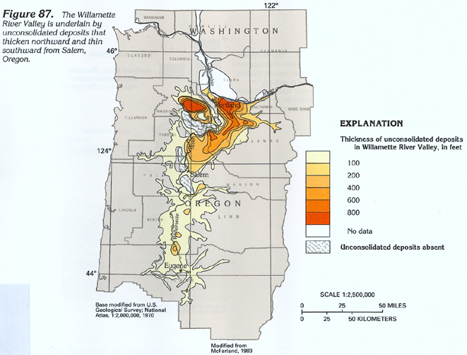 downloadable tiff file H087.tif.gz (2.1MB
compressed)
downloadable tiff file H087.tif.gz (2.1MB
compressed)  downloadable tiff file H088.tif.gz (1.7MB
compressed)
downloadable tiff file H088.tif.gz (1.7MB
compressed) 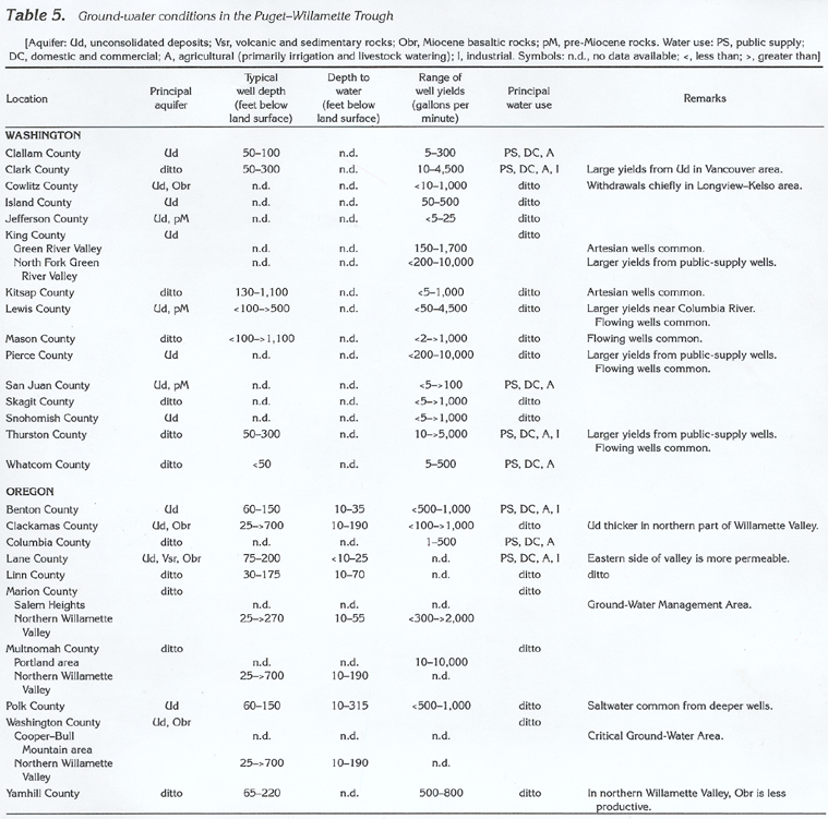 downloadable tiff file Htab5.tif.gz (2.9MB
compressed)
downloadable tiff file Htab5.tif.gz (2.9MB
compressed)