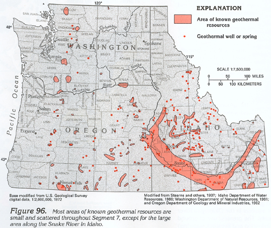
Parts of Idaho, Oregon, and Washington have known geothermal resources (fig. 96) that are particularly valuable in Boise, Idaho, and Klamath Falls, Oreg., where the resource has been used for space heating since the late 1890's. The temperature of geothermal water is appreciably higher than the local mean annual air temperature. In Idaho, geothermal water can be so hot that it needs to be cooled before it can be used for irrigation.
Geothermal water can contain excessive concentrations of sodium that decrease the permeability of fine-grained soils by breaking apart the clay minerals in the soil, which results in the formation of a layer of caliche or hardpan. Some geothermal water contains excessive concentrations of other dissolved minerals, such as calcium, sulfate, chloride, fluoride, arsenic, and iron, most of which were dissolved from the silicic volcanic rocks that compose the geothermal reservoir or from the fine-grained unconsolidated deposits that overlie the geothermal reservoir.
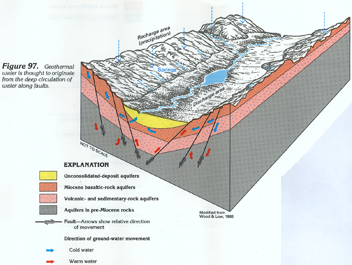
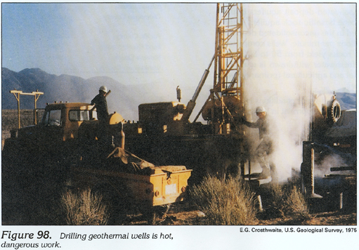
One theory of the origin of geothermal water, which generally is under confined conditions, is shown in figure 97. Precipitation in highland areas recharges the aquifer system, and the ground water moves to great depth, mainly along faults. At some depth, the downward-circulating water is warmed (average temperature in the Earth increases at a rate of about 1 degree Fahrenheit for each 60 to 100 feet of depth) to the point where it becomes lighter than the overlying water. The warm water then moves upward along faults, where it is intercepted by wells, or discharges to springs. Areas with successful geothermal wells are shown in figure 96. Many, such as the well shown being drilled in figure 98, were drilled at sites of geothermal springs.
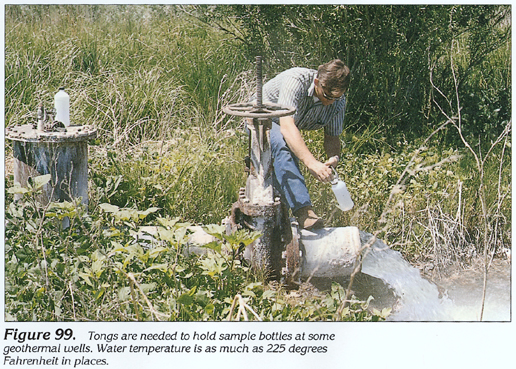
During the 1970's, considerable attention was given to developing additional geothermal resources in Idaho and Oregon. As a result, water-level measuring and water-sampling programs were initiated to monitor hydraulic-head changes in the aquifers and geothermal-water quality. A typical technique for sampling geothermal wells is to hold the sampling device with tongs to avoid being scalded by the hot water (fig. 99). A geothermal well near Vale in Malheur County, Oreg., produced water with a temperature of 225 degrees Fahrenheit.
Most of the geothermal systems developed are used for space heating, food processing, and aquaculture. Some geothermal wells yield small quantities of methane, which is used in a few places in Idaho for cooking and heating.
The volume of water in geothermal systems is small relative
to that in cold-water systems. For this reason, reinjecting water
withdrawn from geothermal systems into the aquifer can decrease
pressure loss and alleviate water-level declines.