GROUND WATER ATLAS of the UNITED STATES
Illinois, Indiana, Kentucky, Ohio, Tennessee
HA 730-K
Appalachian Plateaus aquifers
There are two different files for each illustration
- A 72 ppi GIF file, suitable for screen viewing is accessed through
the thumbnail image
- An eps file, suitable for downloading to be printed or edited is accessed
through the "eps file" link. Most files are Adobe Illustrator
6.0, exceptions are noted. These files have been compressed with GNU's
gzip utility. If your web browser defaults to a screen display of the file,
turn on the "Load to local disk" option before downloading. Download
and process these eps files as ascii, not binary.
Introduction
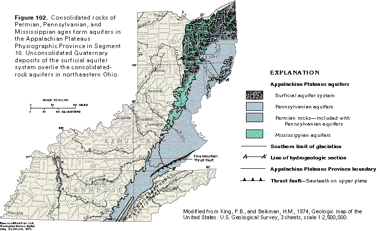
Figure 102 Map of Appalachian Plateaus aquifers (50K)
 editable eps file k102.eps.gz
(198K compressed)
editable eps file k102.eps.gz
(198K compressed)
Figure 103 Correlation chart (50K)
 editable eps file k103.eps.gz
(50K compressed)
editable eps file k103.eps.gz
(50K compressed)
Figure 104 Cross section of Paleozoic rocks (17K)
 editable eps file k104.eps.gz
(17K compressed)
editable eps file k104.eps.gz
(17K compressed)
Figure 105 Cross section showing movement along faults (17K)
 editable eps file k105.eps.gz
(17K compressed)
editable eps file k105.eps.gz
(17K compressed)
 editable eps file k102.eps.gz
(198K compressed)
editable eps file k102.eps.gz
(198K compressed)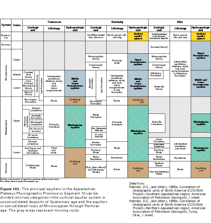 editable eps file k103.eps.gz
(50K compressed)
editable eps file k103.eps.gz
(50K compressed) 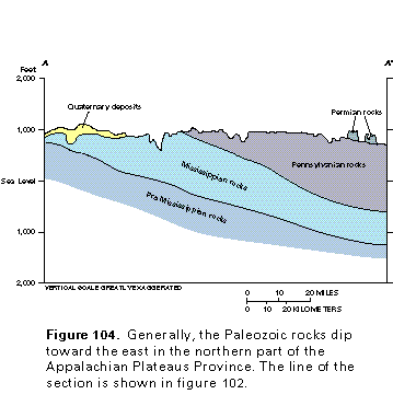 editable eps file k104.eps.gz
(17K compressed)
editable eps file k104.eps.gz
(17K compressed) 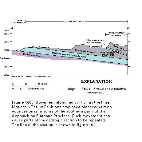 editable eps file k105.eps.gz
(17K compressed)
editable eps file k105.eps.gz
(17K compressed)