Figure 131 Map showing the thickness of the upper Claiborne aquifer (33K)
 editable eps file k131.eps.gz
(50K compressed)
editable eps file k131.eps.gz
(50K compressed)
Figure 131 Map showing the thickness of the upper Claiborne aquifer
(33K)
editable eps file k131.eps.gz
(50K compressed)
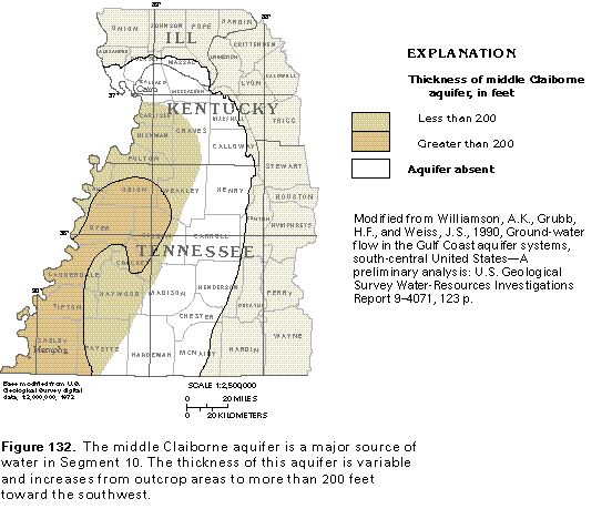
Figure 132 Map showing the thickness of the middle Claiborne aquifer
(33K)
 editable eps file k132.eps.gz
(33K compressed)
editable eps file k132.eps.gz
(33K compressed)
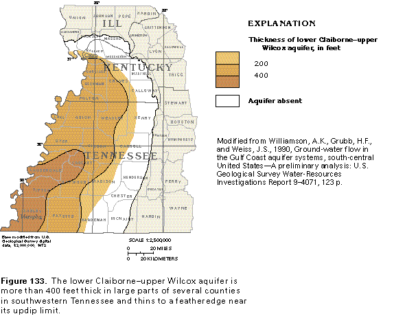
Figure 133 Map showing the thickness of the lower Claiborne-upper
Wilcox aquifer (33K)
 editable eps file k133.eps.gz
(50K compressed)
editable eps file k133.eps.gz
(50K compressed)
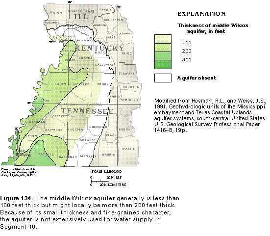
Figure 134 Map showing the thickness of the middle Wilcox aquifer
(33K)
 editable eps file k134.eps.gz
(50K compressed)
editable eps file k134.eps.gz
(50K compressed)
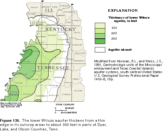
Figure 135 Map showing the thickness of the lower Wilcox aquifer
(33K)
 editable eps file k135.eps.gz
(50K compressed)
editable eps file k135.eps.gz
(50K compressed)
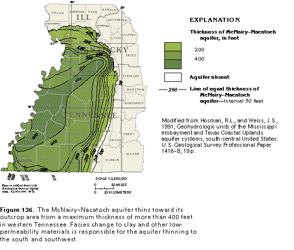
Figure 136 Map showing the thickness of the McNairy-Nacatoch
aquifer(33K)
 editable eps file k136.eps.gz
(50K compressed)
editable eps file k136.eps.gz
(50K compressed)
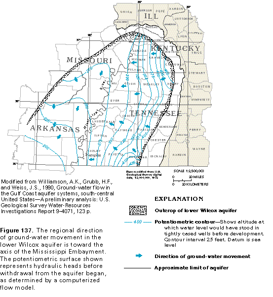
Figure 137 Map showing potentiometric surface (33K)
 editable eps file k137.eps.gz
(83K compressed)
editable eps file k137.eps.gz
(83K compressed)