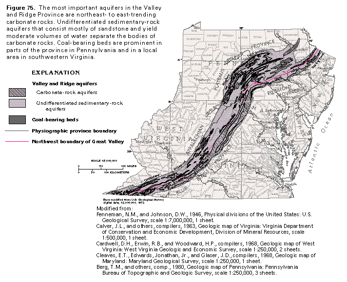
Figure 75 Map of Valley and Ridge aquifers (314K)
 editable eps file L075.eps.gz
(347K compressed)
editable eps file L075.eps.gz
(347K compressed)
Figure 75 Map of Valley and Ridge aquifers (314K)
editable eps file L075.eps.gz
(347K compressed)
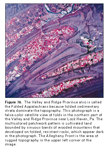 This illustration contains a placed image. Download the Adobe Illustrator
6 eps file L076.eps.gz (8.2M compressed)
which contains an imbedded Adobe Photoshop 3 (eps) file. You may also want
to download the editable Photoshop
file L076psh.eps.gz (8.2M compressed)
This illustration contains a placed image. Download the Adobe Illustrator
6 eps file L076.eps.gz (8.2M compressed)
which contains an imbedded Adobe Photoshop 3 (eps) file. You may also want
to download the editable Photoshop
file L076psh.eps.gz (8.2M compressed) 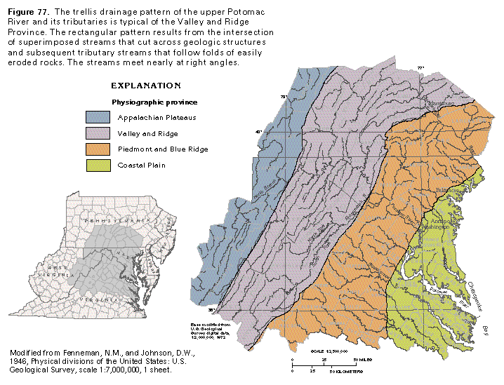 editable eps file L077.eps.gz
(314K compressed)
editable eps file L077.eps.gz
(314K compressed) 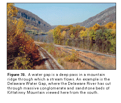 This illustration contains a placed image. Download the Adobe Illustrator
6 eps file L078.eps.gz (6.2M compressed)
which contains an imbedded Adobe Photoshop 3 (eps) file. You may also want
to download the editable Photoshop
file L078psh.eps.gz (6.2M compressed)
This illustration contains a placed image. Download the Adobe Illustrator
6 eps file L078.eps.gz (6.2M compressed)
which contains an imbedded Adobe Photoshop 3 (eps) file. You may also want
to download the editable Photoshop
file L078psh.eps.gz (6.2M compressed)  This illustration contains a placed image. Download the Adobe Illustrator
6 eps file L079.eps.gz (5.3M compressed)
which contains an imbedded Adobe Photoshop 3 (eps) file. You may also want
to download the editable Photoshop
file L079psh.eps.gz (5.3M compressed)
This illustration contains a placed image. Download the Adobe Illustrator
6 eps file L079.eps.gz (5.3M compressed)
which contains an imbedded Adobe Photoshop 3 (eps) file. You may also want
to download the editable Photoshop
file L079psh.eps.gz (5.3M compressed)