GROUND WATER ATLAS of the UNITED STATES
Alaska, Hawaii, Puerto Rico and the U. S. Virgin Islands
HA 730-N
Hawaii Regional summary
There are two different files for each illustration
- A 72 ppi GIF file, suitable for screen viewing is accessed
through the thumbnail image.
- An eps file, suitable for downloading to be printed or edited
is accessed through the "eps file" link. Most files
are Adobe Illustrator 6.0, exceptions are noted. These files
have been compressed with GNU's gzip utility. If your web browser
defaults to a screen display of the file, turn on the "Load
to local disk" option before downloading. Download and process
these eps files as ascii, not binary.
Water-Level Fluctuations
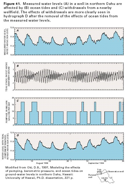
Figure 41 Graphs showing that water levels in a well
in northern Oahu are affected by ocean tides and withdrawals from
a nearby wellfields (35K)
 editable eps
file N041.eps.gz (404K compressed)
editable eps
file N041.eps.gz (404K compressed)
Figure 42 Graphs showing that water levels
in southern Oahu have declined over time (21K)
 editable eps
file N042.eps.gz (252K compressed)
editable eps
file N042.eps.gz (252K compressed)
Figure 43 Graph showing water levels in
a well in central Oahu fluctuating in response to changes in rainfall
(20K)
 editable eps
file N043.eps.gz (27K compressed)
editable eps
file N043.eps.gz (27K compressed)
Figure 44 Graph showing that the discharge
of springs that issue from the volcanic-rock aquifer in the Pearl
Harbor area varies directly with changes in aquifer water level
(13K)
 editable eps
file N044.eps.gz (23K compressed)
editable eps
file N044.eps.gz (23K compressed)
 editable eps
file N041.eps.gz (404K compressed)
editable eps
file N041.eps.gz (404K compressed) 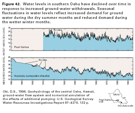 editable eps
file N042.eps.gz (252K compressed)
editable eps
file N042.eps.gz (252K compressed) 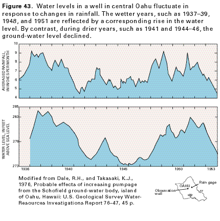 editable eps
file N043.eps.gz (27K compressed)
editable eps
file N043.eps.gz (27K compressed) 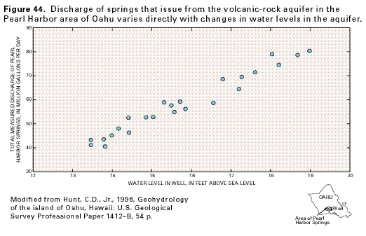 editable eps
file N044.eps.gz (23K compressed)
editable eps
file N044.eps.gz (23K compressed)