Miscellaneous Investigations Series I-1420 (NM-13)
Abstract
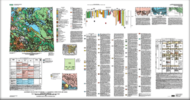
For scientific purposes, the map differentiates Quaternary surficial deposits and materials on the basis of clast lithology or composition, matrix texture or particle size, structure, genesis, stratigraphic relations, engineering geologic properties, and relative age, as shown on the correlation diagram and indicated in the “Description of Map Units.” Deposits of some constructional landforms, such as end moraines, are distinguished as map units. Deposits of erosional landforms, such as outwash terraces, are not distinguished, although glaciofluvial, ice-contact, fluvial, and lacustrine deposits that are mapped may be terraced. Differentiation of sequences of fluvial and glaciofluvial deposits at this scale is not possible. For practical purposes, the map is a surficial materials map. Materials are distinguished on the basis of lithology or composition, texture or particle size, and other physical, chemical, and engineering characteristics. It is not a map of soils that are recognized and classified in pedology or agronomy. Rather, it is a generalized map of soils as recognized in engineering geology, or of substrata or parent materials in which pedologic or agronomic soils are formed. As a materials map, it serves as a base from which a variety of maps for use in planning engineering, land-use planning, or land-management projects can be derived and from which a variety of maps relating to earth surface processes and Quaternary geologic history can be derived. 1 Present affiliation: Wisconsin Geological and Natural History Survey, Madison, Wis. |
Version 1.0 Posted October 2007
This text-only version of the map is accessible as defined by Section 508.
|
Fullerton, D.S., Christiansen, E.A., Schreiner, B.T., Colton, R.B., and Clayton, Lee, 2007, Quaternary geologic map of the Regina 4° x 6° quadrangle, United States and Canada: U.S. Geological Survey Miscellaneous Investigations Series Map I-1420 (NM-13), 37 p., scale 1:1,000,000, pamphlet 39 p.

![]() U.S. Department of the Interior | U.S. Geological Survey
U.S. Department of the Interior | U.S. Geological Survey
URL: http://pubsdata.usgs.gov/pubs/imap/i-1420/nm-13/index.html
Questions or Assistance: Contact USGS
Last modified: Wednesday, 30-Nov-2016 17:34:13 EST
