
Online Version 1.0
The PDF file of the map will produce a plot that faithfully replicates the format, symbols, colors, and line work of a USGS full-color printed map. (The actual published paper map is a 4-color offset-printed map.) The file size is 7.7 MB, and page size at 100% is approximately 58" by 42". Plot resolution, quality, and colors will vary with plotter, inks, and paper used. Adobe Acrobat Reader 4 is required to read the map. Acrobat Reader 3 cannot display the maps because the page size exceeds the program's capabilities.
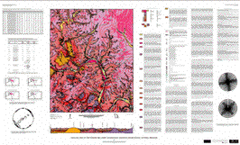
PDF file of Geologic Investigations Series Map I-2722 [7.7 MB]
If you wish to download the latest version of Acrobat Reader free of charge, click here.

The following export files are presented in two projections: geographic coordinates and UTM NAD83. All files with a *83.e00 name are in Arc export format, with a UTM projection, zone 15, units in meters, datum NAD83, and spheroid GRS80. All files with a *.e00 name (in separate volume) are in Arc export format, with a geographic projection, units in decimal degrees, datum NAD27, and spheroid Clarke1866.The files have been compressed in two separate volumes:
Geographic coordinates: proj_dd.zip [4.2 MB]
NAD83 coordinates: proj_utm.zip [4.5 MB]
If you wish to download the latest version of ArcExplorer, the lightweight GIS data viewer developed by ESRI, free of charge, click here.

The offset-printed version of this map is available for purchase from USGS Information Services. See Ordering U.S. Geological Survey Products, call toll-free (from the U.S.) 1-888-ASK-USGS, or e-mail infoservices@usgs.gov.