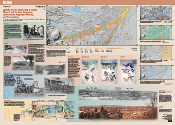
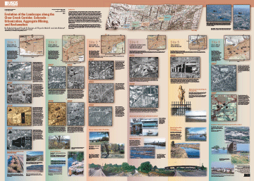
Evolution of the Landscape along the Clear Creek Corridor, Colorado—Urbanization, Aggregate Mining, and Reclamation
By Belinda Arbogast, Daniel H. Knepper, Jr., Roger A. Melick, and John Hickman
Version 1.0
PDF files for viewing and printing:
Sheet 1 - Map PDF file (not Section 508 accessible;1.81
MB)
Sheet 1 - Text-only map PDF file (Section 508 accessible;
29 KB)
Sheet 2 - Map PDFfile (not Section 508 accessible;
2.38 MB)
Sheet 2 - Text-only map PDF file (Section
508 accessible; 35 KB)
Pamphlet PDF file (not Section 508 accessible; 15.49
MB)
Pamphlet Text-only PDF file (Section 508 accessible;
636 KB)
Metadata file:
Metadata text file (21 KB)
Download GIS files:
GZIPPED TAR archive of ArcInfo files,
metadata, readme file (1.79 MB)
ZIPPED archive of ArcInfo files, metadata,
readme file (1.78 MB)
GZIPPED TAR archive of georeferenced image
files of base map (2.15 MB)
ZIPPED archive of georeferenced image files
of base map (2.15 MB)
This online edition of this publication consists of a digital database, metadata, PDF files of the two map sheets, and PDF files of the accompanying text pamphlet.
High-quality, full-color printed copies of this publication can be purchased at Information Services, U.S. Geological Survey (1-888-ASK-USGS).
| AccessibilityFOIAPrivacyPolicies and Notices | |
| |
|