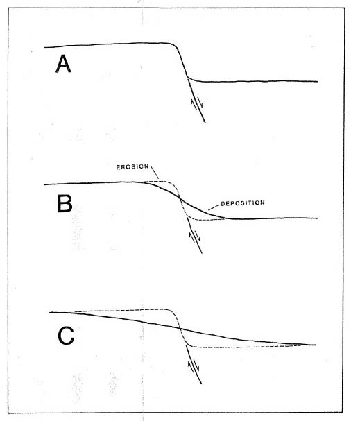
Figure 5. Topographic profiles across a hypothetical fault in the Houston area. A, shortly after displacement of the land surface. Scarp is sharp and has a steep slope. B, the same fault scarp modified by erosion. Material eroded from the upthrown side is deposited near the base of the scarp. The scarp now has a rounded form and a relatively gentle slope. Location of the fault trace in the absence of structural damage can only be approximated. C, fault scarp after grading for construction or after preparation of a field for rice cultivation. The scarp is all but destroyed; only a gentle slope remains in its place. The elevation difference between the upthrown and downthrown fault blocks remains, but the location of the underlying fault can only be estimated within broad limits because of extensive modification of the original topography.