
U.S. Geological Survey Open-File Report 94-152
Online version 1.0
By James M. Robb
U.S. Geological Survey, Woods Hole, MA 02543(jrobb@usgs.gov)
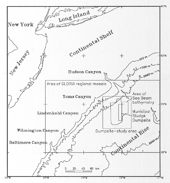 The sea-floor of a dumpsite area offshore New York and New Jersey
(Deep-water dumpsite 106) was studied using detailed bathymetry,
sidescan-sonar images, subbottom profiles, bottom photographs, and
bottom-sediment samples. These data show that this continental rise
area contains deposits of submarine landslides and pathways of sediment
gravity flows. Images of the sea floor obtained with a deep-towed
high-resolution sidescan sonar system show offshore-trending furrowed
surfaces over parts of the area. If such furrows are old, one might
expect them to have been obliterated by sediment resuspension and
redeposition due to the mostly gentle contour-parallel bottom currents
that are measured in the present day. While most of the sea-floor
features were probably formed during Pleistocene or early Holocene
(glacial or early post-glacial) times, our information suggests that
vigorous present-day episodes of offshore-directed transport may
continue to occur, at unknown intervals.
The sea-floor of a dumpsite area offshore New York and New Jersey
(Deep-water dumpsite 106) was studied using detailed bathymetry,
sidescan-sonar images, subbottom profiles, bottom photographs, and
bottom-sediment samples. These data show that this continental rise
area contains deposits of submarine landslides and pathways of sediment
gravity flows. Images of the sea floor obtained with a deep-towed
high-resolution sidescan sonar system show offshore-trending furrowed
surfaces over parts of the area. If such furrows are old, one might
expect them to have been obliterated by sediment resuspension and
redeposition due to the mostly gentle contour-parallel bottom currents
that are measured in the present day. While most of the sea-floor
features were probably formed during Pleistocene or early Holocene
(glacial or early post-glacial) times, our information suggests that
vigorous present-day episodes of offshore-directed transport may
continue to occur, at unknown intervals.