
By USGS Auburn Project Review Team 1
U.S. Geological Survey Open File Report 96-0011
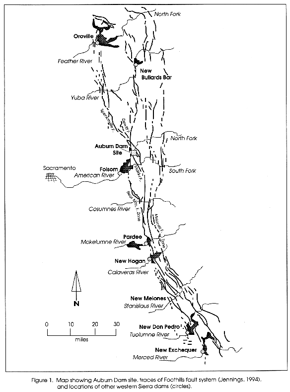
In 1991 the U.S. Army Corps of Engineers (the Corps), under instructions from Congress to study alternative means of flood control on the American River, issued a report (U.S. Army Corps of Engineers, 1991) recommending construction of a concrete gravity flood-control dam near the site of the previously proposed Auburn Dam. In 1995 the Corps issued a Supplemental Information Report (U.S. Army Corps of Engineers, 1995) giving additional information on the project. For these planning studies the Corps used the design values approved by the Secretary of the Interior in 1979. These were a maximum displacement of 9 inches on a fault intersecting the dam foundation, a maximum earthquake at the site of magnitude 6.5, a peak horizontal acceleration of 0.64 g, and a peak vertical acceleration of 0.39 g.
The USGS was requested by the U.S. Department of the Interior to review the Corps 1991 and 1995 reports with the goal of evaluating the seismic design values and the issue of reservoir induced seismicity in light of a) geological and seismological investigations conducted in the western Sierran foothills since 1979 and b) present understanding of how faults behave and earthquakes occur. The USGS assembled a team of geologists and geophysicists with a broad range of knowledge of the scientific issues associated with the project. The team reviewed the 1991 and 1995 Corps reports for the newly proposed Auburn Dam as well as those for the previous Auburn Dam project. On November 1, 1995, the team received an overview from William D. Page and Marcia McLaren of the Pacific Gas and Electric Company (PG&E) on recent geologic investigations of potentially active structures and seismicity studies in the western Sierran foothills. The team visited the proposed Auburn Dam site to see those geological structures and faults that traverse the existing foundation excavation and the footprint for the new dam. It also met with Corps and USBR staff involved in the project.
This review focuses on the review focuses on the assessment of seismic hazard associated with the Auburn Dam project. In this report we a) review and evaluate the bases for the original seismic design values for fault displacement, maximum earthquake magnitude, and ground motions; b) discuss the issue of reservoir-induced seismicity; and c) present conclusions and recommendations. We appreciate the thoughtful comments of R. A. Page (USGS, Menlo Park, Calif.), E. A. Roeloffs (USGS, Vancouver, Wash.), M. V. Shulters (USGS, Sacramento, Calif.) and D. Howell (USGS, Menlo Park, Calif.).