OFR 97-492: NURE HSSR Data
| About USGS / Science Topics / Maps, Products & Publications / Education / Publication: FAQ |
>> Pubs Warehouse > OF 97-492 > State Coverage > Geochemistry
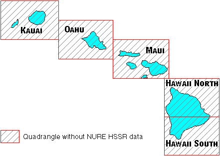
Because the NURE program was never completed, there are several quadrangles that do not contain any NURE HSSR data. Those uncompleted quadrangles that are in Hawaii are listed here.
Home Page: USGS National Geochemical Database - NURE HSSR data
History of NURE HSSR Program
Why a new NURE HSSR data format?
On-Line Manual for USGS-Reformatted NURE HSSR Data Files
Frequently Asked Questions Concerning NURE HSSR Data
Selected Publications from the NURE HSSR Program
Go directly to the NURE HSSR Sediment Data Download site.
Go directly to the NURE HSSR Water Data Download site.
Page written by Steven M. Smith (smsmith@usgs.gov)
Version 1.10: July 29, 1999
Version 1.20: August 07, 2000
Version 1.30: September 11, 2001
Version 1.41: February 23, 2006
| AccessibilityFOIAPrivacyPolicies and Notices | |
| |
|
