The Animas River drainage basin (fig. 1) has its headwaters in the mountainous terrain above Silverton, Colo. and drains south into the San Juan River in northern New Mexico. Elevations range from more than 14,000 ft. at the headwaters to less than 6,000 ft. at the confluence with the San Juan River near Aztec, New Mexico(fig. 2). The major population center in the basin is the city of Durango, Colo. The geology exposed at the surface and underlying the basin is varied. Precambrian rocks crop out in the eastern part of the drainage basin in the Animas Canyon area south of Silverton (fig. 3) forming the high rugged mountainous area of the Animas Canyon. Paleozoic and Mesozoic sedimentary rocks crop out in the southern part of the drainage basin. The headwaters of the Animas River watershed are underlain by the Tertiary igneous intrusive and volcanic rocks that formed as a result of a late Tertiary age episode of andesitic to dacitic volcanism followed by a later episode of ash-flows, lava flows and intrusions of dacitic to rhyolitic composition (Lipman and others, 1976). During this later episode of volcanism, the Silverton caldera formed. Pervasive and intense hydrothermal alteration and mineralization events postdate the formation of the Silverton caldera by several million years (Casadevall and Ohmoto, 1977). This area of the Animas River watershed above Silverton has been extensively fractured, hydrothermally altered, and mineralized by Miocene hydrothermal activity.
Gold deposits were first discovered in 1871 on Arrastra Creek above Silverton by following the occurrence of placer gold upstream. Following the signing of a treaty with the Ute Indians in 1873, between 1,000 and 1,500 mining claims were staked in the Animas River watershed upstream from Silverton. Mining activity spread rapidly throughout the area. The chimney deposits (mineralized breccia pipes, see fig. 4) at the head of Mineral Creek were discovered in 1881. The railroad was brought up from Durango in 1882 providing cheap transportation to the smelters in Durango (Sloan and Skowronski, 1975). Mining continued in the Animas River watershed at various levels of activity until 1991 when the Sunnyside Mine was closed.
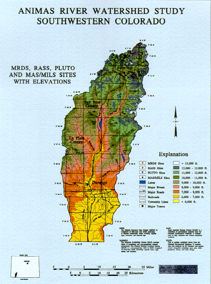
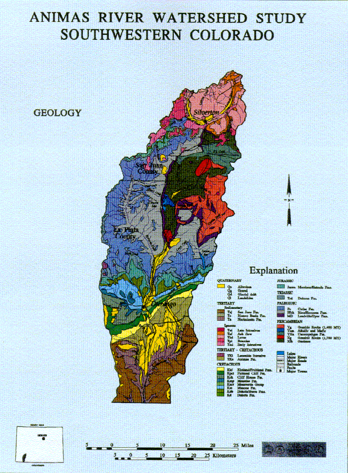
The extent of mining activity within various portions of the Animas River watershed can be estimated from the distribution of mining claims and Minerals Availability System (MAS) records (Babitzke and others, 1982) within the basin. In figure 2, plots of the geochemical data from the USGS mines data bases (Ryder, 1994) are indicative of the density of mines and prospects in the Animas River drainage basin above Silverton, Colo. Mineral deposits in several major mining districts have recorded production. Deposits in the Red Mountain district in the northwestern part of the Silverton caldera, the Eureka district in the Eureka graben within the Silverton caldera, and the South Silverton district along the southern margin of the Silverton caldera east of the town of Silverton (see fig. 4 Burbank and Luedke, 1968 Leedy, 1971 Casadevall and Ohmoto, 1977) comprised the majority of the mineral production. There are also several porphyry molybdenum deposits discovered by drilling in the Mineral Creek area (oral commun., Tom Casadevall, 1996). Some of the porphyry molybdenum deposits are surrounded by large iron bogs at the surface. Iron bogs are found elsewhere within the basin associated with springs flowing from mineralized fractures, some of which have been studied recently by W.G. Wright (written commun., 1996).