U.S. Geological Survey
Open-File Report 98-139
Version 1.0
![]() Back to: Sediment Transport
Back to: Sediment Transport
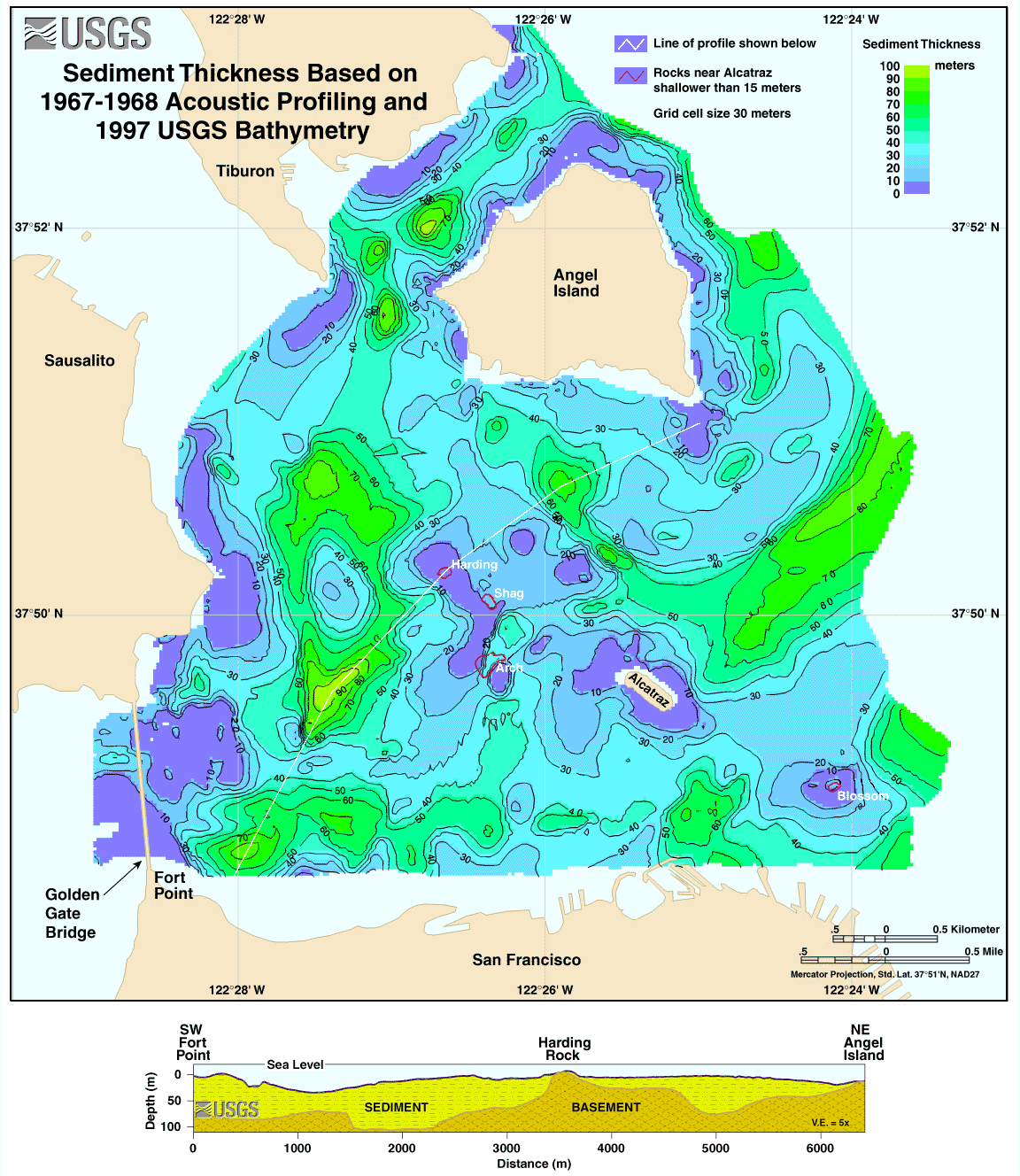
This map of sediment thickness was calculated as a difference between depth to bedrock and depth to the sea floor (bathymetry). The thickest sediment is shown in green while the thinnest is blue. A cross-section was constructed along the pale yellow line and is displayed below the map. The cross-section shows that the bay floor has an irregular bedrock base that has been covered by as much as 90 meters (295 feet) of sediment.

![]() U.S. Department of the Interior | U.S. Geological Survey
U.S. Department of the Interior | U.S. Geological Survey
URL: https://pubs.usgs.gov/of/1998/of98-139/sedthick.html
Contact: John Chin
Page Maintained By: Michael Diggles
Page Created By: Laura Zink Torresan
Page Last Modified: 10 October 2008
