Characteristics of discrete and basin-centered parts of the Lower Silurian regional oil and gas accumulation, Appalachian basin: Preliminary results from a data set of 25 oil and gas fields
U.S. Geological Survey Open-File Report 98-216
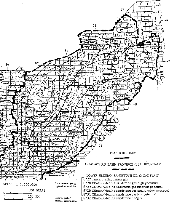
Figure 1: Map of the northern part of the Appalachian basin province (067) showing oil and gas plays in the Lower Silurian "Clinton" sands, Medina Group sandstones, and Tuscarora Sandstone identified in the 1995 USGS National Oil and Gas Assessment.
 |
![]()
Created by the EERT WWW Staff.
[an error occurred while processing this directive]