Characteristics of discrete and basin-centered parts of the Lower Silurian regional oil and gas accumulation, Appalachian basin: Preliminary results from a data set of 25 oil and gas fields
U.S. Geological Survey Open-File Report 98-216
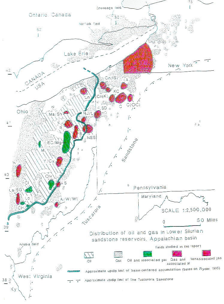
Figure 2: Map of the regional hydrocarbon accumulation in Lower Silurian sandstone reservoirs of the Appalachian basin, U.S. and Canada showing oil and gas fields used in the report. Also shown is the approximate boundary between discrete and basin-centerd parts of the accumulation.
 |
![]()
![]()
Created by the EERT WWW Staff.
[an error occurred while processing this directive]