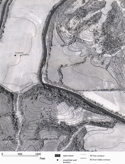
Figure 2. Portion of a 1" = 500' scale base map used for reconnaissance geologic mapping, developed from the USGS Digital Orthophoto Quadrangle and Digital Line Graph data for the 7.5 minute Fishhook, Illinois Quadrangle. Unverified well locations from the ISGS are also shown. |
RETURN TO Remote Sensing Inputs to a Geologic Mapping Program for Illinois
U.S.Department of the Interior, U.S. Geological Survey
<https://pubs.usgs.gov/openfile/of98-487/luman2.html>
Maintained by Dave Soller
Last updated 10.06.98