USGS
 Environmental Geochemistry and Sediment Quality in Lake Pontchartrain
 

Summary Table of Figures for Lake Pontchartrain Geologic History

Field studies and background data Fig. 1 Location map for field surveys
Fig. 2 Bathymetric and sediment texture
Subsurface expressions of the ancestral Mississippi River Fig. 3 (a) Seismic profile

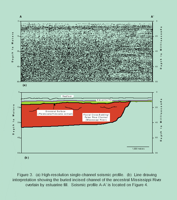
(b) Channel overlain by estuarine fill

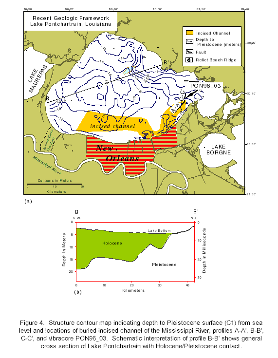
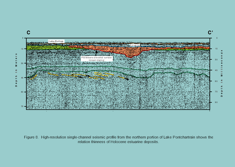
Pleistocene-Holocene sediment distributions

Fig. 4 Contour map of depth to Pleistocene surface
Fig. 5 Generalized vibracore with typical sediment units
Fig. 6 USACE boring and seismic profiles
Fig. 7 High-resolution seismic profile with vibracore
Fig. 8 Thinning of Holocene deposits in northern Lake Pontchartrain
Schematic development of Lake Pontchartrain Fig. 9 Changes over time with sea-level rise
Sediment profiles from NW Lake Pontchartrain to Lake Borgne Fig. 10 Superposition of various depositional units (marsh, estuarine/lagoonal, deltaic, etc.)
Schematic development of the Northern Gulf of Mexico shelf Fig. 11 Estuary and shelf development through Holocene transgression


arrow2l.jpg (1149 bytes) Back to Geologic History of Lake Pontchartrain


[an error occurred while processing this directive]