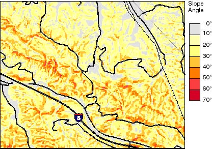
Figure 8. Slope map derived from DEM of part of the Oat Mountain quadrangle (location shown in fig. 3).
RETURN
U.S. Department of the Interior | U.S. Geological Survey URL: https://pubsdata.usgs.gov/pubs/of/1998/ofr-98-113/figure8.html Questions or Assistance: USGS Web Contact Page Last Modified: Wed Dec 7 16:46 EDT 2016