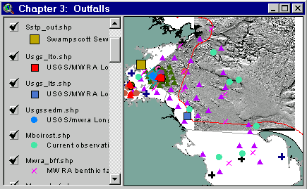
Sample from the ArcView window for Chapter 3
| Chapter 3: Outfalls |
Return to TABLE OF CONTENTS |
| To view all the coverages described in this Chapter, open the view titled Chapter 3 while running the ArcView project (mbay_30.apr or mbay_31.apr) in the mbaygis directory of this CD-ROM. To view summary metadata (file names, descriptions, provider, references) see the table below. To view complete metadata, go to directory "9_biblio" on this CD-ROM and open the file metadata.mdb using Microsoft Access or the file Gismeta.htm using your browser. |
Sample from the ArcView window for Chapter 3 |
The Massachusetts Water Resources Authority (MWRA) outfall will begin discharging treated sewage effluent from the Boston metropolitan area, now discharged into Boston Harbor, through a new ocean outfall located in Massachusetts Bay in 1999. Other outfalls, such as sewer and thermal waste outfalls, combined stormwater overflows (CSOs), and National Pollution Discharge Elimination System (NPDES) point outfalls, discharge or have discharged into Massachusetts Bay. Among these other outfalls, the location of the Swampscott Sewage Treatment Plant (Quinlan, 1984) and of point discharges (CSO and NPDES) are included on this CD-ROM. Investigations have been undertaken around some of these structures, especially the marine outfalls, to meet regulatory obligations.
The tunnel for the new MWRA ocean outfall begins at the Deer Island Treatment Plant and terminates in a linear series of 55 diffusers located approximately 9 miles offshore in Massachusetts Bay. This CD-ROM contains a small portion of the data and information obtained as part of the numerous investigations designed to understand the long-term effects of relocating the outfall from Boston Harbor to Massachusetts Bay. These investigations were carried out by the MWRA and its contractors (see list of MWRA technical publications at http://www.mwra.state.ma.us/harbor/enquad/trlist.htm), Federal and State agencies, and academic institutions. Bothner and others (1992) carried out detailed mapping of the region surrounding the outfall using sidescan sonar and bottom photography, providing the framework for selecting sites for long-term monitoring of sediment chemistry and biology. Knebel and Circe (1995) and Knebel and others (1996) used these and other data to provide an overall map of sedimentary environments for Massachusetts and Cape Cod Bay. More recently, western Massachusetts Bay, including the region surrounding the new outfall, has been surveyed using multibeam (Butman and others, in preparation), providing maps of the surface topography and sediment backscatter at a horizontal resolution of 6-10 m. A study of circulation in the Massachusetts Bays was conducted in 1989-1990 (Geyer and others, 1992). Signell and others (1996), using a three dimensional circulation model, developed predictions of effluent dilution for the effluent discharged from the existing outfall in the harbor, and from the new outfall in Massachusetts Bay in winter and summer. These simulations show that relocating the outfall will result in improved water quality in the harbor, and not significantly alter water quality in Massachusetts Bay, except in the immediate vicinity of the outfall. In 1997, the Harbor Branch Oceanographic Institution conducted a submersible dive (Clelia Dive No. 484) on and around the MWRA diffuser outfall (see Subchapter 2B for a more detailed summary of the Clelia operations, and Lindsay and others, 1998). A laser line scan system image of a diffuser riser can be viewed via a hot link connection. One of the diffusers (No. 44) will not be operational and may serve to monitor the influence of effluent on biofouling.
The MWRA is carrying out an extensive program to monitor water quality, sediment chemistry, and biota before and after the new ocean outfall begins operation (Albro and others 1998; Kropp and Boyle, 1998; Tucker and Giblin, 1998; Lefkovitz and Moore, 1998). The location of stations were carefully selected based on the simulations of water quality (Signell, 1996 see coverages), topography (Knebel and others, 1996), and sediments. Measurements are concentrated in the immediate vicinity of the new outfall (the ‘near field’), where simulations of water quality suggest that concentrations of effluent will be measurable above background levels. There are fewer stations located distant from the outfall (the ‘far field’), where simulations show that water quality will not be changed from the present situation. The sea floor environment in western Massachusetts Bay is extremely varied (Knebel, and Butman and others, in preparation). The topography is dominated by a series of ridges that have about 10 m of relief (see the multibeam maps). The ridges are topped with boulders and gravel, while finer sands and muds are concentrated in the bathymetric lows.
Coverages in this Chapter include:
Western Massachusetts Bay (6 m horizontal grid spacing)
Bathymetry (5 m contours: ArcView shapefile bathy5mb.shp)
Shaded relief (ArcView file wmbshd_g)
Pseudocolored backscatter over shaded relief (wmbpsd_g)Stellwagen Bank (10 m horizontal grid spacing)
Bathymetry (5 m countours: ArcView shapefile bathy5sb.shp)
Shaded relief (northern section - ArcView tif sbshd_ng.tif)
Shaded relief (southern section - ArcView tif sbshd_sg.tif)
Near field water quality stations (Albro and others, 1998): ArcView shapefile mwrawqnf.shp
Far field water quality stations (Albro and others, 1998): ArcView shapefile mwrawqff.shp
Near field benthic stations (Kropp and Boyle, 1998): ArcView shapefile mwra_bnf.shp
Far field benthic stations (Kropp and Boyle, 1998): ArcView shape filemwra_bff.shp
Hard bottom survey transects (Kropp and Boyle, 1998): ArcView shapefile mwrahbtr.shp
Benthic nutrient flux stations (Tucker and Giblin, 1998): ArcView shapefile mwrabflx.shp
Fish and shellfish stations (Lefkovitz and Moore, 1998): ArcView shapefile mwrafish.shp and mwra_lob.shp
Present outfall location, winter at 02 m: Arc/Info grids dr02wing and dr02winm
Present outfall location, winter at 16 m: Arc/Info grids dr16wing and dr16winm
Present outfall location, summer at 02 m: Arc/Info grids dr02sumg and dr02summ
Present outfall location, summer at 16 m: Arc/Info grids dr16sumg and dr16summ
New outfall location, winter at 02 m: Arc/Info grids bb02wing and bb02winm
New outfall location, winter at 16 m: Arc/Info grids bb16wing and bb16winm
New outfall location, summer at 02 m: Arc/Info grids bb02sumg and bb02summ
New outfall location, summer at 16 m: Arc/Info grids bb16sumg and bb16summ
List of technical reports resulting from studies by the MWRA Environmental Quality Division (ENQUAD): http://www.mwra.state.ma.us/harbor/enquad/trlist.htm)
Coverages provided in Chapter 3: (Summary metadata for files in the Chapter 3 view are listed alphabetically in the table below. For complete metadata, go to directory "9_biblio" on this CD-ROM and open the file metadata.mdb using Microsoft Access or the file Gismeta.htm using your browser.)
| File Name | Layer Content | Published reference | E-mail of Contact Person | Agency/Organization |
|---|---|---|---|---|
| 1mingrid.shp | One Minute Latitute/Longitude Grid | wwwnurc@uconnvm.uconn.edu | NOAA/NURC | |
| 3mile.shp | 3 Mile Boundary line off the coast of Mass | seidelc@mtg.saic.com | SAIC | |
| 404water.shp | 404 Boundary Waters off the coast of Mass | seidelc@mtg.saic.com | SAIC | |
| 484cle.shp | Raw navigation fixes from 1997 Clelia dive 484 | wwwnurc@uconnvm.uconn.edu | NOAA/NURC | |
| 484lls.shp | Laser line scan sites from 1997 Clelia dive 484 | wwwnurc@uconnvm.uconn.edu | NOAA/NURC | |
| 5mingrid.shp | Five Minute Latitute/Longitude Grid | wwwnurc@uconnvm.uconn.edu | NOAA/NURC | |
| bathy5mb.shp | 5-meter bathymetric contour lines for Western Mass Bay (Quads 19-21) | Butman, B., W. W. Danforth and L. Hayes, Sea Floor Topography and Backscatter of Quadrangles 19-21, Western Massachusetts Bay, Off Boston, Massachusetts, USGS Open-File Report (in prep.) | bbutman@usgs.gov, lhayes@usgs.gov | USGS |
| bathy5sb.shp | 5-meter bathymetric contour lines for Stellwagen Bank (Quads 1-18) | Valentine, P., J. Baker, T. Unger, C. Polloni, 1998, Sea Floor Topographic Map and Perspective-View Imagery of Quadrangles 1-18, Stellwagen Bank National Marine Sanctuary off Boston, Massachusetts, USGS Open-File Report 98-138. | pvalentine@usgs.gov; lhayes@usgs.gov | USGS |
| bb02sumg | Simulated effluent concentrations from Boston's sewage outfall: Bay Outfall, Summer, 2 m below surface | Signell, R.P., H.L. Jenter and A.F. Blumberg, 1996, "Circulation and Effluent Dilution Modeling in Massachusetts Bay: Model Implementation, Verification, and Results", USGS Open File Report 96-015, 121 pages. | rsignell@usgs.gov | USGS |
| bb02sumg.tif | Simulated effluent concentrations from Boston's sewage outfall: Bay Outfall, Summer, 2 m below surface | Signell, R.P., H.L. Jenter and A.F. Blumberg, 1996, "Circulation and Effluent Dilution Modeling in Massachusetts Bay: Model Implementation, Verification, and Results", USGS Open File Report 96-015, 121 pages. | rsignell@usgs.gov | USGS |
| bb02wing | Simulated effluent concentrations from Boston's sewage outfall: Bay Outfall, Winter, 2 m below surface | Signell, R.P., H.L. Jenter and A.F. Blumberg, 1996, "Circulation and Effluent Dilution Modeling in Massachusetts Bay: Model Implementation, Verification, and Results", USGS Open File Report 96-015, 121 pages. | rsignell@usgs.gov | USGS |
| bb02wing.tif | Simulated effluent concentrations from Boston's sewage outfall: Bay Outfall, Winter, 2 m below surface | Signell, R.P., H.L. Jenter and A.F. Blumberg, 1996, "Circulation and Effluent Dilution Modeling in Massachusetts Bay: Model Implementation, Verification, and Results", USGS Open File Report 96-015, 121 pages. | rsignell@usgs.gov | USGS |
| bb16sumg | Simulated effluent concentrations from Boston's sewage outfall: Bay Outfall, Summer, 16 m below surface | Signell, R.P., H.L. Jenter and A.F. Blumberg, 1996, "Circulation and Effluent Dilution Modeling in Massachusetts Bay: Model Implementation, Verification, and Results", USGS Open File Report 96-015, 121 pages. | rsignell@usgs.gov | USGS |
| bb16sumg.tif | Simulated effluent concentrations from Boston's sewage outfall: Bay Outfall, Summer, 16 m below surface | Signell, R.P., H.L. Jenter and A.F. Blumberg, 1996, "Circulation and Effluent Dilution Modeling in Massachusetts Bay: Model Implementation, Verification, and Results", USGS Open File Report 96-015, 121 pages. | rsignell@usgs.gov | USGS |
| bb16wing | Simulated effluent concentrations from Boston's sewage outfall: Bay Outfall, Winter, 16 m below surface | Signell, R.P., H.L. Jenter and A.F. Blumberg, 1996, "Circulation and Effluent Dilution Modeling in Massachusetts Bay: Model Implementation, Verification, and Results", USGS Open File Report 96-015, 121 pages. | rsignell@usgs.gov | USGS |
| bb16wing.tif | Simulated effluent concentrations from Boston's sewage outfall: Bay Outfall, Winter, 16 m below surface | Signell, R.P., H.L. Jenter and A.F. Blumberg, 1996, "Circulation and Effluent Dilution Modeling in Massachusetts Bay: Model Implementation, Verification, and Results", USGS Open File Report 96-015, 121 pages. | rsignell@usgs.gov | USGS |
| CSOS.shp | Boston Harbor CSO's | enquad@world.std.com, phastings@usgs.gov | MWRA | |
| dr02sumg deer02sum |
Simulated effluent concentrations from Boston's sewage outfall: Harbor Outfalls, Summer, 2 m below surface | Signell, R.P., H.L. Jenter and A.F. Blumberg, 1996, "Circulation and Effluent Dilution Modeling in Massachusetts Bay: Model Implementation, Verification, and Results", USGS Open File Report 96-015, 121 pages. | rsignell@usgs.gov | USGS |
| dr02sumg.tif | Simulated effluent concentrations from Boston's sewage outfall: Harbor Outfalls, Summer, 2 m below surface | Signell, R.P., H.L. Jenter and A.F. Blumberg, 1996, "Circulation and Effluent Dilution Modeling in Massachusetts Bay: Model Implementation, Verification, and Results", USGS Open File Report 96-015, 121 pages. | rsignell@usgs.gov | USGS |
| dr02wing | Simulated effluent concentrations from Boston's sewage outfall: Harbor Outfalls, Winter, 2 m below surface | Signell, R.P., H.L. Jenter and A.F. Blumberg, 1996, "Circulation and Effluent Dilution Modeling in Massachusetts Bay: Model Implementation, Verification, and Results", USGS Open File Report 96-015, 121 pages. | rsignell@usgs.gov | USGS |
| dr02wing.tif | Simulated effluent concentrations from Boston's sewage outfall: Harbor Outfalls, Winter, 2 m below surface | Signell, R.P., H.L. Jenter and A.F. Blumberg, 1996, "Circulation and Effluent Dilution Modeling in Massachusetts Bay: Model Implementation, Verification, and Results", USGS Open File Report 96-015, 121 pages. | rsignell@usgs.gov | USGS |
| dr16sumg | Simulated effluent concentrations from Boston's sewage outfall: Harbor Outfalls, Summer, 16 m below surface | Signell, R.P., H.L. Jenter and A.F. Blumberg, 1996, "Circulation and Effluent Dilution Modeling in Massachusetts Bay: Model Implementation, Verification, and Results", USGS Open File Report 96-015, 121 pages. | rsignell@usgs.gov | USGS |
| dr16sumg.tif | Simulated effluent concentrations from Boston's sewage outfall: Harbor Outfalls, Summer, 16 m below surface | Signell, R.P., H.L. Jenter and A.F. Blumberg, 1996, "Circulation and Effluent Dilution Modeling in Massachusetts Bay: Model Implementation, Verification, and Results", USGS Open File Report 96-015, 121 pages. | rsignell@usgs.gov | USGS |
| dr16wing | Simulated effluent concentrations from Boston's sewage outfall: Harbor Outfalls, Winter, 16 m below surface | Signell, R.P., H.L. Jenter and A.F. Blumberg, 1996, "Circulation and Effluent Dilution Modeling in Massachusetts Bay: Model Implementation, Verification, and Results", USGS Open File Report 96-015, 121 pages. | rsignell@usgs.gov | USGS |
| dr16wing.tif | Simulated effluent concentrations from Boston's sewage outfall: Harbor Outfalls, Winter, 16 m below surface | Signell, R.P., H.L. Jenter and A.F. Blumberg, 1996, "Circulation and Effluent Dilution Modeling in Massachusetts Bay: Model Implementation, Verification, and Results", USGS Open File Report 96-015, 121 pages. | rsignell@usgs.gov | USGS |
| dump_psd | Pseudocolor/Shaded Relief image (ARC/INFO grid) of MassBay disposal site (see description) | Valentine, Baker, Unger, Evans, and Polloni, 1998, U.S. Geological Survey Open-File Report 98-344. 1 CD-ROM. Sea Floor Topographic, Backscatter, and Interpretive Maps and Bottom Photos of the Massachusetts Bay Disposal Site region off Boston, MA. | pvalentine@usgs.gov, lhayes@usgs.gov | USGS |
| dump_ss | Backscatter image (ARC/INFO grid) of MassBay disposal site | Valentine, Baker, Unger, Evans, and Polloni, 1998, U.S. Geological Survey Open-File Report 98-344. 1 CD-ROM. Sea Floor Topographic, Backscatter, and Interpretive Maps and Bottom Photos of the Massachusetts Bay Disposal Site region off Boston, MA. | pvalentine@usgs.gov, lhayes@usgs.gov | USGS |
| dump_sun | Shaded Relief image (ARC/INFO grid) of MassBay disposal site | Valentine, Baker, Unger, Evans, and Polloni, 1998, U.S. Geological Survey Open-File Report 98-344. 1 CD-ROM. Sea Floor Topographic, Backscatter, and Interpretive Maps and Bottom Photos of the Massachusetts Bay Disposal Site region off Boston, MA. | pvalentine@usgs.gov, lhayes@usgs.gov | USGS |
| gom15grd | 15 second grid of Gulf of Maine bathymetry (Geographic) | Roworth, E. and Signell, R., 1999, Construction of digital bathymetry for the Gulf of Maine. U.S. Geological Survey Open-File Report 98-801. 1 CD-ROM. | rsignell@usgs.gov, lhayes@usgs.gov | USGS |
| gom30grd | 30 second grid of Gulf of Maine bathymetry (Geographic) | Roworth, E. and Signell, R., 1999, Construction of digital bathymetry for the Gulf of Maine. U.S. Geological Survey Open-File Report 98-801. 1 CD-ROM. | rsignell@usgs.gov, lhayes@usgs.gov | USGS |
| Inactive.shp | Boston Harbor Inactive CSO's | enquad@world.std.com, phastings@usgs.gov | MWRA | |
| MB_mets.shp | Copper and Zinc concentrations in surface sediments | Buchholtz ten Brink, M.R. and others, Contaminated sediments database for the Gulf of Maine. U.S. Geological Survey Open-File Report. Web publication and CD-ROM. (in prep.) (see referen.htm for full list of authors) | mtenbrink@usgs.gov, emecray@usgs.gov | USGS |
| MB_text.shp | Surficial sediment texture, USGS Atlantic Margin Database | Buchholtz ten Brink, M.R. and others, Contaminated sediments database for the Gulf of Maine. U.S. Geological Survey Open-File Report. Web publication and CD-ROM. (in prep.) (see referen.htm for full list of authors) | phastings@usgs.gov | USGS |
| mbcircst.shp | Locations of current observations for 1990-1991 Massachusetts Bay field experiment | Geyer, W.R, Gardner, G.G., Brown, W.S., Irish, J., Butman, B., Loder, T., Signell, R.P., 1992, Physical Oceanographic Investigations of Massachusetts and Cape Cod Bays. Massachusetts Bays Program MBP-92-03. 497 p. | bbutman@usgs.gov | WHOI, U. Mass., UNH, USGS |
| memanh.shp | Maine, Massachusetts, and New Hampshire state outlines | ESRI Data and Maps - 1996 | john.lindsay@noaa.gov | NOAA/USGS |
| mwra_bff.shp | MWRA outfall monitoring program, benthic farfield stations | Kropp, R.K. and Boyle, J.D., 1998. Combined Work/Quality Assurance Project Plan (CW/QAPP) for Benthic Monitoring:1997-2001, MWRA Harbor and Outfall Monitoring Project. Massachusetts Water Resources Authority. ENQUAD report ms-50. 72 p. | kkeay@mwra.state.ma.us, bbutman@usgs.gov, lhayes@usgs.gov | MWRA |
| mwra_bnf.shp | MWRA outfall monitoring program, benthic nearfield stations | Kropp, R.K. and Boyle, J.D., 1998. Combined Work/Quality Assurance Project Plan (CW/QAPP) for Benthic Monitoring:1997-2001, MWRA Harbor and Outfall Monitoring Project. Massachusetts Water Resources Authority. ENQUAD report ms-50. 72 p. | kkeay@mwra.state.ma.us, bbutman@usgs.gov, lhayes@usgs.gov | MWRA |
| mwra_lob.shp | MWRA outfall monitoring program, lobster monitoring locations | Lefkovitz, L., Moore, M.J., 1998. Combined work/quality assurance plan for fish and shellfish monitoring: 1998-2000. Boston: Massachusetts Water Resources Authority. ENQUAD report ms-49. 61 p. | kkeay@mwra.state.ma.us, bbutman@usgs.gov, lhayes@usgs.gov | MWRA |
| mwra_out.shp | Locations of Waste diffuser outfalls | john.lindsay@noaa.gov | MWRA | |
| mwrabflx.shp | Benthic Flux Sampling locations | Tucker, J. and Giblin, A, 1998. Combined Work/Quality Assurance Project Plan (CW/QAPP) for Benthic Nutrient Flux Studies:1998-2000, MWRA Harbor and Outfall Monitoring Project, Massachusetts Water Resources Authority. ENQUAD report ms-51. | kkeay@mwra.state.ma.us, bbutman@usgs.gov, lhayes@usgs.gov | MWRA |
| mwrafish.shp | Flounder monitoring locations | Lefkovitz, L., Moore, M.J., 1998. Combined work/quality assurance plan for fish and shellfish monitoring: 1998-2000. Boston: Massachusetts Water Resources Authority. ENQUAD report ms-49. 61 p. | kkeay@mwra.state.ma.us, bbutman@usgs.gov, lhayes@usgs.gov | MWRA |
| mwrahbtr.shp | MWRA outfall monitoring program, target locations for Hardbottom Survey Transects | Kropp, R.K. and Boyle, J.D., 1998. Combined Work/Quality Assurance Project Plan (CW/QAPP) for Benthic Monitoring:1997-2001, MWRA Harbor and Outfall Monitoring Project. Massachusetts Water Resources Authority. ENQUAD report ms-50. 72 p. | kkeay@mwra.state.ma.us, bbutman@usgs.gov, lhayes@usgs.gov | MWRA |
| mwramuss.shp | MWRA outfall monitoring program, mussel collection and deployment locations | Lefkovitz, L., Moore, M.J., 1998. Combined work/quality assurance plan for fish and shellfish monitoring: 1998-2000. Boston: Massachusetts Water Resources Authority. ENQUAD report ms-49. 61 p. | kkeay@mwra.state.ma.us, bbutman@usgs.gov, lhayes@usgs.gov | MWRA |
| mwrawqff.shp | MWRA outfall monitoring program station locations for Water Quality, Far-Field | Albro, Trulli, Boyle, Sauchuk, Oviatt, Keller, Zimmerman, Turner, Borkman, and Tucker, 1998. Combined Work/Quality Assurance Project Plan for Water Column Monitoring 1998-2000, MWRA Harbor and Outfall Monitoring Project. MWRA. ENQUAD report ms-48. 121 p. | kkeay@mwra.state.ma.us, bbutman@usgs.gov, lhayes@usgs.gov | MWRA |
| mwrawqnf.shp | MWRA outfall monitoring program, station locations for Water Quality, Near-Field | Albro, Trulli, Boyle, Sauchuk, Oviatt, Keller, Zimmerman, Turner, Borkman, and Tucker, 1998. Combined Work/Quality Assurance Project Plan for Water Column Monitoring 1998-2000, MWRA Harbor and Outfall Monitoring Project. MWRA. ENQUAD report ms-48. 121 p. | kkeay@mwra.state.ma.us, bbutman@usgs.gov, lhayes@usgs.gov | MWRA |
| outf_ss.tif | Digital mosaic of sidescan-sonar images of the region surrounding the MWRA outfall | Bothner, et al., 1992, A Geologic Map of the Sea Floor in Western Massachusetts Bay, Constructed from Digital Sidescan-Sonar Images, Photography, and Sediment Samples, USGS DDS-3 | mbothner@usgs.gov | USGS |
| Outfall.shp | Boston Harbor effluent outfalls | enquad@world.std.com, phastings@usgs.gov | MWRA | |
| Sbshd_ng.tif | Shaded Relief for Northern Stellwagen Bank, Geographic coordinates | Valentine, P., T. Unger, J. Baker, and C. Polloni, 1999, Sun-illuminated sea floor topographic maps and perspective-view imagery of Quadrangles 1-18, Stellwagen Bank National Marine Sanctuary off Boston, MA, U.S. Geological Survey Open-File Report 99-363. | pvalentine@usgs.gov | USGS |
| Sbshd_sg.tif | Shaded Relief for Southern Stellwagen Bank, Geographic coordinates | Valentine, P., T. Unger, J. Baker, and C. Polloni, 1999, Sun-illuminated sea floor topographic maps and perspective-view imagery of Quadrangles 1-18, Stellwagen Bank National Marine Sanctuary off Boston, MA, U.S. Geological Survey Open-File Report 99-363. | pvalentine@usgs.gov | USGS |
| sedfindd.shp | Sedimentary Environments Map | Knebel, H.J. and Circe, R.C., 1995; Knebel, H.J., Rendigs, R.R., List, J.H., and Signell, R.P., 1996; Butman, B. and Bothner, M.H., 1998. (see referen.htm for full references) | hknebel@usgs.gov | USGS |
| sstp_out.shp | Swampscott STP approximate location | john.lindsay@noaa.gov | NOAA/NOS/OR&R | |
| stnloc.shp | USGS bottom photos from 1992 outfall survey | Bothner, et al., 1992, A Geologic Map of the Sea Floor in Western Massachusetts Bay, Constructed from Digital Sidescan-Sonar Images, Photography, and Sediment Samples, USGS DDS-3 | cpolloni@usgs.gov, mbothner@usgs.gov | USGS |
| usgs_lto.shp | USGS/MWRA Long-term monitoring station, near outfall | bbutman@usgs.gov | USGS | |
| usgs_lts.shp | USGS/MWRA Long-term monitoring station, offshore near Scituate | bbutman@usgs.gov | USGS | |
| USGSsedm.shp | USGS long-term sediment monitoring stations | mbothner@usgs.gov | USGS | |
| wmbpsd_g | Pseudocolor image (ARC/INFO grid) Western Massachusetts Bay in Geographic coordinates (see description) | Butman, B., W. W. Danforth and L. Hayes, Sea Floor Topography and Backscatter of Quadrangles 19-21, Western Massachusetts Bay, Off Boston, Massachusetts, USGS Open-File Report (in prep.) | bbutman@usgs.gov, lhayes@usgs.gov | USGS |
| wmbshd_g | Shaded relief map of Western Massachusetts Bay in Geographic coordinates | Butman, B., W. W. Danforth and L. Hayes, Sea Floor Topography and Backscatter of Quadrangles 19-21, Western Massachusetts Bay, Off Boston, Massachusetts, USGS Open-File Report (in prep.) | bbutman@usgs.gov, lhayes@usgs.gov | USGS |
Return to TABLE OF CONTENTS
Continue to CHAPTER 3A