| Library 8: Information Products |
Return to TABLE OF CONTENTS |
Maps and interpretive figures assembled by researchers and others working in the Massachusetts Bay region have been widely used for presentations and educational purposes. The participants at the Woods Hole workshop felt that the community would benefit from access to digital versions of these figures. For the most part, the data used to assemble these figures are included on this CD-ROM. This Library contains selected figures (in JPEG format).
Figures provided in Library 8: (Click on thumbnail images for full views, or right-click to download. Summary metadata for files in Library 8 are listed alphabetically in the table below. For complete metadata, go to the directory "9_biblio" on this CD-ROM and open the file metadata.mdb using Microsoft Access or the file Gismeta.htm using your browser.)
| File Name | Layer Content | Published reference | E-mail of Contact Person | Agency/ Organization |
|---|---|---|---|---|
| USGS3D.jpg
|
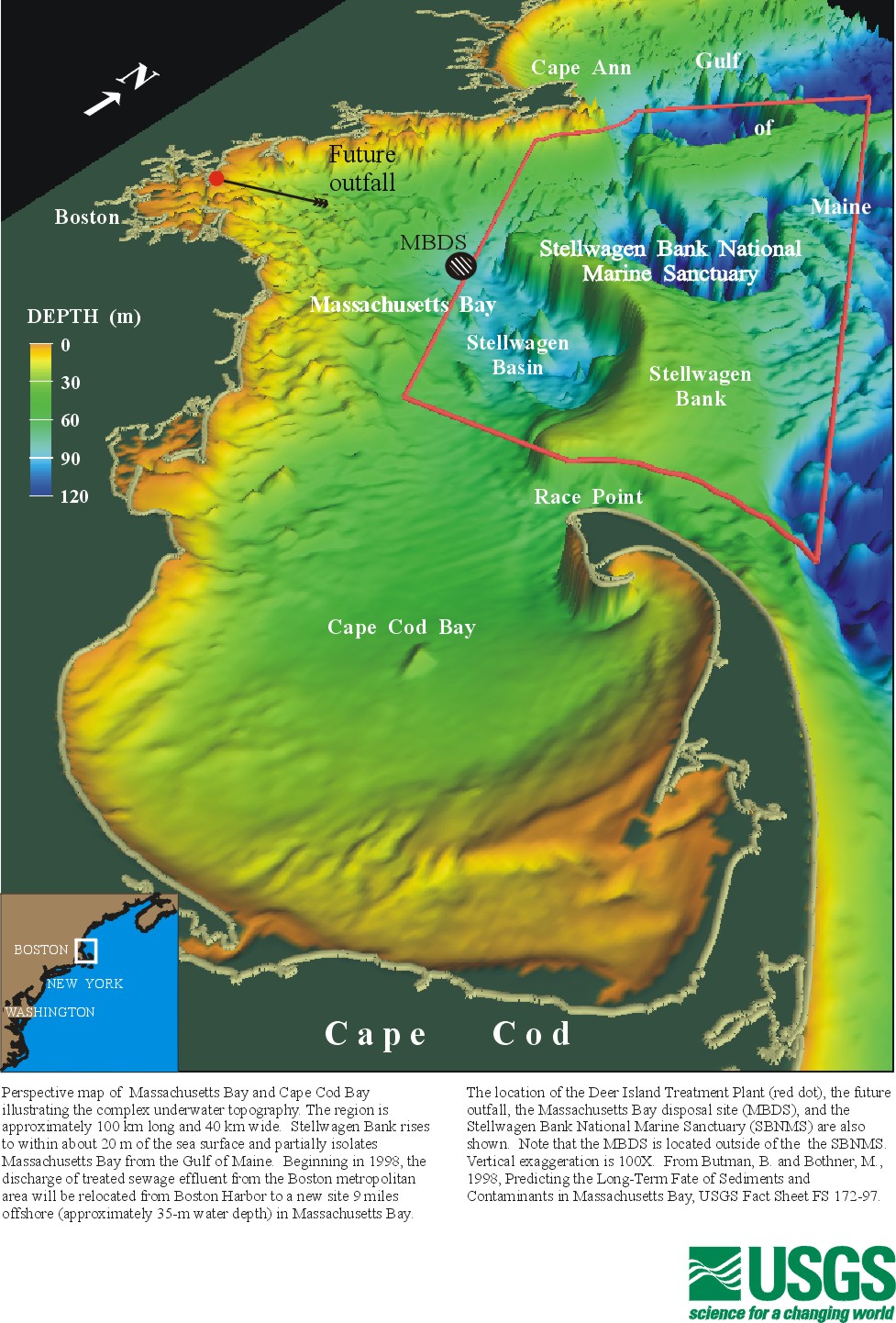
3D perspective of Massachusetts Bay (not ArcView format) | Butman, B., and Bothner, M., 1998, Predicting the Long-Term Fate of Sediments and Contaminants in Massachusetts Bay, USGS Fact Sheet FS 172-97. | rsignell@usgs.gov | USGS |
| usgscsr.jpg
|
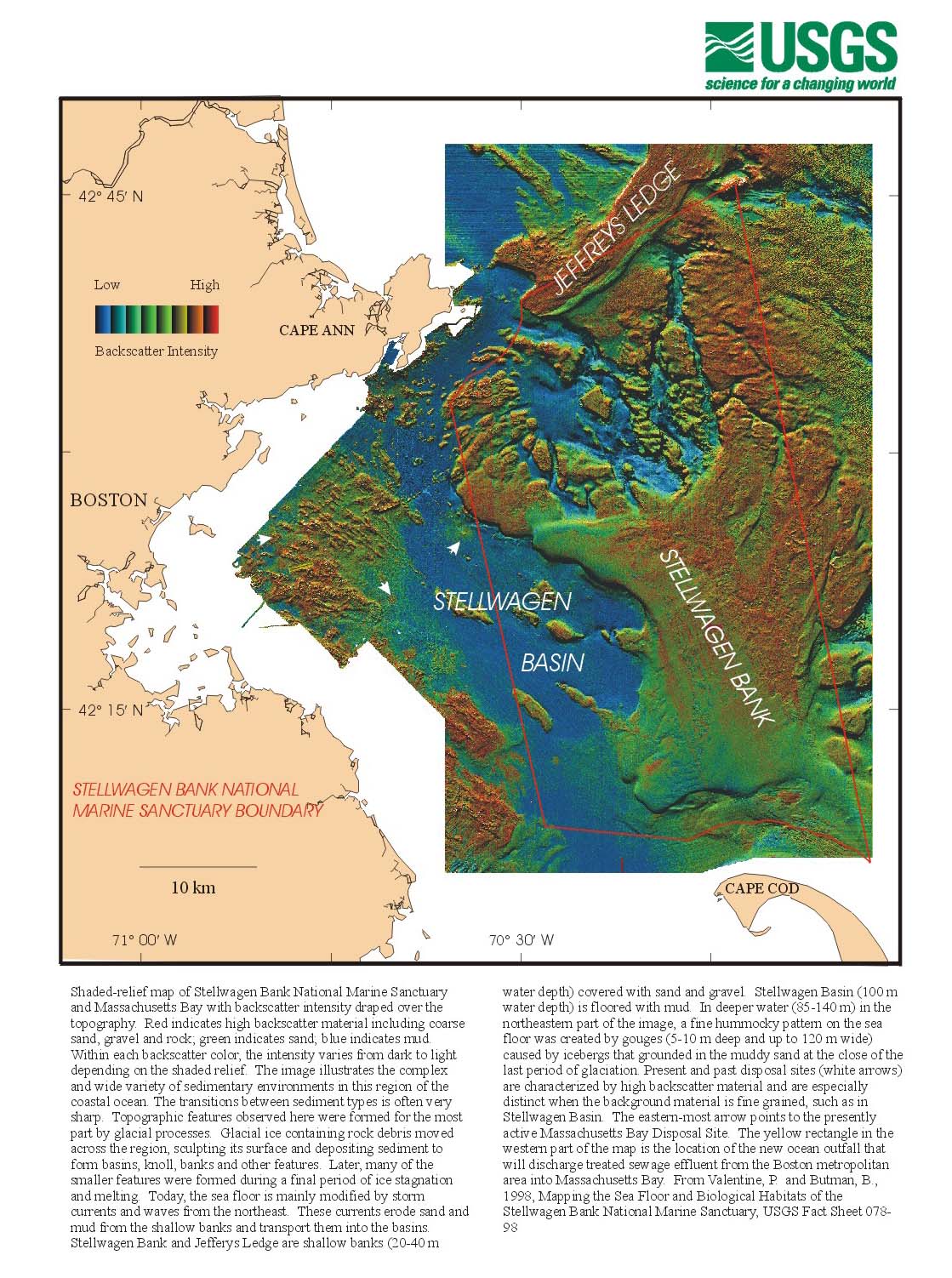
Colored shaded relief map (not ArcView format) | Valentine, P. and Butman, B., 1998, Mapping the Sea Floor and Biological Habitats of the Stellwagen Bank National Marine Sanctuary Region. U.S. Geological Survey Fact Sheet 078-9. | pvalentine@usgs.gov, bbutman@usgs.gov | USGS |
| USGSGoMB.jpg
|
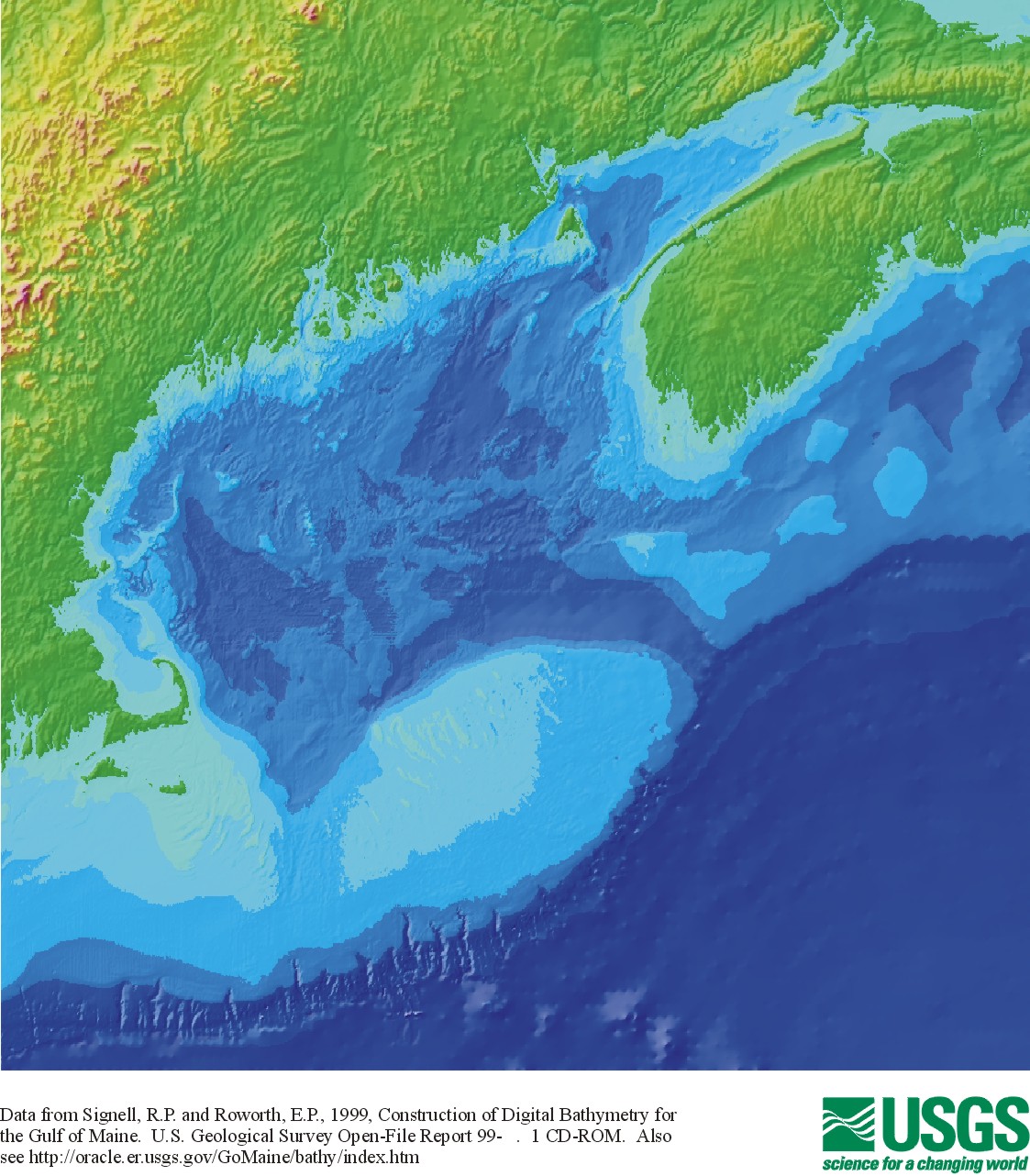
Gulf of Maine bathymetry (not ArcView format) | Roworth, E. and Signell, R.P., 1999, Construction of Digital Bathymetry for the Gulf of Maine, U.S. Geological Survey Open File Report 99-801 . 1 CD-ROM. | rsignell@usgs.gov | USGS |
| usgsoutm.jpg
|
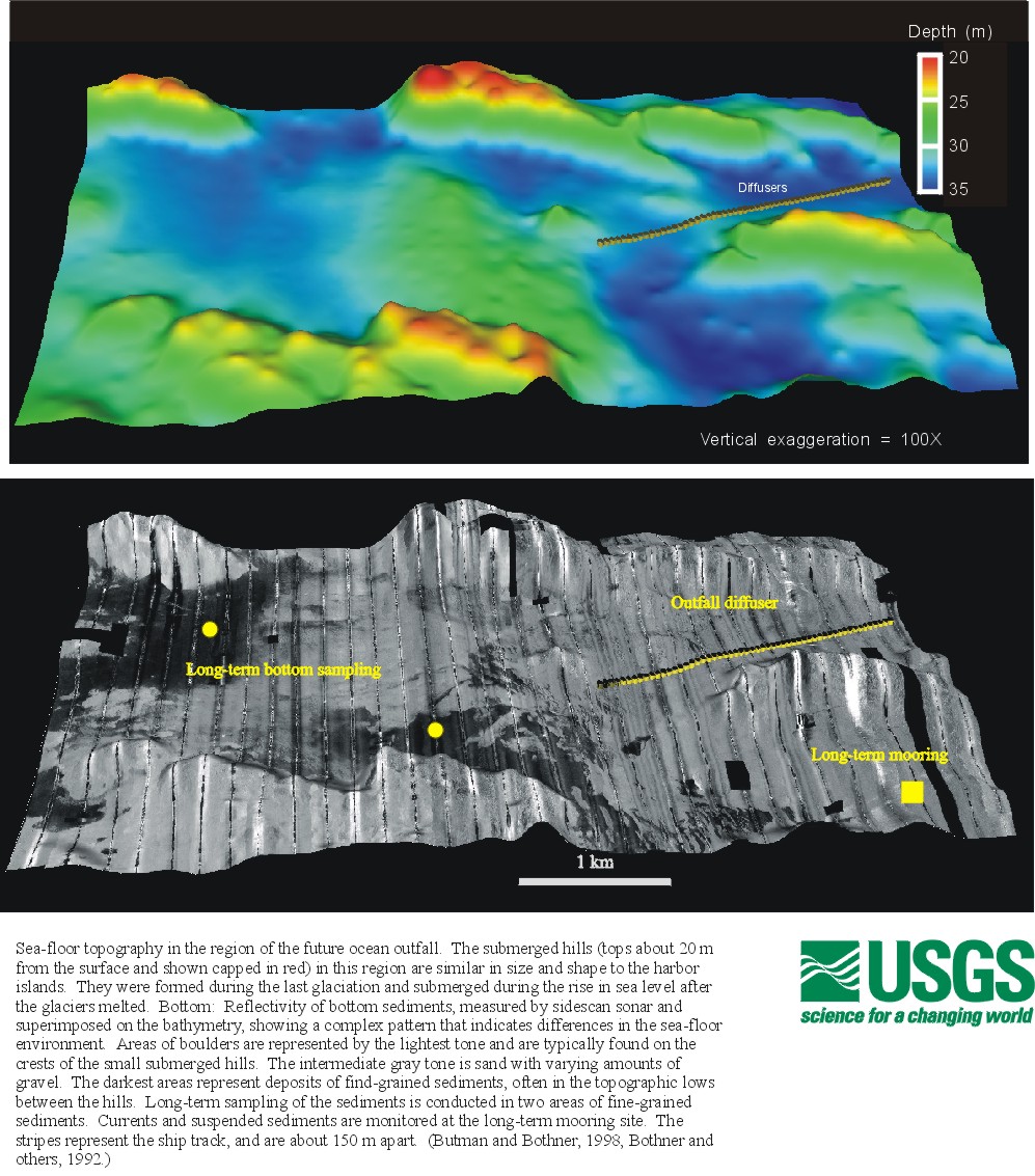
Bathymetry and backscatter in the vicinity of MWRA outfall with USGS monitoring sites. (not ArcView format) | Butman, B. and Bothner, M.H., 1998, Predicting the Long-Term Fate of Sediments and Contaminants in Massachusetts Bay. U.S. Geological Survey Fact Sheet 172-97; Bothner and others, 1992, U.S. Geological Survey Digital Data Series DDS-3, one CD-ROM. | mbothner@usgs.gov, bbutman@usgs.gov | USGS |
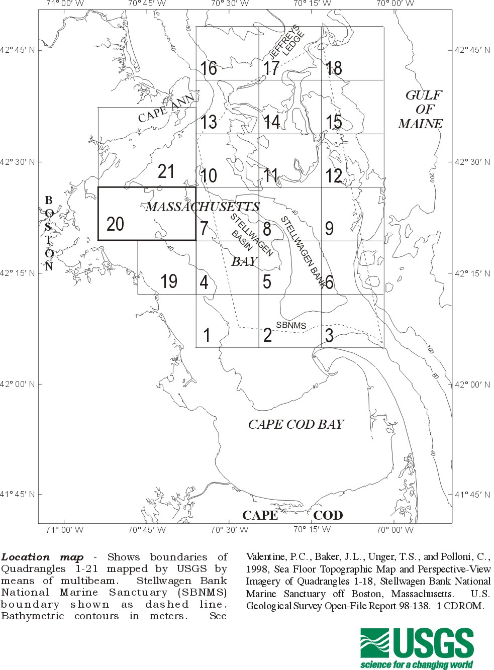
| usgsquad.jpg
|
USGS Quadrangle map boundaries (not ArcView format) | Valentine, Baker, Unger, and Polloni, 1998, U.S. Geological Survey Open-File Report 98-138. 1 CD-ROM; Butman, Danforth and Hayes, U.S. Geological Survey Open-File Report. 1 CD-ROM, in prep. | pvalentine@usgs.gov, bbutman@usgs.gov | USGS |
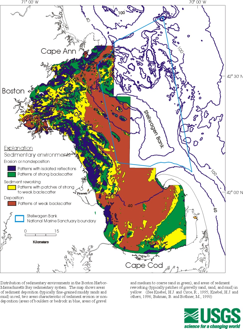
| usgssede.jpg
|
Sedimentary environments of Boston Harbor and Massachusetts Bay (not ArcView format) | Knebel, H.J., and Circe, R.C., 1995, Seafloor environments within the Boston Harbor-Massachusetts Bay sedimentary system: A regional synthesis: Journal of Coastal Research, v. 11, p. 230-251. | hknebel@usgs.gov | USGS |
Return to TABLE OF CONTENTS
Continue to REFERENCES
[an error occurred while processing this directive]