
Preliminary Digital Geologic Map of the Penokean (Early Proterozoic) Continental
Margin in Northern Michigan and Wisconsin
By William F. Cannon and Doug Ottke
1999
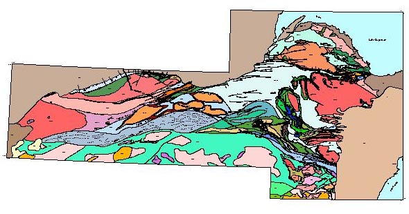
View larger version of map [270 KB jpg]
View PDF version [1.5 MB]
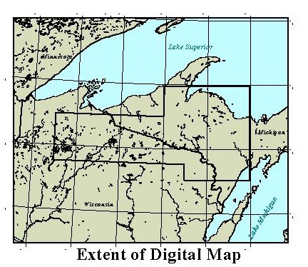
This map portrays the geology of Early Proterozoic rocks deposited along the southern margin
of the Archean Superior craton during the Penokean orogenic cycle in northern Michigan and
Wisconsin. It is a preliminary product of a study of the geologic and metallogenic evolution
of that area intended to make available the compiled geology as the larger study progresses.
The map has been compiled from a wealth of detailed and regional studies conducted largely by
the USGS during the past 50 years. The data is structured and attributed so that users can easily query and modify maps and
create a variety of derivative maps based on such features as lithology, age, tectonic setting,
and stratigraphy. An ArcView project with associated shape files is provided for viewing and querying
of the map. Also provided are .e00 files if further manipulation of the map is desired.
Download the compressed ArcView project and shape files: Penokean.zip (10.9 Mb)
Download the compressed .e00 files for the geology polygon coverage and fault line coverage: e00files.zip (7.6 Mb)
Read the metadata
Eastern Mineral Resources
 USGS Home Page
USGS Geologic Information
USGS Home Page
USGS Geologic Information
 USGS Help Page
For Additional Information Contact: Connie Dicken
USGS Geologic Division, Eastern Mineral Resources
703-648-6399
12201 Sunrise Valley Drive, MS 954
Reston, VA   20192
This page is https://pubs.usgs.gov/openfile/of99-547/
Maintained by Eastern Publications Group
Last modified: 20 March 2000