
![]()
![]()
U.S. DEPARTMENT OF THE INTERIOR
U.S. GEOLOGICAL SURVEY
|
By
|
Open-File Report 99-50-C
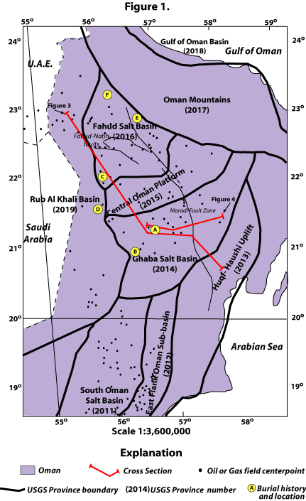
| Figure 1. Map showing U.S. Geological Survey (USGS) Province boundaries, province names and numbers, location of burial histories, and oil and gas field centerpoints (Petroconsultants, 1996) in Central and North Oman. Scale: 1:3,600,000. [Burial history location for: A, figure 12 near Saih Rawl field; B, figure 13 near Barik field; C, figure 15 near Yibal field; D, figure 15 near Jaleel field; E, figure 18 in Omani foredeep; F, figure 19 near Anaima-1 well]. |
 |
| <<Return to List of Figures |