
![]()
![]()
U.S. DEPARTMENT OF THE INTERIOR
U.S. GEOLOGICAL SURVEY
|
By
|
Open-File Report 99-50-C
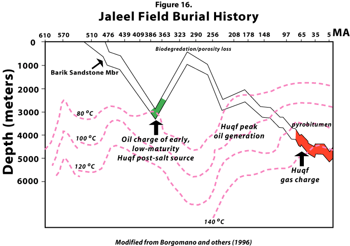
| Figure 16. Burial-history diagram for deep-gas reservoirs, Upper Cambrian-Lower Ordovician Barik Sandstone Member, showing temperatures and stages of oil and gas charge from Huqf post-salt source rocks, Jaleel field, Fahud Salt Basin. Modified from Borgomano and others (1996). |
 |
| <<PREVIOUS Figure | Return to List of Figures |