
![]()
![]()
U.S. DEPARTMENT OF THE INTERIOR
U.S. GEOLOGICAL SURVEY
|
By
|
Open-File Report 99-50-C
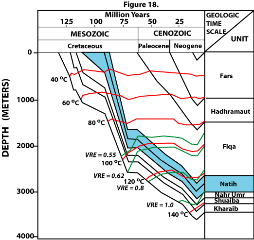
| Figure 18. Burial-history diagram, burial temperatures, and vitrinite reflectance equivalent (VRE) for Natih Formation source rocks in Late Cretaceous/Tertiary foredeep, Fahud Salt Basin, north Oman. Modified from Terken (1998; in press). |
 |
| <<PREVIOUS Figure | Return to List of Figures |