USGS Logo

U.S. DEPARTMENT OF THE INTERIOR
U.S. GEOLOGICAL SURVEY


Ghaba Salt Basin Province and Fahud Salt Basin Province, Oman -- Geological Overview and Total Petroleum Systems

By
RICHARD M. POLLASTRO

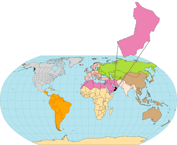
World Map with Province

Open-File Report 99-50-C


south-southeast with the Ghaba-Makarem Combined Structural Assessment Unit (20140101) of the North Oman Huqf/`Q' — Haushi(!) TPS (201401). 

     Similar to the Ghaba-Makarem Combined Structural Assessment Unit (20140101), expected exploration stategies and areas of new-field discoveries in this assessment unit are: 

     1. extension of Haima (Barik, Miqrat, etc.) deep-gas/condensate play into the Fahud Salt Basin with new-field discoveries at depths >5000 m; some additional targets may also be discovered in reservoirs of the underlying Buah Limestone, Huqf Supergroup. 
     2. growth of proven gas/condensate reserves from Haima Supergroup in existing fields (field growth). 
     3. extension of exploration into Fahud Salt Basin for new oil fields and oil-field growth within clastic reservoirs of the Haushi Group (Al Khlata and Gharif). 
     4. new fields in Shu'aiba and Natih limestones in fractured, low-relief, `pancake' structures (all large structures have been drilled) in western portion of assessment unit and along western border of Oman, eastern-flank portion of the Rub `al Khali Province (2019). 
     5. growth of proven oil reserves in all reservoirs of existing fields (field growth). 

     It is predicted in this study that a large portion of the exploration efforts in Fahud Salt Basin Province will focus on the Haima Supergroup, and possibly Huqf Supergroup, deep-gas/condensate play. Because much of the gas resource is likely to be discovered in existing fields, a large gas growth factor, the Mid-Continent growth factor derived from the U.S.Geological Survey 1995 National Oil and Gas Assessment (J.W. Schmoker, USGS) was used in the assessment of resources.

     Size and number of new economic discoveries may be limited by or dependent on the following: 

     1. seismic resolution of low relief structures and presence/absence of fractures or leaching in Shu'aiba reservoirs with smaller closure. 
     2. reduced porosity in deep Gharif targets (Guit and others, 1995) in Fahud Salt Basin which are likely to contain gas rather than oil.
     3. thin, poor quality, and commonly the presence of pore-plugging bitumen in Haima deep-gas reservoirs in the Fahud Salt Basin.

     4. poor quality, high-nitrogen content of gas along Oman Mountain front and overthrust. 

Middle Cretaceous Natih(!) Total Petroleum System (201602)
     Although about 80 percent of the hydrocarbons produced in Oman are thought to be generated by source rocks of the Infracambrian Huqf Supergroup (Sykes and Abu Risheh, 1989), the Middle Cretaceous Natih(!) TPS is a smaller (about 20,000 km2 in geographic extent) but highly-efficient petroleum system (Terken, 1998; in press). The Natih(!) TPS is contained primarily (78 areal percent) within the Fahud Salt Basin Province with an estimated in-place resource volume of some 9 BBOE (Terken, 1998: in press); this in-place volume is exclusive of hydrocarbons generated by Huqf sources. About 2 billion barrels of discovered recoverable reserves attributed to the Middle Cretaceous Natih(!) TPS are concentrated in Fahud and Natih fields. 

     The geographic extent of 1) the pod of active source rock, 2) minimum petroleum system, and 3) Total Petroleum System for the Natih(!) TPS are shown in figure 17. The pod of active source rock was determined from a series of burial history reconstructions, geothermal gradients, and thermal maturity data (mostly vitrinite reflectance). The minimum petroleum system boundary incorporates the pod of active source rock and all known fields and oils shows from wells that have produced `Natih-type' oil. The maximum extent of the Middle Cretaceous Natih(!) TPS is structurally bound to the north by the Oman Mountains, to the south and southwest by the Late Cretaceous to Tertiary foreland bulge, and to the southeast by the the salt-structured core of the Ghaba Salt Basin (fig. 2 and fig. 17). 

Source rock lithology and geochemistry
     The 400 m-thick carbonate sequence of the Natih Formation is comprised of seven lithologic subdivisions designated A through G. Two organic-rich shaley intervals, the Natih `B' and `E' units, that are easily identified on well logs and of limited geographic extent, have sourced the hydro- carbons of the Natih(!) TPS. In particular, the 500-meter-thick Natih `B' unit is of excellent source rock quality having TOC contents as high as 15 weight percent and averaging about 5 percent. These units contain predominantly structureless TypeI/II organic matter (Grantham and others, 1988; van Buchem and others, 1996; Terken, in press). 


<<PREVIOUS
Source rock lithology and geochemistry - cont'd  NEXT>>
 
To Top of this Report
 

U. S. Geological Survey Open-File Report 99-50D