
![]()
![]()
U.S. DEPARTMENT OF THE INTERIOR
U.S. GEOLOGICAL SURVEY
|
By
|
Open-File Report 99-50-C
| porosity,
commonly fractured, grainstones and chalky carbonates of the Lower Cretaceous
Shu'aiba Formation and Middle Cretaceous Natih Formation. Although some
fields producing from Natih reservoirs are sourced by the organic-rich
facies of the Natih Formation (the Natih(!) Total Petroleum System discussed
later), a large volume of oil and gas in Natih reservoirs is sourced from
the Huqf. Most production, however, is from the Shu'aiba Formation (Thamama-Khamah
Group, Early Aptian) (Murris, 1980; Alsharhan and Nairn, 1997). The Shu'aiba
is overlain by the Nahr Umr Formation of the Wasia Group, a widespread
transgressive shale, which forms a regional seal for these reservoirs (fig.
5). The intergrity of this seal is excellent as hydrocarbons produced
from the Shu'aiba are commonly different from those produced in Middle
Cretaceous Natih reservoirs overlying the Nahr Umr shales (Brennan, 1985).
In both the Shu'aiba and Natih Formations, shallow-water, shelf-margin
carbonate buildups (mainly rudistid reefs) and associated grainstones (debris
shoals) formed on and around low relief structural highs (mostly formed
by salt pillows and tilted, upthrown fault blocks) comprise the best reservoirs
(Frost and others, 1983; Harris and Frost, 1984). Uplift from both tectonic
and halokinetic movements produced secondary (mostly moldic and vuggy)
porosity from subaerial erosion and meteoric diagenesis. Porosities ranging
from 30 to 40 percent have been recorded in the Shu'aiba at Yibal, Al Hawaisah,
Natih, Fahud, and Daleel fields.
Sandstones of the Haushi Group (Gharif and Al Khlata Formations-Khuff limestone seal) form reservoirs in some fields. The Barik sandstone member (Mabrouk Shale seal) and Miqrat Formations (Al Bashair Shale seal) of the Lower Cambrian to Lower Ordovician age parts of the Haima Supergroup are primarily deep gas reservoirs with reservoir potential recently recognized in Precambrian carbonates of the Buah Formation. Similar to the Ghaba Salt Basin, most of the fields of the Fahud Salt Basin are structurally complex, salt-induced anticlines and domes that have been broken up into several fault blocks by crestal collapse features (Nederlof and others, 1995). Specific common trap styles are faulted closures, dip closures, and faulted-dip closures (Lake, 1996). Source rock character |
|||
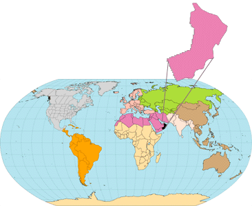
| section on the North
Oman Huqf/`Q' Haushi(!) TPS and are also summarized in table
1. North Oman Huqf oils have
d13C
compositions between about -33 and -35 and C27
sterane from 10 to 45% and can be distinguished other Huqf-sourced oils
(i.e., South Oman Huqf and `Q' types, see fig.
7).
Burial history, generation, and
migration Vitrinite reflectance equivalents of Huqf source rocks within the the North Oman Huqf Shu'aiba(!) TPS ranges from about 2.0 to 4.0 percent (Sykes and Abu Risheh, 1989; and Visser (1991). Burial history reconstructions by Visser (1991) suggest that an early minor stage of oil generation occurred in Middle and Lower Huqf source rocks during the early Silurian (fig. 15). Peak oil generation occurred during Late Permian/Early Triassic (~250 ma); gas generation began during the Cretaceous (~110 Ma). Modelling by Amthor and others (1998) suggest that gas expelled from Huqf source rocks in the Fahud Salt Basin charged structures across the Fahud Salt Basin and reached the Makarem high during a period ranging from 80 Ma to present day (fig. 16). Fahud-Huqf Combined Structural
Assessment Unit (20160101) |
| <<PREVIOUS |
Fahud-Huqf Combined Structural Assessment
Unit - cont'd NEXT>>
|
| To Top of this Report |