![]()
U. S. DEPARTMENT OF THE INTERIOR
U.S. GEOLOGICAL SURVEY
|
by Michele L. W. Tuttle, Ronald R. Charpentier, and Michael E. Brownfield
Open-File Report 99-50-H |
| Chapter A
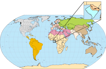
Tertiary Niger Delta (Akata-Agbada) Petroleum System (No. 701901), Niger Delta Province, Nigeria, Cameroon, and Equatorial Guinea, Africa by Michele L. W. Tuttle, Michael E. Brownfield, and Ronald R. Charpentier ABSTRACT Known oil and gas resources of the Niger Delta rank the province as the twelfth largest in the world. To date, 34.5 billion barrels of recoverable oil and 93.8 trillion cubic feet of recoverable gas have been discovered. In 1997, Nigeria was the fifth largest crude oil supplier to the United States, supplying 689,000 barrels/day of crude. INTRODUCTION The Niger Delta Province contains only one identified petroleum system (Kulke, 1995; Ekweozor and Daukoru, 1994; this study). This system is referred to here as the Tertiary Niger Delta (Akata Agbada) Petroleum System.1 The maximum extent of the petroleum system coincides with the boundaries of the province (fig. 1). The minimum extent of the system is defined by the areal extent of fields and contains known resources (cumulative production plus proved reserves) of 34.5 billion barrels of oil (BBO) and 93.8 trillion cubic feet of gas2 (TCFG) (14.9 billion barrels of oil equivalent, BBOE) (Petroconsultants, 1996a). Currently, most of this petroleum is in fields that are onshore or on the continental shelf in waters less than 200 meters deep (fig. 1), and occurs primarily in large, relatively simple structures. A few giant fields do occur in the delta, the largest contains just over 1.0 BBO (Petroconsultants, Inc., 1996a). Among the provinces ranked in the U.S. Geological Survey's World Energy Assessment (Klett and others, 1997), the Niger Delta province is the twelfth richest in petroleum resources, with 2.2% of the worlds discovered oil and 1.4% of the worlds discovered gas (Petroconsultants, Inc. 1996a). In 1908, the German Nigerian Bitumen Corporation drilled the first wells in the vicinity of the tar seep deposits in the northern portion of the delta (Frost, 1997). However, significant oil shows were not found in Tertiary rocks until the early 1950s. Shell-British Petroleum brought the first well on stream in 1958 at 5,100 barrels per day. From 1958 until the Biafran War in 1967, exploration and production increased in Nigeria. The war curtailed both activities until its end in 1970, when world oil prices were rising and Nigeria again could benefit economically from its petroleum resources in the Niger Delta. In 1971, Nigeria joined the Organization of the Petroleum Exporting Countries (OPEC) with a total production of 703 million barrels of oil (MMBO) per annum. In 1997, production rose to 810 MMBO (Energy Information Administration, 1998a). Thirty-one percent of this production (251 MMBO) was exported to the United States, making Nigeria the fifth largest supplier of U.S. oil. Despite the political uncertainty in Nigeria today, the countrys sustainable production capacity is expected to increase over current production--they have agreed, however, to reduce their production by 225,000 barrels/day in 1998. Petroleum exploration is also expanding, especially in deeper water offshore, with the Nigerian government currently planning to offer six additional lease blocks in water up to 3000 m deep. Considering both oil and gas, the overall success ratio for exploration drilling is as high as 45% (Kulke, 1995; figs. 2A and 2B). Exploration of the small portions of the Niger Delta in Cameroon and Equatorial Guinea began much later than in Nigeria. Recoverable oil and gas (produced plus proved reserves) are much smaller than in Nigeria. In 1997, 96% of the Niger Delta recoverable petroleum was in Nigeria, 3.5% in Cameroon, and 0.5% in Equatorial Guinea (Petroconsultants, Inc., 1996a). Acknowledgements. The authors wish to acknowledge T. Klett, F. Persits, and L. Osmonson of the U.S. Geological Survey for assistance with data and maps; .Petroconsultants Group and Geomark Research, Inc.; and L. Magoon, G. Ulmishek, and G. Dolton for thoughtful reviews of the manuscript. PROVINCE
GEOLOGY Tectonics After rifting ceased, gravity tectonism became the primary deformational process. Shale mobility induced internal deformation and occurred in response to two processes (Kulke, 1995). First, shale diapirs formed from loading of poorly compacted, over-pressured, prodelta and delta-slope clays (Akata Fm.) by the higher density delta-front sands (Agbada Fm.). Second, slope instability occurred due to a lack of lateral, basinward, support for the under-compacted delta-slope clays (Akata Fm. ) (fig. 4). For any given depobelt, gravity tectonics were completed before deposition of the Benin Formation and are expressed in complex structures, including shale diapirs, roll-over anticlines, collapsed growth fault crests, back-to-back features, and steeply dipping, closely spaced flank faults (Evamy and others, 1978; Xiao and Suppe, 1992). These faults mostly offset different parts of the Agbada Formation and flatten into detachment planes near the top of the Akata Formation. Lithology In the Paleocene, a major transgression (referred to as the Sokoto transgression by Reijers and others, 1997) began with the Imo shale being deposited in the Anambra Basin to the northeast and the Akata shale in the Niger Delta Basin area to the southwest (fig. 5). In the Eocene, the coastline shape became convexly curvilinear, the longshore drift cells switched to divergent, and sedimentation changed to being wave-dominated (Reijers and others, 1997). At this time, deposition of paralic sediments began in the Niger Delta Basin proper and, as the sediments prograded south, the coastline became progressively more convex seaward. Today, delta sedimentation is still wave-dominated and longshore drift cells divergent (Burke, 1972). The Tertiary section of the Niger Delta is divided into three formations, representing prograding depositional facies that are distinguished mostly on the basis of sand-shale ratios. The type sections of these formations are described in Short and Stäuble (1967) and summarized in a variety of papers (e.g. Avbobvo, 1978; Doust and Omatola, 1990; Kulke, 1995). The Akata Formation at the base of the delta is of marine origin and is composed of thick shale sequences (potential source rock), turbidite sand (potential reservoirs in deep water), and minor amounts of clay and silt (fig. 5, fig. 6a, fig 6b, and fig. 7). Beginning in the Paleocene and through the Recent, the Akata Formation formed during lowstands when terrestrial organic matter and clays were transported to deep water areas characterized by low energy conditions and oxygen deficiency (Stacher, 1995). Little of the formation has been drilled; therefore, only a structural map of the top of the formation is available (fig. 8A). It is estimated that the formation is up to 7,000 meters thick (Doust and Omatsola, 1990). The formation underlies the entire delta, and is typically overpressured. Turbidity currents likely deposited deep sea fan sands within the upper Akata Formation during development of the delta (Burke, 1972). Deposition of the overlying Agbada Formation, the major petroleum-bearing unit, began in the Eocene and continues into the Recent (fig. 5, fig. 6a, fig 6b, and fig. 7). The formation consists of paralic siliciclastics over 3700 meters thick (Fig. 8B) and represents the actual deltaic portion of the sequence. The clastics accumulated in delta-front, delta-topset, and fluvio-deltaic environments. In the lower Agbada Formation, shale and sandstone beds were deposited in equal proportions, however, the upper portion is mostly sand with only minor shale interbeds. The Agbada Formation is overlain by the third formation, the Benin Formation, a continental latest Eocene to Recent deposit of alluvial and upper coastal plain sands that are up to 2000 m thick (Avbovbo, 1978). Depobelts Doust and Omatsola (1990) describe three depobelt provinces based on structure. The northern delta province, which overlies relatively shallow basement, has the oldest growth faults that are generally rotational, evenly spaced, and increase their steepness seaward. The central delta province has depobelts with well-defined structures such as successively deeper rollover crests that shift seaward for any given growth fault. Last, the distal delta province is the most structurally complex due to internal gravity tectonics on the modern continental slope. PETROLEUM
AND ITS OCCURRENCE Outside of the "oil-rich belt" (central, easternmost, and northernmost parts of the delta), the gas:oil ratios (GOR) are high. The GOR within each depobelt increases seaward and along strike away from depositional centers. Causes for the distribution of GORs are speculative and include remigration induced by tilting during the latter history of deposition within the downdip portion of the depobelt, updip flushing of accumulations by gas generated at higher maturity, and/or heterogeneity of source rock type (Doust and Omatsola, 1990). Stacher (1995), using sequence stratigraphy, developed a hydrocarbon habitat model for the Niger Delta (fig. 11). The model was constructed for the central portion of the delta, including some of the oil-rich belt, and relates deposition of the Akata Formation (the assumed source rock) and the sand/shale units in the Agbada Formation (the reservoirs and seals) to sea level. Pre-Miocene Akata shale was deposited in deep water during lowstands and is overlain by Miocene Agbada sequence system tracts. The Agbada Formation in the central portion of the delta fits a shallow ramp model with mainly highstand (hydrocarbon-bearing sands) and trangressive (sealing shale) system tracts--third order lowstand system tracts were not formed. Faulting in the Agbada Formation provided pathways for petroleum migration and formed structural traps that, together with stratigraphic traps, accumulated petroleum. The shale in the transgressive system tract provided an excellent seal above the sands as well as enhancing clay smearing within faults. Properties
of Petroleum Fields Properties
of Oil and Gas Oils derived from terrestrial organic matter such as those in the Niger Delta have high pristane:phytane ratios (fig. 13). If the oils are derived from terrestrial organic matter younger than mid-Cretaceous, then the oleanane:C30-hopane ratios are high as well (fig. 13).4 Concentrations of Ni and V in Niger Delta oils are less than 100 and V/(V+Ni) values range between 0.01 and 0.41 with an average of 0.12 ppm (Nwachukwu and others, 1995), consistent with values in oils derived from Type III organic matter (Lewan and Maynard, 1982). Concentrations of sulfur and V/(V+Ni) in Niger Delta oil, place the Niger Delta source rocks in Lewans (1984) Regime II with respect to source-rock depositional conditions. These trace-metal data, together with the organic geochemistry and physical properties of the oil indicate that the Niger Delta source rocks contain predominately terrestrial organic matter. The organic matter was deposited in suboxic-anoxic bottom waters where vanadyl and nickel availability for bonding was hindered in part by formation of hydroxides and complexing with metastable sulfide ions, respectively. Preservation of the organic matter would be quite good under these conditions. The associated gas in the Niger Delta is thermal in origin (d13C values of -36 to 40; Doust and Omatsola, 1990), with low CO2 and N2 concentrations. Hydrogen sulfide is not a problem associated with Niger Delta gas; however, relatively high mercury concentrations have been observed. Currently, 75 % of the gas produced from the Niger Delta is flared5, 10% is reinjected to maintain reservoir pressure, and only 15% marketed. (Energy Information Administration, 1998b). SOURCE ROCK Agbada-Akata Based on organic-matter content and type, Evamy and others (1978) proposed that both the marine shale (Akata Fm.) and the shale interbedded with paralic sandstone (lower Agbada Fm.) were the source rocks for the Niger Delta oils. Ekweozor and others (1979) used ab-hopanes and oleananes to fingerprint crude with respect to their source--the shale of the paralic Agbada Formation on the eastern side of the delta and the Akata marine-paralic source on the western side of the delta. Ekweozor and Okoye (1980) further constrained this hypothesis using geochemical maturity indicators, including vitrinite reflectance data, that showed rocks younger than the deeply buried lower parts of the paralic sequence to be immature. Lambert-Aikhionbare and Ibe (1984) argued that the migration efficiency from the over-pressured Akata shale would be less than 12%, indicating that little fluid would have been released from the formation. They derived a different thermal maturity profile, showing that the shale within the Agbada Formation is mature enough to generate hydrocarbons. [See discussion about expulsion from abnormally pressured source rocks in the section on Petroleum Generation, Migration and Accumulation.] Ejedawe and others (1984) use maturation models to conclude that in the central part of the delta, the Agbada shale sources the oil while the Akata shale sources the gas. In other parts of the delta, they believe that both shales source the oil. Doust and Omatsola (1990) conclude that the source organic matter is in the deltaic offlap sequences and in the sediments of the lower coastal plain. Their hypothesis implies that both the Agbada and Akata Formations likely have disseminated source rock levels, but the bulk will be in the Agbada Formation. In deep water, they favor delta slope and deep turbidite fans of the Akata Formation as source rocks. The organic matter in these environments still maintains a terrestrial signature, however, it may be enriched in amorphous, hydrogen-rich matter from bacterial degradation. Stacher (1995) proposes that the Akata Formation is the only source rock volumetrically significant and whose depth of burial is consistent with the depth of the oil window. Cretaceous Source Rock Chemical
Characteristics The organic matter consists of mixed maceral components (85-98% vitrinite with some liptinites and amorphous organic matter) (Bustin, 1988). There is no evidence of algal matter and the shales are low in sulfur (.02 to .1 %). Hydrogen indices (HI) are quite low and generally range from 160 to less than 50 mg HC/g TOC. Ekweozor and Daukoru (1994) believe that Bustins average of 90 mg HC/g TOC underestimates the true source-rock potential because of matrix effects on whole-rock pyrolysis of deltaic rocks. Udo and others (1988) report HI values of 232 for immature kerogen isolates from Agbada-Akata shales. HI values over 400 have been measured (U.S. Geological Survey, unpublished proprietary data). Pristane/phytane in extracts range between 2 and 4 (Bustin, 1988). Bustin found that both HI values and pristane/phytane change with stratigraphic position similarly to TOC contents (lower values in younger strata). He attributes these stratigraphic trends in organic-matter to increased dilution as sedimentation rates increased and possibly an increase in oxidizing conditions of the depositional environment. Source Rock Potential SPI (in metric tons HC/m2) = h(S1+S2)r/1000 where h is thickness of source rock in meters, S1+S2 is the average genetic potential in kilograms of HC per metric ton of rock, and r is the rock density in metric tons per cubic meter (Demaison and Huizinga, 1994). Using a genetic potential of 7.5 kg/t (median of U.S. Geological Survey unpublished proprietary Niger Delta data) and assuming a density of 2.26 g/cm3 (Michael Lewan, U.S. Geological Survey, written communication, 1999), the thickness of source rocks required by the above equation is 825 meters. This is much larger than the 100 to 300 meter thickness calculated using material balance equations (Michael Lewan, U.S. Geological Survey, written communication, 1999) as summarized in Chapter B. One hundred to 300 meters of mature source rock could be easily accommodated in the mature, lower portion of the Agbada Formation and the uppermost Akata Formation. We agree with researchers (Evamy and others, 1978 among others) who believe that both formations are source rocks for the Niger Delta oil. The two formations are just different facies within the same depositional system and likely contain similar organic matter. Each formation contributes variably to the hydrocarbons generated, depending on the location within the delta and the depth of burial. Based on proposed migration pathways, oil composition, and a variety of other factors, we tend to favor a source-rock thickness on the order of 100 to 300 meters rather than 825 meters. A 100 to 300 meter thickness implies that, if correct, the SPI value for the Niger Delta estimated by Demaison and Huizinga (1994) is too high. RESERVOIR ROCK In the outer portion of the delta complex, deep-sea channel sands, low-stand sand bodies, and proximal turbidites create potential reservoirs (Beka and Oti, 1995). Burke (1972) describes three deep-water fans that have likely been active through much of the deltas history (fig. 14). The fans are smaller than those associated with other large deltas because much of the sand of the Niger-Benue system is deposited on top of the delta, and buried along with the proximal parts of the fans as the position of the successive depobelts moves seaward (Burke, 1972). The distribution, thickness, shaliness, and porosity/permeability characteristics of these fans are poorly understood (Kulke, 1995). Tectono-stratigraphy computer experiments6 show that local fault movement along the slope edge controls thickness and lithofacies of potential reservoir sands downdip (Smith-Rouch and others, 1996). The slope-edge fault simulation from these experiments is shown in Figure 15. Smith-Rouch (written communication, 1998) states that "by extrapolating the results to other areas along the shelf margin, new potential reservoirs are identified." TRAPS AND SEALS On the flanks of the delta, stratigraphic traps are likely as important as structural traps (Beka and Oti, 1995). In this region, pockets of sandstone occur between diapiric structures. Towards the delta toe (base of distal slope), this alternating sequence of sandstone and shale gradually grades to essentially sandstone. The primary seal rock in the Niger Delta is the interbedded shale within the Agbada Formation. The shale provides three types of sealsclay smears along faults, interbedded sealing units against which reservoir sands are juxtaposed due to faulting, and vertical seals (Doust and Omatsola, 1990). On the flanks of the delta, major erosional events of early to middle Miocene age formed canyons that are now clay-filled (fig. 7). These clays form the top seals for some important offshore fields (Doust and Omatsola, 1990). PETROLEUM GENERATION
AND MIGRATION Figure 18 shows a burial history chart for the Oben-1 well in the northern portion of the delta (see fig. 17 for well location). In the late Eocene, the Akata/Agbada formational boundary in the vicinity of this well entered the oil window at approximately 0.6 Ro (Stacher, 1995). Evamy and other (1978) argue that generation and migration processes occurred sequentially in each depobelt and only after the entire belt was structurally deformed, implying that deformation in the Northern Belt would have been completed in the Late Eocene.7 The Akata/Agbada formational boundary in this region is currently at a depth of about 4,300 m, with the upper Akata Formation in the wet gas/condensation generating zone (vitrinite reflectance value >1.2; Tissot and Welte, 1984). The lowermost part of the Agbada Formation here entered the oil window sometime in the Late Oligocene. The Northern Belts Ajalomi-1 well about 25 km to the south of Oben-1 shows the Akata source rock first entering the oil window in the Oligocene after reservoir rock deposition (see Figure 14, p. 266 in Stacher, 1995). Stacher assumes migration overlaps in time with the burial and structure development of overlying reservoir sequences and occurs primarily across and up faults (see fig. 11). Migration pathways were short as evidenced from the wax content, API gravity, and the chemistry of oils (Short and Stäuble, 1967; Reed, 1969). Migration from mature, over-pressured shales in the more distal portion of the delta may be similar to that described from over-pressured shales in the Gulf of Mexico. Hunt (1990) relates episodic expulsion of petroleum from abnormally pressured, mature source rocks to fracturing and resealing of the top seal of the over-pressured interval. In rapidly sinking basins, such as the Gulf of Mexico, the fracturing/resealing cycle occurs in intervals of thousands of years. This type cyclic expulsion is certainly plausible in the Niger Delta basin where the Akata Formation is over-pressured. Beta and Oti (1995) predict a bias towards lighter hydrocarbons (gas and condensate) from the over-pressured shale as a result of down-slope dilution of organic matter as well as differentiation associated with expulsion from over-pressured sources. SUMMARY Petroleum generation within the delta began in the Eocene
and continues today. Generation occurred from north to south as progressively
younger depobelts entered the oil window. Reservoirs for the discovered
petroleum are sandstones throughout the Agbada Formation. Reservoirs for
undiscovered petroleum below currently producing intervals and in the distal
portions of the delta system may include turbidite sands within the Akata.
Trap and seal formation is related to gravity tectonics within the delta.
Structural traps have been the most favorable exploration target, however,
stratigraphic traps are likely to become more important targets in distal
and deeper portions of the delta.
1Akata-Agbada follows the petroleum system naming convention of Magoon and Dow (1994) where the petroleum system source rock is given first followed by the reservoir rock containing the largest volume of hydrocarbons. [Back] 2 Reijers and others (1997) report natural gas reserves at 260 TCFG (46.3 BBOE). This is a near 2.5-fold increase that likely reflects the underreporting of gas in The Petroconsultants Inc.s database. [Back] 3Gravity field data from Hospers (1965) indicate that the Niger Delta is in near-isostatic equilibrium and represents a load accomodated by subsidence of the crust. [Back] 4Oils derived from marine organic matter of mid-Cretaceous or younger age have ratios between 0.05 and 0.2 (Paul Lillis, U.S. Geological Survey, personal communication). [Back] 5Currently, an effort is underway to recover much of the associated gas for piping to near-by West Africa countries. [Back] 6Four experiments in tectono-stratigraphy were conducted on a digitized offshore Nigeria seismic profile using a 2-D forward stratigraphic computer simulation (PHIL). One set of experiments evaluated diverse stratigraphic responses to variable accommodation space developed first via eustasy, second via fault movement and third via a combination of eustasy and variable fault movement. The best match between simulation horizon thickness and stratal geometry and seismic horizons was developed by fluctuating the rate of fault movement in partner with a well constrained regional sea level curve , (Linda Smith-Rouch, U.S. Geological Survey, written communication, 1998). [Back] 7The
distribution of biodegraded oils with depth (no biodegradation below 82°
C) strongly suggests that migration of the oil was late and that subsidence
did not occur after migration (for a discussion of this argument, see Evamy
and others, 1978; Doust and Omatsola, 1989).
[Back]
Beka, F. T., and Oti, M. N., 1995, The distal offshore Niger Delta: frontier prospects of a mature petroleum province, in, Oti, M.N., and Postma, G., eds., Geology of Deltas: Rotterdam, A.A. Balkema, p. 237-241. Burke, K., 1972, Longshore drift, submarine canyons, and submarine fans in development of Niger Delta: American Association of Petroleum Geologists, v. 56, p. 1975-1983. Bustin, R. M., 1988, Sedimentology and characteristics of dispersed organic matter in Tertiary Niger Delta: origin of source rocks in a deltaic environment: American Association of Petroleum Geologists Bulletin, v. 72, p. 277-298. Demaison, G., and Huizinga, B.J., 1994, Genetic classification of petroleum systems using three factors: charge, migration, and entrapment, in, Magoon, L.B., and Dow, W.G., eds., The Petroleum System--From Source to Trap, AAPG Memoir 60: Tulsa, American Association of Petroleum Geologists, p. 73-89. Doust, H., and Omatsola, E., 1990, Niger Delta, in, Edwards, J. D., and Santogrossi, P.A., eds., Divergent/passive Margin Basins, AAPG Memoir 48: Tulsa, American Association of Petroleum Geologists, p. 239-248. Edwards, J.D., and Santogrossi, P.A., 1990, Summary and conclusions, in, Edwards, J.D., and Santogrossi, P.A., eds., Divergent/passive Margin Basins, AAPG Memoir 48: Tulsa, American Association of Petroleum Geologists, P. 239-248. Ejedawe, J.E., 1981, Patterns of incidence of oil reserves in Niger Delta Basin: American Association of Petroleum Geologists, v. 65, p. 1574-1585. Ejedawe, J.E., Coker, S.J.L., Lambert-Aikhionbare, D.O., Alofe, K.B., and Adoh, F.O., 1984, Evolution of oil-generative window and oil and gas occurrence in Tertiary Niger Delta Basin: American Association of Petroleum Geologists, v. 68, p. 1744-1751. Ekweozor, C. M., and Daukoru, E.M, 1984, Petroleum source bed evaluation of Tertiary Niger Delta--reply: American Association of Petroleum Geologists Bulletin, v. 68, p. 390-394. Ekweozor, C. M., and Daukoru, E.M, 1994, Northern delta depobelt portion of the Akata-Agbada(!) petroleum system, Niger Delta, Nigeria, in, Magoon, L.B., and Dow, W.G., eds., The Petroleum System--From Source to Trap, AAPG Memoir 60: Tulsa, American Association of Petroleum Geologists, p. 599-614. Ekweozor, C. M., Okogun, J.I., Ekong, D.E.U., and Maxwell J.R., 1979, Preliminary organic geochemical studies of samples from the Niger Delta, Nigeria: Part 1, analysis of crude oils for triterpanes: Chemical Geology, v 27, p. 11-28. Ekweozor, C.M., and Okoye, N.V., 1980, Petroleum source-bed evaluation of Tertiary Niger Delta: American Association of Petroleum Geologists Bulletin, v. 64, p 1251-1259. Energy Information Administration, 1998a, <http://www.eia.doe.gov/emeu/cabs/ngriasar.html> Energy Information Administration, 1998b, <http://www.eia.doe.gov/emeu/world/country/cntry_NI.html> Evamy, B.D., Haremboure, J., Kamerling, P., Knaap, W.A., Molloy, F.A., and Rowlands, P.H., 1978, Hydrocarbon habitat of Tertiary Niger Delta: American Association of Petroleum Geologists Bulletin, v. 62, p. 277-298. Frost, B.R. ,1997, A Cretaceous Niger Delta Petroleum System, in, Extended Abstracts, AAPG/ABGP Hedberg Research Symposium, Petroleum Systems of the South Atlantic Margin, November 16-19, 1997, Rio de Janeiro, Brazil. GeoMark Research, Inc., 1998, OILS: Oil Information Library System, version 1.0: Houston, Texas, GeoMark Research, Inc., [database available from GeoMark Research, Inc., 9748 Whithorn Drive, Houston, TX 77095]. Haack, R.C., Sundararaman, P., and Dahl, J., 1997, Niger Delta petroleum System, in, Extended Abstracts, AAPG/ABGP Hedberg Research Symposium, Petroleum Systems of the South Atlantic Margin, November 16-19, 1997, Rio de Janeiro, Brazil. Hospers, J., 1965, Gravity field and structure of the Niger Delta, Nigeria, West Africa: Geological Society of American Bulletin, v. 76, p. 407-422. Hunt, J.M., 1990, Generation and migration of petroleum from abnormally pressured fluid compartments: American Association of Petroleum Geologists Bulletin, v. 74, p. 1-12. Kaplan, A., Lusser, C.U., Norton, I.O., 1994, Tectonic map of the world, panel 10: Tulsa, American Association of Petroleum Geologists, scale 1:10,000,000. Klett, T.R., Ahlbrandt, T.S., Schmoker, J.W., and Dolton, J.L., 1997, Ranking of the worlds oil and gas provinces by known petroleum volumes: U.S. Geological Survey Open-file Report-97-463, CD-ROM. Kulke, H., 1995, Nigeria, in, Kulke, H., ed., Regional Petroleum Geology of the World. Part II: Africa, America, Australia and Antarctica: Berlin, Gebrüder Borntraeger, p. 143-172. Lambert-Aikhionbare, D. O., and Ibe, A.C., 1984, Petroleum source-bed evaluation of the Tertiary Niger Delta: discussion: American Association of Petroleum Geologists Bulletin, v. 68, p. 387-394. Lehner, P., and De Ruiter, P.A.C., 1977, Structural history of Atlantic Margin of Africa: American Association of Petroleum Geologists Bulletin, v. 61, p. 961-981. Lewan M.D., 1984, Factors controlling the proportionality of vanadium to nickel in the bitumen of organic sedimentary rocks: Geochimica et Cosmochimica Acta, v. 48, p. 2231-2238 Lewan, M.D., and Maynard, J.B., 1982, Factors controlling enrichment of vanadium and nickel in the bitumen of organic sedimentary rocks: Geochimica et Cosmochimica Acta, v. 46, p. 2547-2560. Magoon, L.B., and Dow, W.G., 1994, the petroleum System, in, Magoon, L.B., and Dow, W.G., eds., The Petroleum System--from Source to trap, AAPG Memoir 60: Tulsa, American Association of Petroleum Geologists, p. 3-24. Mbendi, 1996, <http://mbendi.co.za/cyngoi.html> Nwachukwu, S.O., 1972, The tectonic evolution of the southern portion of the Benue Trough, Nigeria: Geology Magazine, v. 109, p. 411-419. Nwachukwu,J.I., and Chukwurah, P. I., 1986, Organic matter of Agbada Formation, Niger Delta, Nigeria: American Association of Petroleum Geologists Bulletin, v. 70, p. 48-55. Nwachkwu, J.I., Oluwole, A.F., Asubiojo, O.I., Filby, R.H., Grimm, C.A., and Fitzgerald, S., 1995, A geochemical evaluation of Niger Delta crude oils, in, Oti, M.N., and Postma, G., eds., Geology of Deltas: Rotterdam, A.A. Balkema, p. 287-300. Oluwole, A.F., Adegoke, O.S., Kehinde, L.O. et al., 1985, Chemical composition of bitumen extracts from Nigerian tar sands, in, 3rd. International UNITAR/UNDP Heavy Crude & Tar Sand conf., Long Beach, CA, USA, 22.--31.7.85, Preprints 1, 467-480. Persits, F., Ahlbrandt, T., Tuttle, M., Charpentier, R., and Brownfield, M., 1997, Map of the geology, oil and gas field, and geologic provinces of Africa, U.S. Geological Survey Open-file Report 97-470A, CD-ROM. Petroconsultants, 1996a, Petroleum exploration and production database: Houston, Texas, Petroconsultants, Inc., [database available from Petroconsultants, Inc., P.O. Box 740619, Houston, TX 77274-0619]. Petroconsultants, 1996b, PetroWorld 21: Houston, Texas, Petroconsultants, Inc., [database available from Petroconsultants, Inc., P.O. Box 740619, Houston, TX 77274-0619]. Reed, K.J., 1969, Environment of deposition of source beds of high-wax oil: American Association of Petroleum Geologists Bulletin, v. 53, p. 1502-1506. Reijers, T.J.A., Petters, S.W., and Nwajide, C.S., 1997, The Niger Delta Basin, in Selley, R.C., ed., African Basins--Sedimentary Basin of the World 3: Amsterdam, Elsevier Science, pp. 151-172. Shannon, P. M., and Naylor N., 1989, Petroleum Basin Studies: London, Graham and Trotman Limited, p 153-169. Short, K. C., and Stäublee, A.J., 1965, Outline of geology of Niger Delta: American Association of Petroleum Geologists Bulletin, v. 51, p. 761-779. Smith-Rouch, L. S., Meisling, K.E., Hennings, P.E., and Armentrout, J.M., 1996, Tectono-stratigraphic computer experimentsNigeria example: American Association of Petroleum Geologists Bulletin Abstracts, May 1996. Stacher, P., 1995, Present understanding of the Niger Delta hydrocarbon habitat, in, Oti, M.N., and Postma, G., eds., Geology of Deltas: Rotterdam, A.A. Balkema, p. 257-267. Thomas, 1995, Niger delta oil production, reserves, field sizes assessed: Oil & Gas Journal, November 13, 1995, p. 101-103. Tissot, B.P., and Welte, D.H., 1984, Petroleum Formation and Occurrence: Berlin, Springer-Verlag, p. 518. UNESCO, 1990, International Geologic Map of Africa. Paris, CGMW and UNESCO, scale 1:5,000,000. Udo, O.T., and Ekweozor C.M., 1988, Comparative source rock evaluation of Opuama Channel Complex and adjacent producing areas of Niger delta: Nigerian Association of Petroleum Explorationists Bulletin, 3, n. 2, p. 10-27. Udo, O.T., Ekweozor, C.M., and Okogun, J.I., 1988, Petroleum geochemistry of an ancient clay-filled canyon in the western Niger delta, Nigeria: Nigerian Association of Petroleum Explorationists Bulletin, v. 3, p. 8-25. Weber, K.J., 1987, Hydrocarbon distribution patterns in Nigerian growth fault structures controlled by structural style and stratigraphy: Journal of Petroleum Science and Engineering, v. 1, p. 91-104. Weber, K. J., and Daukoru, E.M., 1975, Petroleum geology of the Niger Delta: Proceedings of the Ninth World Petroleum Congress, volume 2, Geology: London, Applied Science Publishers, Ltd., p. 210-221. Whiteman, A., 1982, Nigeria: Its Petroleum Geology, Resources and Potential: London, Graham and Trotman, 394 p. Xiao, H., and Suppe, J., 1992, Origin of rollover: American Association of Petroleum Geologists Bulletin, v. 76, p. 509-229. [Return
to Previous Page] [
U. S. Geological Survey Open File Report 99-50H |