![]()
U. S. DEPARTMENT OF THE INTERIOR
U.S. GEOLOGICAL SURVEY
|
by Michele L. W. Tuttle, Ronald R. Charpentier, and Michael E. Brownfield
Open-File Report 99-50-H |
|
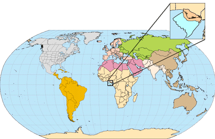
By the U.S. Geological Survey World Energy Project This report was prepared as part of the World Energy Project of the U.S. Geological Surveys Energy Resources Program. The purpose of this effort is to assess the quantities of oil, gas, and natural gas liquids that have the potential to be added to reserves within the next 30 years. These volumes either reside in undiscovered fields whose sizes exceed the minimum-field-size cutoff value (variable, but at least 1 million barrels of oil equivalent), or occur as reserve growth of fields already discovered. To organize, evaluate, and delineate areas to assess, a hierarchical scheme of geographic and geologic units was developed. These are regions, geologic provinces, petroleum systems, and assessment units. In the World Energy Project, regions serve as organizational units and geologic provinces are used as prioritization tools. The project divided the world into eight regions and 937 geologic provinces. Provinces were ranked according to the discovered oil and gas volumes within each (Klett and others, 1997). Seventy-six "priority" provinces (exclusive of the U.S. and chosen for their high ranking) and 26 "boutique" provinces (exclusive of the U.S. and chosen for their anticipated petroleum richness or special regional economic or strategic importance) were selected for appraisal of oil and gas resources. The petroleum geology and assessment results of priority and boutique provinces are described in a series of reports, including the following two chapters. A geologic province is an area having characteristic dimensions of hundreds of kilometers that encompasses a natural geologic entity (for example, sedimentary basin, thrust belt, accreted terrain) or some combination of contiguous geologic entities. Province boundaries were drawn as logically as possible along natural geologic boundaries, although, in some places, their location is based on other factors such as a specific bathymetric depth in open oceans. Petroleum systems and assessment units are delineated within each of the geologic provinces assessed for undiscovered oil and gas. Although the boundaries of petroleum systems and assessment units are usually contained within a geologic province, it is not required. The total petroleum system concept emphasizes the oils that come from a common source (Magoon and Dow, 1994), unlike geologic provinces and plays that emphasize similarities in the rocks and structural characteristics. The mapped area of the petroleum system includes all genetically related petroleum that occurs in shows and accumulations (discovered and undiscovered) generated by a pod of mature source rock. The area also includes the essential geologic elements (i.e. reservoirs, seals, traps, and overburden rocks) that control the fundamental processes of petroleum occurrencegeneration, expulsion, migration, entrapment, and preservation. The "minimum" petroleum system is that part of a petroleum system encompassing discovered shows and accumulations together with the geologic space in which the various essential elements have been proved by these discoveries. An assessment unit is a portion of a petroleum system in which discovered and undiscovered fields constitute a single, relatively homogeneous population1. A petroleum system might equate to a single assessment unit, or, if necessary, may be subdivided into two or more assessment units such that each assessment unit is sufficiently homogeneous in terms of geology, exploration considerations, and risk to assess individually. Heterogeneity cannot be alleviated in all assessment units. In such cases, uniform accumulation density and exploration concepts are not extrapolated across the entire assessment unit. A numeric code identifies each region, province, total
petroleum system, and assessment unit; these codes are uniform throughout
the project and will identify the same item in any of the publications.
The code is as follows:
The codes for the regions and provinces are listed in Klett and others, 1997. Known oil and gas volumes (sum of cumulative production and estimated reserves) quoted in this report are derived from Petroconsultants, Inc. 1996 Petroleum Exploration and Production database (Petroconsultants, 1996) and other area reports from Petroconsultants, Inc., unless otherwise noted. Increases in reported estimated total recoverable volumes are commonly observed from year to year. To address this phenomenon, the U.S. Geological Survey has developed and adopted several "field-growth" models and also uses the U.S. Minerals Management Service model. When applicable, a model is applied to the reported data and the resultant "grown" data, rather than the Petroconsultants "known" data, are used in the assessment process. Figures in this report that show boundaries of the petroleum
system(s), assessment units, and pods of active source rocks were compiled
using geographic information system (GIS) software. Political boundaries
and cartographic representations were taken, with permission, from Environmental
Systems Research Institute's ArcWorld 1:3 million digital coverage (Environmental
Systems Research Institute, 1992). These are not politically definitive
and are displayed for general reference only. Oil and gas field center
points, shown on these figures, are reproduced, with permission, from Petroconsultants
(1996).
1The methodology of our resource assessment is based on the probability of number and size of undiscovered fields and, therefore, is sensitive to the homogeneity of each population being assessed. REFERENCES CITED IN FOREWORD Klett, T. R., Ahlbrandt, T. S., Schmoker, J. W., and Dolton, G. L., 1997, Ranking of the world's oil and gas provinces by known petroleum volumes: U. S. Geological Survey Open-File Report 97-463, CD-Rom. Petroconsultants, 1996, Petroleum exploration and production database: Houston, Texas, Petroconsultants, Inc., [database available from Petroconsultants, Inc., P.O. Box 740619, Houston, TX 77274-0619]. [Return
to Previous Page] [
U. S. Geological Survey Open File Report 99-50H |