| Prev |
| Next |
| Map |
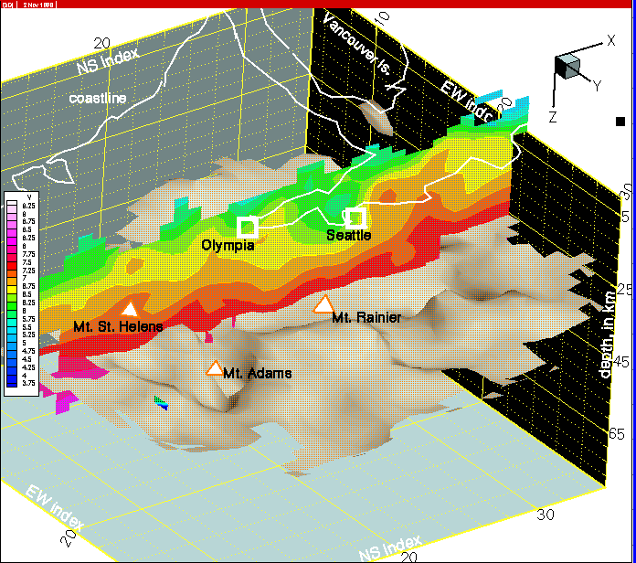
Figure 34--In this cross-section at column 16, the prism sediments are being shoved into a narrower region, confined by the mafic rocks on either side that are undergoing north-south compression.
| wa024.html | col 16 | western Washington tomography | p-wave model | ||||||
|
Figure 34--In this cross-section at column 16, the prism sediments are being shoved into a narrower region, confined by the mafic rocks on either side that are undergoing north-south compression. |
||||||||
Return to:Subduction Zone Dynamics Intro | PACNW | Earthquake Hazards | Central Region | USGS