

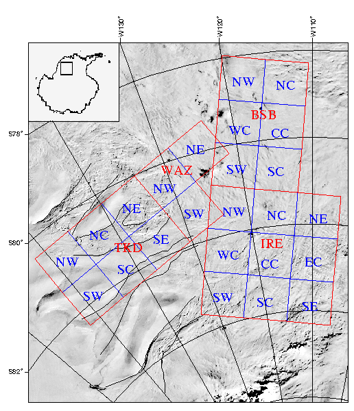
The Central West Antarctica aeromagnetic maps contain data from 5 separate Antarctica field seasons including 4 geographic areas (IRE, BSB, WAZ, TKD). The map shown above [gridname = avhrr_index] is an index to the names and geographic regions of the original surveys. The basemap displays AVHRR (advanced very high resolution radiometer) data from Ferrigno and others (1996). A data table summarizes the survey specifications, including dates flown and original flight elevations. The final data, in both point and grid format, are available to copy using FTP.