![]()
Several products can be downloaded from this web site:
1) Adobe Illustrator® 8.0 File of Map 1. This file is approximately 4.8 Mbytes in size. You must own Adobe Illustrator software to view the file.
2) Adobe Illustrator® 8.0 File of Map 2. This file is approximately 4.9 Mbytes in size. You must own Adobe Illustrator software to view the file.
To download the above files (instead of opening them in your
browser window):
Macintosh: hold down the option key and click with your mouse.
Windows: right click with your mouse.
Both of the above maps include the track-lines as selectable layers.
3) Seismic data, in 16-bit integer SEG-Y format can be downloaded from: ftp://geopubs.wr.usgs.gov/pub/open-file/of00-043/seismic_data/. These files are very large, are require special processing software.
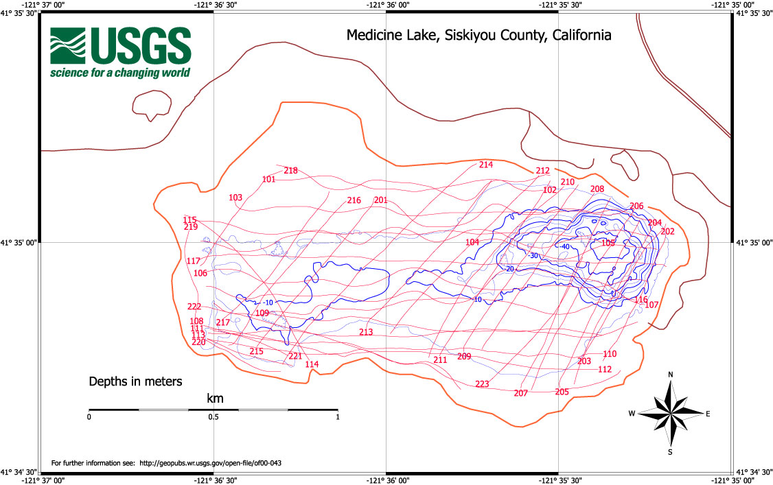
Appendix II lists line parameters such as line name, ping range and plotting direction for the track lines.
Map 3 (Figure B5) shows the relative location of the various track lines.
The ftp site contains the data for all 40 track lines. Files with the suffix .sgy are data files. The letters and numbers preceding the suffix denote the individual track line (e.g., ml104.sgy is trackline 104).
Files with the suffix .tpf provide additional information on the corresponding .sgy file. The first line denotes that each file in SEG-Y format has one 3200-byte EBCDIC file header. The second line shows that each file has one 400-byte binary file header. The EBCDIC and binary headers contain acquisition parameters for the individual dataset. The third line contains the number of traces in the .sgy (SEG-Y format) file and the number of bytes per data trace. The fourth (last) line can be ignored.
ml101-117 are single-channel data.
ml201-223 are two-channel data, as described in the Bathymetric and geophysical program section.