
![]()
Colorado Bouguer Gravity Anomaly Map
![]()
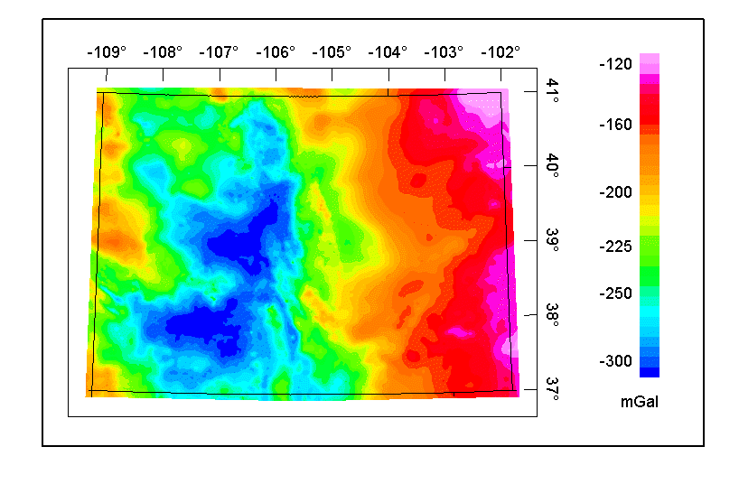
The complete-Bouguer gravity anomaly grid was compiled using data from over 37,000 gravity stations in and adjacent to the state of Colorado. These data were extracted from the gravity data base maintained by the National Geophysical Data Center (from Department of Defense unclassified data) and augmented with data from the USGS and from several university theses and dissertations. Observed gravity relative to the IGSN-71 datum were reduced to the Bouguer anomaly using the 1967 gravity formula and a reduction density of 2.67 g/cc. Terrain corrections were calculated radially outward from each station to a distance of 167 km using a method developed by Plouff (USGS Open-file Report 77-535). The data were converted to a 1-km grid using minimum curvature techniques.
Top || Colorado Mag || Crustal Team || Geology || USGS