
These navigation files cover primarily the shelf area between San Francisco and Point Sur and contain survey tracks, one-minute navigation fixes, and locations of deployed moorings. The cruise designators are of the form IDYYMB, where ID is a letter identifying a research vessel and a sequence number, YY is a 2-digit year; and MB identifies the region Monterey Bay, for example J295MB. Files with 8-character filenames that end in TM (for example, J295MBTM) contain the full tracklines and one-minute navigation points; the matching 6-character file contains a subset of user-defined lines.
These files are part of a geographic information system of spatially referenced data related to the USGS Coastal and Marine Geology Program "Monterey Bay National Marine Sanctuary Project" <http://walrus.wr.usgs.gov/mbms>. The data were collected and analyzed between 1994 and 2000.
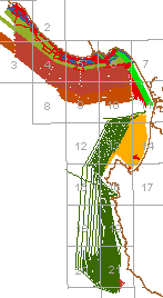
Sidescan sonar and seismic-reflection surveys north of Monterey Canyon
J295MB, J295MBTM Santa Cruz shelf
J695MB, J695MBTM Santa Cruz shelf
M295MB, M295MBTM Santa Cruz shelf
J696MB Half Moon Bay to Santa Cruz
M196MB, M196MBTM Santa Cruz shelf
J197MB Half Moon Bay
J397MB, J397MBTM Santa Cruz to Moss Landing
J398MB, J398MBTM Ano Nuevo to Moss Landing
Sidescan sonar surveys and seismic-reflection south of Monterey Canyon
P195MB Fort Ord
J796MB Santa Cruz to Monterey
A498MB Moss Landing to Point Sur
Other navigation files:
M497MB San Francisco to Monterey Bay Huntec seismic-reflection survey
M195MB Ano Nuevo to Big Sur sampling tracks
P295MB San Francisco to Carmel sampling tracks
M198MB San Francisco to Santa Cruz sampling and photography tracks
J498MB Ano Nuevo coast photograph locations
MOORINGS deployed instrument locations
Survey-specific FGDC-compliant metadata and other information are available at the following URLs:
<http://walrus.wr.usgs.gov/infobank/j/j295mb/html/j-2-95-mb.meta.html>
<http://walrus.wr.usgs.gov/infobank/j/j695mb/html/j-6-95-mb.meta.html>
<http://walrus.wr.usgs.gov/infobank/m/m195mb/html/m-1-95-mb.meta.html>
<http://walrus.wr.usgs.gov/infobank/m/m295mb/html/m-2-95-mb.meta.html>
<http://walrus.wr.usgs.gov/infobank/p/p195mb/html/p-1-95-mb.meta.html>
<http://walrus.wr.usgs.gov/infobank/p/p295mb/html/p-2-95-mb.meta.html>
<http://walrus.wr.usgs.gov/infobank/j/j696mb/html/j-6-96-mb.meta.html>
<http://walrus.wr.usgs.gov/infobank/j/j796mb/html/j-7-96-mb.meta.html>
<http://walrus.wr.usgs.gov/infobank/m/m196mb/html/m-1-96-mb.meta.html>
<http://walrus.wr.usgs.gov/infobank/j/j197mb/html/j-1-97-mb.meta.html>
<http://walrus.wr.usgs.gov/infobank/j/j397mb/html/j-3-97-mb.meta.html>
<http://walrus.wr.usgs.gov/infobank/m/m497mb/html/m-4-97-mb.meta.html>
<http://walrus.wr.usgs.gov/infobank/j/j398mb/html/j-3-98-mb.meta.html>
<http://walrus.wr.usgs.gov/infobank/m/m198mb/html/m-1-98-mb.meta.html>
<http://walrus.wr.usgs.gov/infobank/j/j498mb/html/j-4-98-mb.meta.html>
    or <http://geopubs.wr.usgs.gov/dds/dds-61>
<http://walrus.wr.usgs.gov/infobank/a/a498mb/html/a-4-98-mb.meta.html>
Hamer, Michael R. , and Wong, Florence L. , 2001, Navigation files for 1995-1998 surveys in the Monterey Bay National Marine Sanctuary:.This is part of the following larger work.Online Links:
Wong, F.L., and Eittreim, S.E., 2001, Continental Shelf GIS for the Monterey Bay National Marine Sanctuary: U.S. Geological Survey Open-File Report 01-179, U.S. Geological Survey, Menlo Park, CA.Online Links:
This is a Vector data set.
Planar coordinates are encoded using coordinate pair
Abscissae (x-coordinates) are specified to the nearest 5
Ordinates (y-coordinates) are specified to the nearest 5
Planar coordinates are specified in Meters
The horizontal datum used is North American Datum of 1983.
The ellipsoid used is GRS1980.
The semi-major axis of the ellipsoid used is 6378137.0.
The flattening of the ellipsoid used is 1/298.257.
Details of the navigation parameters are available at <http://walrus.wr.usgs.gov/infobank/programs/html/definition/nav.html>
Boundaries, features, and length of tracklines (km) of the navigation coverages:
              XMIN       YMIN       XMAX       YMAX    FEATURES     LINE-KM
A498MB     -122.13664, 36.23155, -121.82365, 36.78701 lines           1,700
J197MB     -122.57841, 37.29024, -122.40598, 37.50132 lines             327
J295MB     -122.34567, 36.91794, -121.86532, 37.11133 lines             672
J295MBTM   -122.36640, 36.91472, -121.86419, 37.11523 lines, points
J397MB     -122.06802, 36.80131, -121.79468, 36.97624 lines             205
J397MBTM   -122.07135, 36.79752, -121.79458, 36.97753 lines, points
J398MB     -122.33393, 36.60740, -121.81598, 37.11309 lines             321
J398MBTM   -122.33416, 36.60407, -121.81250, 37.11792 lines, points
J498MBPT   -122.32551, 36.94300, -121.96114, 37.11183 points
J695MB     -122.37911, 36.81885, -121.89311, 37.09766 lines             907
J695MBTM   -122.38290, 36.80059, -121.89005, 37.10159 lines, points
J696MB     -122.49697, 36.92893, -121.95194, 37.52513 lines             266
J796MB     -121.96971, 36.62880, -121.77092, 36.94493 lines             180
M195MB     -122.30619, 36.65197, -121.81774, 36.99586 lines             121
M196MB     -122.71619, 36.80176, -121.86237, 37.21343 lines             973
M196MBTM   -122.71883, 36.79684, -121.84750, 37.21914 lines, points
M198MB     -122.68835, 36.84943, -121.89090, 37.85407 lines              54
M295MB     -122.33111, 36.23496, -121.87582, 37.02845 lines             948
M295MBTM   -122.68587, 35.99345, -121.52826, 37.83386 lines, points
M497MB     -122.94892, 36.63824, -121.80785, 37.83312 lines           1,512
MOORINGS   -122.28890, 36.89318, -121.97706, 37.00303 points
P195MB     -121.99488, 36.60580, -121.81926, 36.77666 lines             628
P295MB     -122.91696, 36.52968, -121.76875, 37.81792 lines           1,056
The following are navigation trackline attributes in
the arc attribute table
for all trackline coverages except A498MB:
START_DAPS_TIME navigation time at the start of the trackline in
                YYYYDDDHHMMSSS format where YYYY is year,
                DDD day of the year (1-366), HH hour (0-23),
                MM minutes (0-59), SSS seconds (0-59) and tenths
                of seconds (0-9)
END_DAPS_TIME   navigation time at the end of the trackline in
                YYYYDDDHHMMSSS format
NAV-ID          ArcInfo route number; = 1
START_TIME      navigation time at the start of the trackline
                in seconds of elapsed time from start of cruise
END_TIME        navigation time at the end of the trackline
                in seconds of elapsed time from start of cruise
Other trackline attributes for specific coverages:
LINE NUMBER     identification for trackline segments based on
                user- or instrument-defined
                start- and end-of-lines for J197MB, J295MB, J397MB,
                J398MB, J695MB, M195MB, M196MB, M198MB, M295MB

ID              trackline identification for A498MB
Attributes for one-minute location points in the
point attribute tables of J295MBTM, J397MBTM, J398MBTM,
J695MBTM, M196MBTM, M295MBTM, P195MB:
ELAPSED_TIME         elapsed time (seconds) from start of cruise
CTIME                navigation time in YYYYDDDHHMMSSS format (see above)
LONG_DD              longitude of point (decimal degrees)
LAT_DD               latitude of point (decimal degrees)
LONG_DEG             degree part of longitude (integer degrees)
LONG_MIN             minute part of longitude (decimal minutes)
LAT_DEG              degree part of longitude (integer degrees)
LAT_MIN              minute part of longitude (decimal minutes)
     **  REDEFINED ITEMS  **  /* for labeling
YEAR                 4-character year part of CTIME
DAY                  3-character day part of CTIME
HOUR                 2-character hour part of CTIME
MIN                  2-character minute part of CTIME
SEC                  2-character second part of CTIME
TSEC                 1-character tenths of seconds part of CTIME
Point attributes of locations of MOORINGS deployed by Marlene Noble and
Bruce Jaffe.
LONGITUDE            longitude (decimal degrees)
LATITUDE             latitude (decimal degrees)
ARGOS_ID             identifier #1 for mooring (M. Noble)
BUOY_ID              identifier #2 for mooring (M. Noble)
DEPTH_M              depth of water (meters) for base of mooring
CONTACT              M. Noble (mnoble@usgs.gov) or B. Jaffe (bjaffe@usgs.gov)
Point attributes of J498MBPT locations from which photographs were taken (see also <http://geopubs.wr.usgs.gov/dds/dds-61>).
LONGITUDE:       longitude in decimal degrees from GPS readings or,
                 if ESTIMATE is nonzero, by interpolation
LATITUDE:        latitude in decimal degrees from GPS readings or,
                 if ESTIMATE is nonzero, by interpolation
NAVTIME:         time YYYYDDDHHMMSST year, julian day, hour, minute, seconds,
                    tenths of seconds
HR, MIN, SEC:    hour, minute, and second of photograph by Pacific Standard Time
ESTIMATE:        nonzero if location of point was interpolated
                 when GPS reading was unavailable
DUPL:            = 1 duplicate image
MOVE:            = 1 interpolated location relocated again
ELAPSE_SEC:      elapsed time in seconds from start of survey
ODD:             odd-numbered points flagged for labeling
Florence L. Wong
United States Geological Survey (USGS)
Geologist, GIS Coordinator
USGS, MailStop 999, 345 Middlefield Road
Menlo Park, CA 94025-3561
USA
(650) 329-5327 (voice)
(650) 329-5190 (FAX)
fwong@usgs.gov
These data are intended for science researchers, students, policy makers, and the general public. The data can be used with geographic information systems (GIS) software to display geologic and oceanographic information about the shallower areas of the Monterey Bay National Marine Sanctuary.
Complete
Arc topology present.
Are there legal restrictions on access or use of the data?
- Access_Constraints: None
- Use_Constraints:
- Please recognize the U.S. Geological Survey (USGS) as the source of this information.
Although these data have been used by the U.S. Geological Survey, U.S. Department of the Interior, no warranty expressed or implied is made by the U.S. Geological Survey as to the accuracy of the data.
The act of distribution shall not constitute any such warranty, and no responsibility is assumed by the U.S. Geological Survey in the use of this data, software, or related materials.
This information is not intended for navigational purposes.
Any use of trade, firm, or product names is for descriptive purposes only and does not imply endorsement by the U.S. Government.
United States Geological Survey (USGS)
c/o Florence L. Wong
Geologist, GIS Coordinator
USGS, MailStop 999, 345 Middlefield Road
Menlo Park, CA 94025-3561
USA
(650) 329-5327 (voice)
(650) 329-5190 (FAX)
fwong@usgs.gov
USGS Open-File Report 01-179
Please recognize the U.S. Geological Survey (USGS) as the source of this information.Although these data have been used by the U.S. Geological Survey, U.S. Department of the Interior, no warranty expressed or implied is made by the U.S. Geological Survey as to the accuracy of the data.
Any use of trade, product, or firm names is for descriptive purposes only and does not imply endorsement by the U.S. Government.
The act of distribution shall not constitute any such warranty, and no responsibility is assumed by the U.S. Geological Survey in the use of this data, software, or related materials.
| Data format: | tracklines with attributes in format ArcInfo (version 8.0.2) Size: 27 megabytes |
|---|---|
| Network links: |
<http://geopubs.wr.usgs.gov/open-file/of01-179/> |
United States Geological Survey (USGS)
c/o Florence L. Wong
Geologist, GIS Coordinator
USGS, MailStop 999, 345 Middlefield Road
Menlo Park, CA 94025-3561
USA
(650) 329-5327 (voice)
(650) 329-5190 (FAX)
fwong@usgs.gov