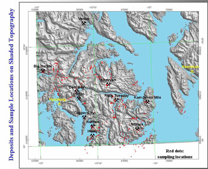
This base map shows the location of the major VMS (?) occurrences that were visited during this past summers field work. The small red dots show the locations of physical property measurements and/or rock samples. Nearly 500 sites were occupied in two weeks. Note the location of the towns of Ketchikan and Hydaburg; Craig is to the northwest off the map.
|
|
|