
U.S. Geological Survey Open-File Report 01-44
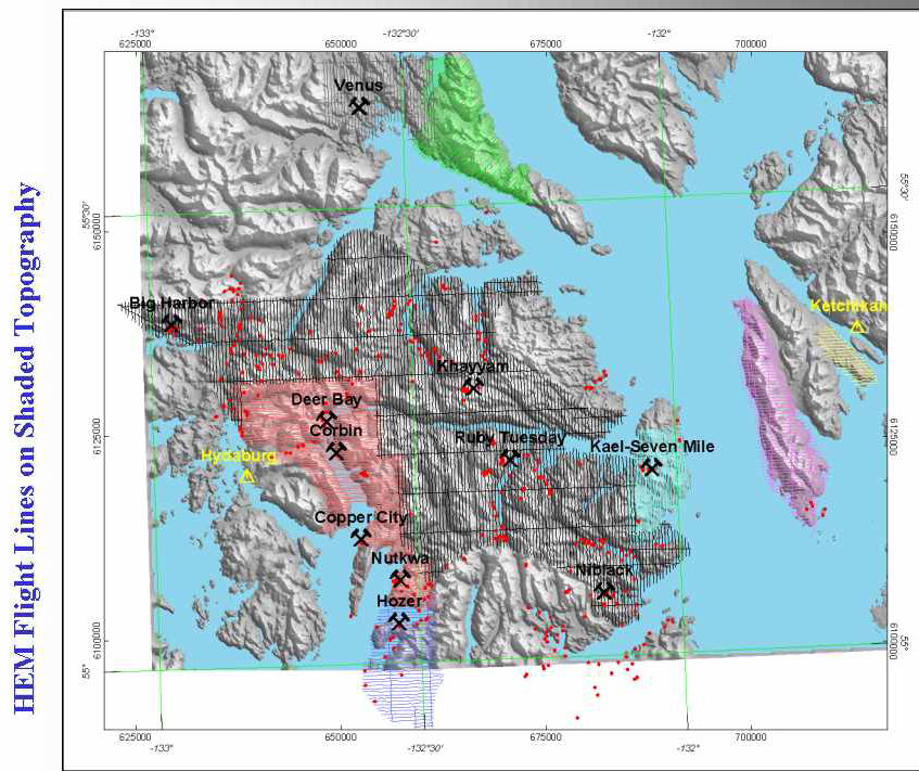
A helicopter electromagnetic and magnetic (HEM) survey was flown in 1999 over areas of Prince of Wales Island (POW) selected to cover significant volcanogenic massive sulfide (VMS) style occurrences. Local villages, Ketchikan Gateway Borough, and the Bureau of Land Management (BLM) provided funding for this work. Previously proprietary HEM surveys donated by Sealaska Native Corporation provide additional coverage. These data were compiled and released in August, 1999 by the Alaska Division of Geological and Geophysical Surveys (DGGS).
- The newer surveys are shown in black, grey, magenta, blue and yellow. The older surveys are depicted in green, coral and cyan.
- The nominal line spacing for the newer surveys was approximately 400 meters (1/4 mile).
- The older surveys were flown at both 400 meter (1/4 mile) and 200 meters (1/8 mile).
- Nominal, coplanar frequencies of 900, 7200 and 56,000 Hz were collected. Coaxial frequencies of 900 and 7200 Hz were also sometimes collected.
- Approximately 7,600 line km (4,700 line miles) were covered on the combined surveys.
U.S. Department of Interior, U.S. Geological Survey
URL: https://pubs.usgs.gov/openfile/of01-44/slide20.html
Contact: Jeff Wynn
Last modified 02.14.01