Link to USGS home page
Coastal and Marine Geology Program
Coastal & Marine Geology Program > Center for Coastal and Watershed Studies > Open File Report 01-303

A Summary of Findings of the West-Central Florida Coastal Studies Project

USGS Open File Report 01-303

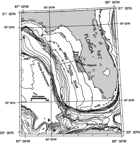
Figure 4. Bathymetric map of west Florida shelf and slope, which drops precipitously into the deep Gulf of Mexico along the Florida Escarpment. The west-central coast of Florida lies at the center of this ancient carbonate platform. The width of this broad shelf and its low gradient are situated on a drowned carbonate ramp.
Bathymetric map of west Florida shelf and slope, which drops precipitously into the deep Gulf of Mexico along the Florida Escarpment.

Coastal & Marine Geology Program > Center for Coastal and Watershed Studies > Open File Report 01-303


[an error occurred while processing this directive]