![]()
New Mexico Aeromagnetic and Gravity Maps and Data:
A Web Site for Distribution of Data
by
Robert P. Kucks, Patricia L. Hill and Charles E. Heywood
Open-File-Report 01-0061
2001
New Mexico Composite Aeromagnetic
Anomaly Map (NW illumination)
at simulated flight altitude of 1000 feet above ground
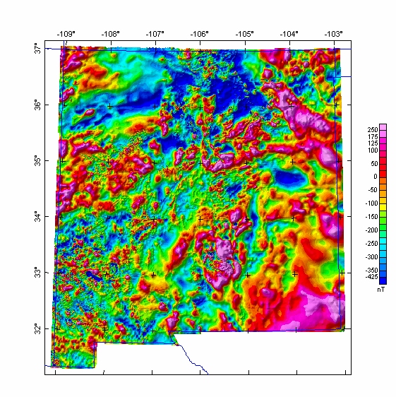
Grids for this map in various formats are available from the data directory as magnm.***

Non-graphical version of this page
Top || New Mexico Mag || Crustal Team || Geology || USGS
U.S. Department of the Interior
U.S. Geological Survey
This page is <URL: https://greenwood.cr.usgs.gov/pub/open-file-reports/ofr-01-0061/html/newmex.htm
Maintained by: Gene Ellis
Last Modified Thursday, 1-3-2001
For more information about this report contact: Bob Kucks