
Debris-flow and flooding hazards associated with the December 1999 storm in coastal Venezuela and strategies for mitigation
Open File Report 01-0144
Wieczorek, G.F., Larsen, M.C., Eaton, L.S., Morgan, B.A. and Blair, J. L.
U.S. Geological Survey
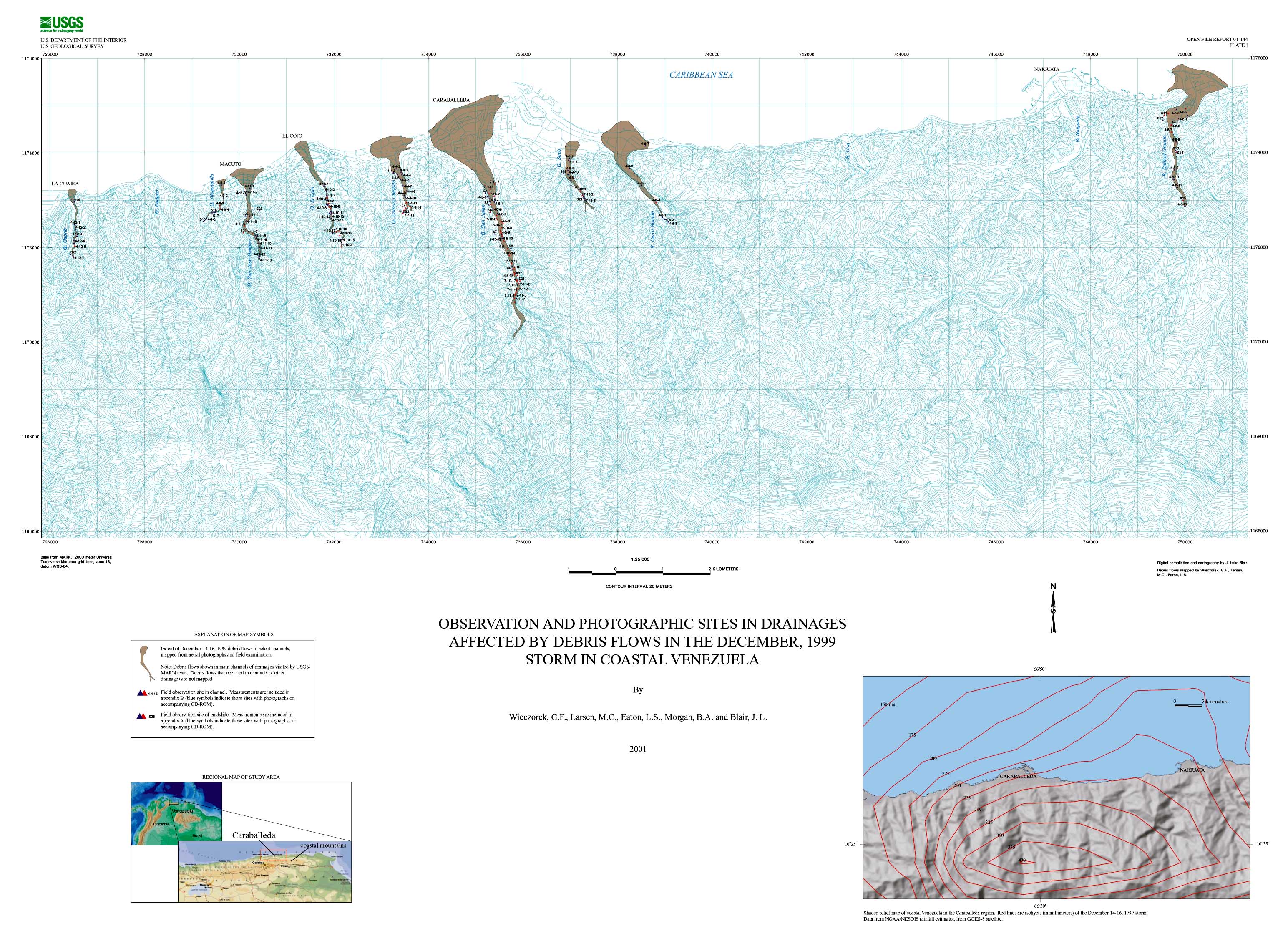
Plate 1. Observation and Photographic Sites in Drainages Affected by Debris Flows in the December, 1999 Storm in Coastal Venezuela