 |
|
|
||||
| OFR 01-0429: World Trade Center USGS Water Sediment Map |
| About USGS / Science Topics / Maps, Products & Publications / Education / FAQ |
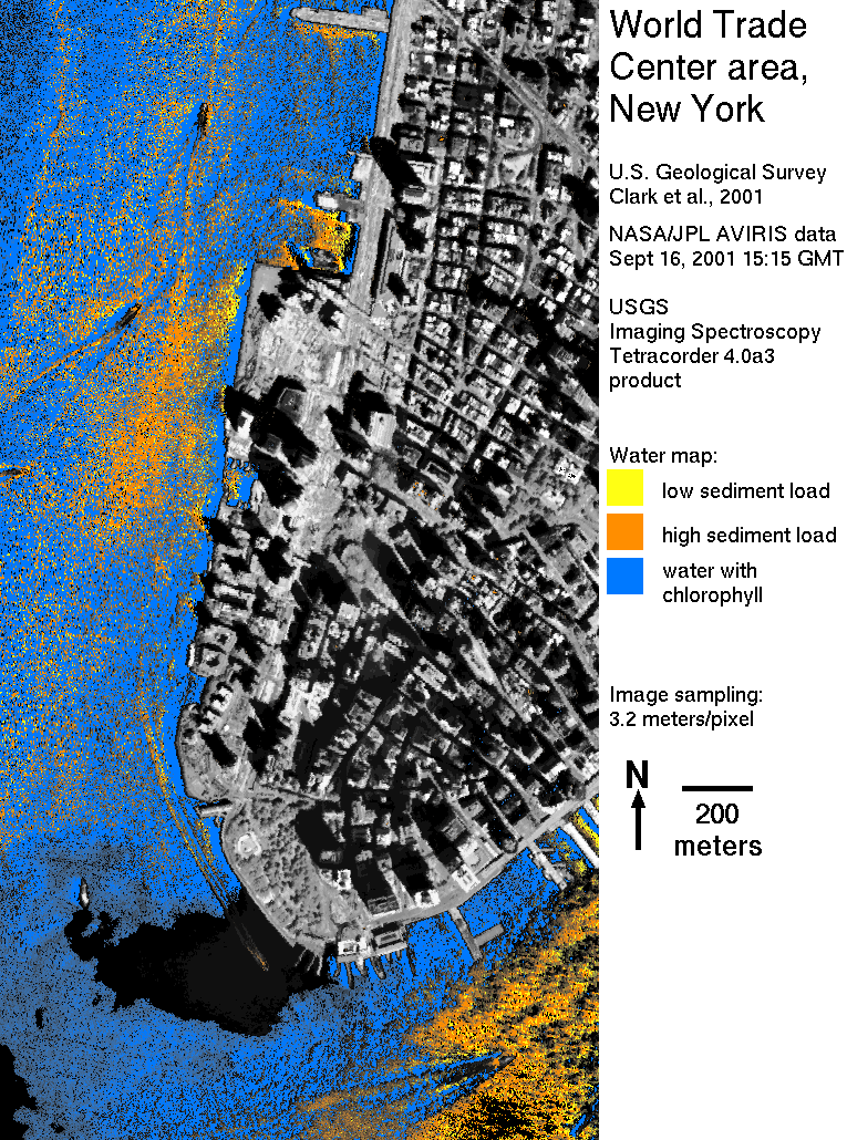
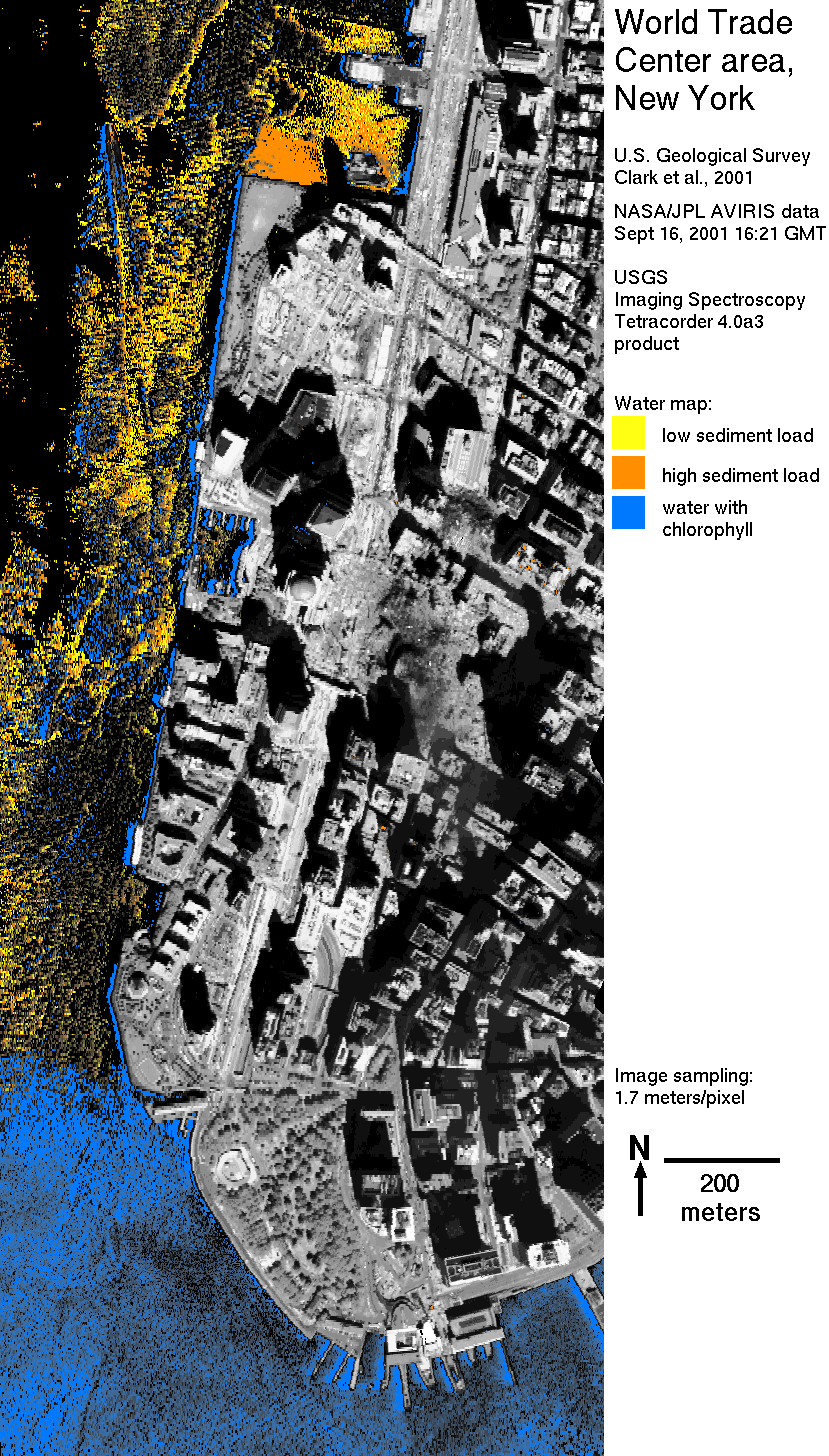
The maps in Water Figures 1, 2, produced by analysis of spectral data from the NASA/JPL Airborne Visible/Infrared Imaging Spectrometer (AVIRIS) instrument, shows sediment in the water next to the World Trade Center. Relative abundances of solids determined for this AVIRIS data set are qualitative because the absorption strengths have not been calibrated to abundance and are shown along with presence of chlorophyll. Water absorption feature shape changes with relative abundance of sediment load. Here, the load has been differentiated as high (orange) and low (yellow) on the map. In regions of lower sediment load, chlorophyll (blue) can be detected. Water mapped as black is either clear water with low chlorophyll or areas where a surface film inhibits seeing into the water.
Waterborne sediment is shown on the map along the eastern shore of the Hudson River and in the East River. Along the Hudson River, sediment is most apparent west of the World Trade Center and alongside piers and docks. Areas with high sediment load are candidates for sampling to determine if such sediments originated from the region of the World Trade Center.
The apparent source region of the sediment occurs where debris from the WTC is being loaded onto barges. Thus, the sediments at this location may be from the WTC.
The black area on the map at the south end of Manhattan Island in the 15:15 GMT data (Water Figure 1) shows high infrared reflectance indicating the presence of a surface film. In the data from 16:21 (Water Figure 2), the surface film is mostly dissipated.
NEXT PAGE of Report: Sample Collection in the WTC Area
Back to document Table of Contents
For further information, contact:
Dr. Roger N. Clark
rclark@usgs.gov
| AccessibilityFOIAPrivacyPolicies and Notices | |
| |
|