 |
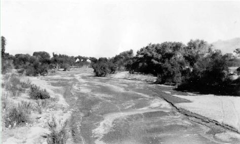
(November 22, 1930). This downstream view, taken from near
the west abutment of the old Congress Street Bridge, shows the
wide alluvial channel of the Santa Cruz River. At this time,
the river flowed through a rural area, and cottonwood trees
lined its banks. The relatively shallow arroyo began downcutting
in 1878, and the 1914 flood of 15,000 ft³/s and 1917 flood
of 7,500 ft³/s caused the most recent channel change before
1930 (photographer and number unknown). |
| |
|
|
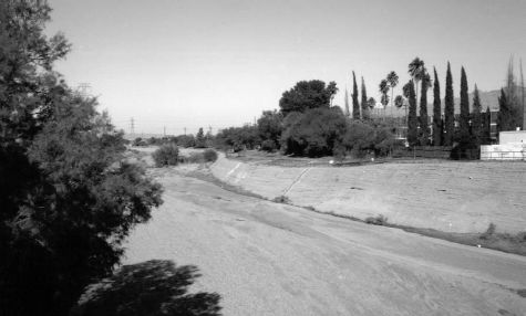
| (December 17, 1994). The channel of the Santa Cruz River is now
confined by soil-cemented banks. The open gallery forest of cottonwood
trees was destroyed by ground-water pumpage and development, and the
channel reached its present depth between 1977 and 1983 (Dominic Oldershaw,
Stake 3300). |
 |
| |
|
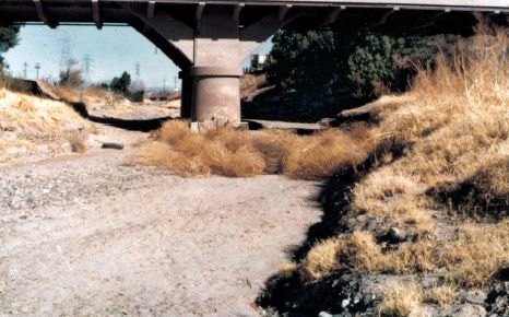 |
(February 3, 1964). This downstream view shows the approach to the
gaging station at the Congress Street Bridge in Tucson. A relatively
small channel became established within the arroyo walls in the middle
part of the 20th century, when few significant floods occurred. Non-native
athel tamarisk, a non-invasive species in Tucson, appear downstream
from the bridge on channel right (photographer and number unknown).
|
| |
|
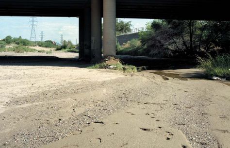
| (August 22, 2000). The bridge was replaced, but its roadway surface
was at about the same elevation as the old one. Channel downcutting,
which primarily occurred during the 1977 and 1983 floods (the latter
had a peak discharge of 52,700 ft³/s), has lowered the bed by
up to 9 feet. Because of persistent problems with lateral channel
change, soil cement now stabilizes the channel banks (Dominic Oldershaw,
Stake 298). |
 |
Next: San Pedro River at Charleston
(09471000)
Previous: Gila River below Blue
Creek (09432000)
Introduction
|
