Open-File Report 02-99
Detailed correlation of
the aeromagnetic survey data with geologic maps at several scales has produced
a wealth of insight into the geologic history and structure of this geologically
very complex area. At least three distinct periods of reversed geomagnetic polarity
from Jurassic to Cenozoic times are required to explain the observed magnetic
anomaly field. Measurements of magnetic susceptibility and remanent polarity
of outcrops were invaluable in sorting out which rocks could explain observed
magnetic anomalies and which are due to buried sources. In several cases the
magnetic anomaly data are able to confidently predict rock unit identities in
areas where they are undifferentiated in the geologic mapping. Several areas
of mineral resource potential have been identified and several areas of interest
for further geological and geophysical studies have been found. For example,
the Gringo Gulch pluton has been shown to both a normally polarized and a reversely
polarized phase and detailed dating studies might accurately date the geomagnetic
field reversal. Detailed study of the Laramide intrusives using the techniques
of magnetic petrology (Clark, 1999) holds promise for evaluation of these rocks
as hosts or sources of ore deposits.
Analysis of trends in the
magnetic anomaly data correlated with mapped faults and boundaries have quantified
major structural directions associated with the major tectonic events in the
geologic history of the study area. In particular, penetrative structures probably
associated with original formation of the crust in the Triassic-Jurassic magmatic
arc event have been identified. These structures are important because they
control loci of subsequent magmatism and mineralization. Further study of these
trends and associations is merited and would yield further insight into geologic
development of this mineral-rich area.
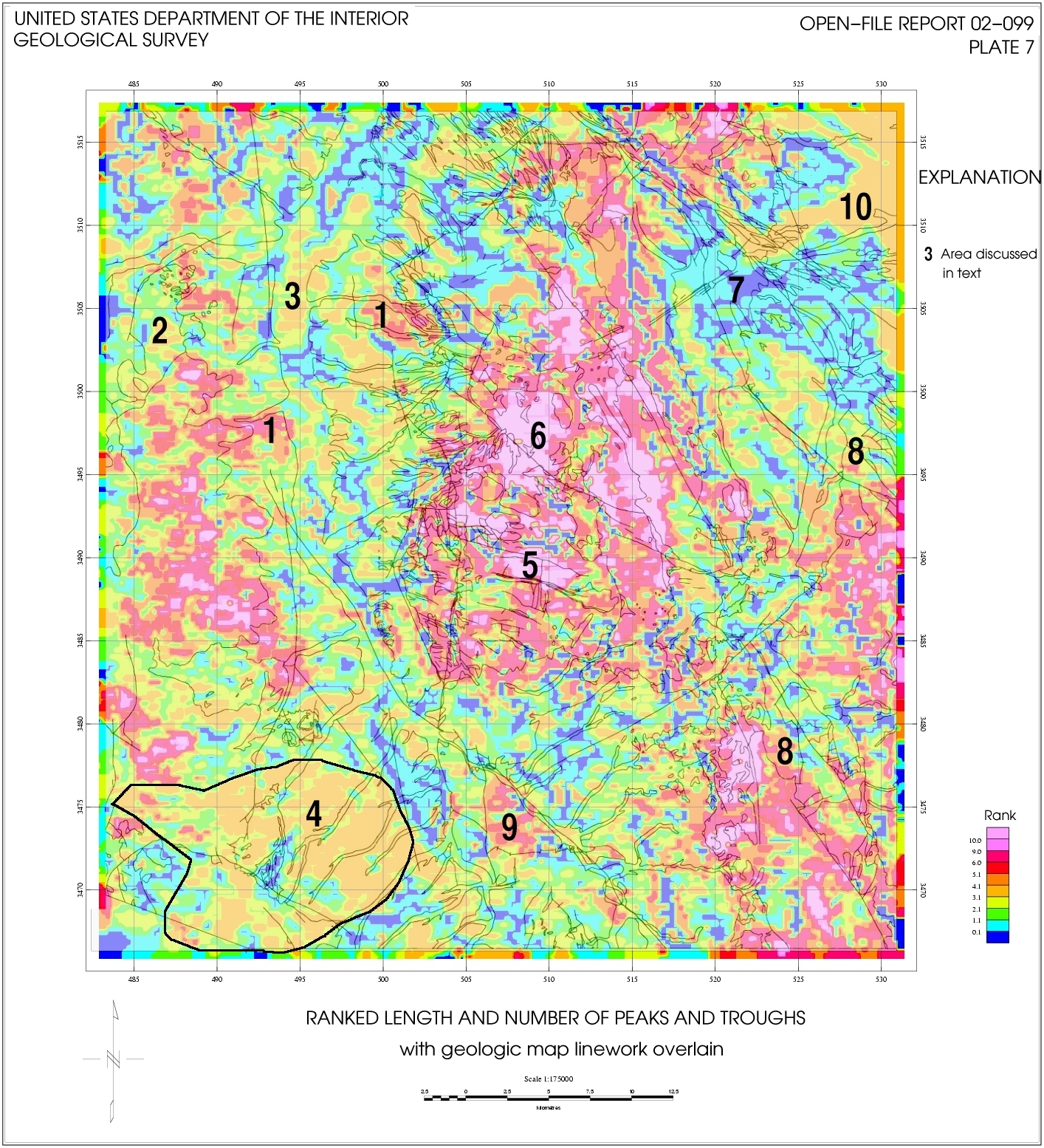
The use of textural measures
in the analysis of the aeromagnetic survey data to infer structure is a useful
procedure because it emphasizes properties that are difficult to see in the
data with traditional representations such as shaded relief images and contour
maps. The measures of number of peaks and troughs per km and Euclidean length
provide filters which allow comparison of texture in areas of large anomalies
with areas of small ones; in traditional displays the large amplitudes dominate
and obscure the areas of smaller anomalies. The process of ranking incorporates
both "roughness" ( number of peaks and troughs/km) and amplitude (Euclidean
length/km) into one image. More research needs to be done on the display of
the ranked values to better show all the information contained in the ranking.
A principal component analysis type of approach and better display schemes (such
as peak/troughs in blue channel and Euclidean length in red channel) should
be investigated in future studies. In addition, it would be desirable to incorporate
some kind of downward continuation correction for deeper sources to make this
a really valuable tool for mapping buried lithology.
By using a window size that
defines the minimum size feature of interest together with the textural measues,
the shallow trends and dominant features in the data are removed and textures
and features of larger areas are displayed. For example, the centers of igneous
activity (mainly Laramide and Tertiary) are well delineated (pl.
7). Trends and textures of underlying older crust that are subtle in the
data because of the dominance of larger features are revealed. Areas of similar
magnetic texture, inferred to represent similar lithology, are mapped until
buried too deeply, even though overlain by younger units of varying magnetic
character and polarity.
Finally, although emphasizing certain aspects of the data, like any other derivative procedure, the textural measures help one to identify the features in the original data itself. If features in the derivative maps cannot be seen in the original data, they may be artifacts of computation rather than expressions of geologic structure.
| Previous Section | Next Section |

![]() U.S. Department of the Interior |
U.S. Geological Survey
U.S. Department of the Interior |
U.S. Geological Survey
URL: http://pubsdata.usgs.gov/pubs/of/2002/0099/conclusion.html
Page Contact Information: GS Pubs Web Contact
Page Last Modified: Wednesday, 07-Dec-2016 19:25:50 EST
