Open-File Report 02-99
The upper Santa Cruz River
Valley is in the southern Basin and Range province of southeastern Arizona and
northern Sonora (Gettings and Houser, 1997). This terrain of alternating fault-bounded
linear mountain ranges and sediment-filled basins began to form at about 17
Ma in southeastern Arizona as the result of dominantly east-northeast/west-southwest
directed crustal extension. The topography of the basins and ranges in this
part of the province has a zigzag northeast and northwest pattern that may be
a result of movement along west-northwest-trending Mesozoic faults that were
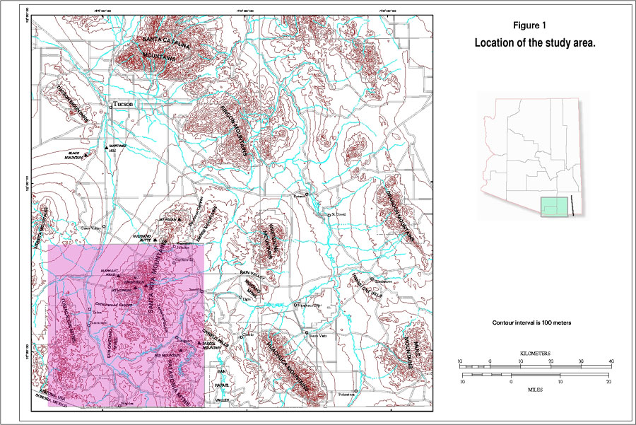
reactivated by the Miocene extension. The Santa Rita, San Cayetano, and Patagonia
Mountains bound the eastern side of the upper Santa Cruz Valley (fig.
1). These mountains are made up of a variety of rocks including igneous,
metamorphic, volcanic, and sedimentary rocks ranging in age from Precambrian
to Miocene (Drewes, 1971, 1972, 1980; Simons, 1974; pl.
1). Mount Wrightson in the Santa Rita Mountains (fig.
1), at 2,881 m, is the highest point in the area.
The Tumacacori and Atascosa Mountains bound the western side of the valley and
are composed chiefly of Tertiary volcanic rocks with the exception of a Jurassic
granitic pluton at the northern end of the Tumacacoris (fig. 1; pl.
1). The Pajarito Mountains at the southern end of the valley west of Nogales
are composed of Cretaceous volcanic rocks (Drewes, 1980). The mountains west
of the valley are considerably lower than those to the east. Sardina Peak in
the Tumacacori Mountains is 1,712 m; Atascosa Peak in the Atascosa Mountains
is 1,957 m.
The sedimentary rocks in
the upper Santa Cruz Valley are Miocene to Holocene, chiefly alluvial sand and
gravel deposits of fans, valley centers, terraces, and channels. On the basis
of age and consolidation, these rocks can be separated into two basin-fill units
overlain by surficial deposits as follows; (1) lower basin-fill unit or Nogales
Formation, probably lower and middle Miocene, and poorly to moderately well
consolidated, (2) upper basin-fill unit, upper Miocene to lower(?) Pleistocene,
and unconsolidated to poorly consolidated, and (3) Pleistocene and Holocene
surficial deposits including alluvium of stream channels, flood plains, and
terraces, unconsolidated overall but locally well indurated. Some volcanic flows
are intercalated with the basin fill, generally at the top of the Nogales Formation
(pl. 1).
The rocks of the study area record a long history of tectonism and magmatism that is described in numerous publications. Dickinson (1989) summarizes the tectonic history of the area at scales appropriate to this study.
| Previous Section | Next Section |

![]() U.S. Department of the Interior |
U.S. Geological Survey
U.S. Department of the Interior |
U.S. Geological Survey
URL: http://pubsdata.usgs.gov/pubs/of/2002/0099/gsetting.html
Page Contact Information: GS Pubs Web Contact
Page Last Modified: Wednesday, 07-Dec-2016 19:25:50 EST
