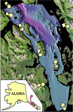

|
View of the entrance to Glacier Bay looking northerly.
The terminus of the Little Ice Age glacier was at this approximate
location in 1794 when Vancouver's exploration discovered the
glacier (see Fig 1; sheet 1).
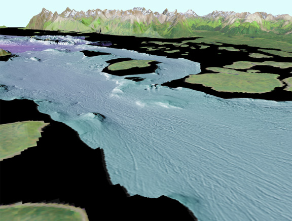
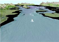
Linear gouges (A) are likely caused by icebergs grounded on
the coarse bottom sediment of Sitakaday Narrows (see Fig
2; sheet 1). The bergs were pushed through the Narrows by
tidal currents that reach speeds up to 7 knots. The distance
across the bottom of the image is about 4.5 km (2.8 miles) with
2x vertical exaggeration.Larger View,
JPEG (143 kb) |
|
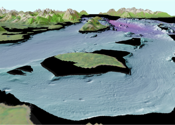
Sitakaday Narrows viewed from southwest to northeast
showing a bedrock knob (A) off Rush Point (B). Iceberg wallow
pits (C) and gouges (Fig1) (D)
show changes in travel path and bottom clearance of icebergs
due to tidal current effects. The wallow pits can be as deep
as 5 m (16 ft), while the gouges can be as deep as 2.5 m (8
ft). Strawberry (E) and Young (F) Islands are east of the Narrows.
The distance across the bottom of the image is about 2.5 km
(1.5 miles) with 2x vertical exaggeration.Larger
View, JPEG (160 kb) |
|
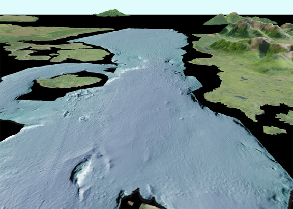
View of Glacier Bay looking northwest over Strawberry
Island (A) and Glacier Bay main passage (B). Iceberg gouges
(C) turn the corner around Strawberry Island and bend southwest
toward the main passage. The distance across the bottom of the
image is about 4.5 km (6.1 miles) with 2x vertical exaggeration.Larger
View, JPEG (154 kb) |

|
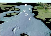
View looking south from over Willoughby Island
toward Sitakaday Narrows (A). The entrance to Glacier Bay at
Icy Strait (B) is in the distance. Iceberg wallow pits can be
seen at (C), while ice gouges (D) extend south through and beyond
Sitakaday Narrows. A bedrock knob (E) on the west side of the
Narrows shoals to about 6 m (20 ft). Strawberry (F) and Young
(G) Islands are on the east side of the Narrows. The distance
across the bottom of the image is about 5 km (3.1 miles) with
2x vertical exaggeration.Larger View,
JPEG (136 kb) |

|
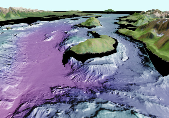
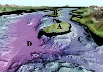
View looking northwest over North (A) and South
(B) Marble Islands. These islands are part of a bedrock high
(C) that runs northwest to southeast within Glacier Bay. Glacier
Bay main passage (D) is to the west of the bedrock high, while
Beartrack Cove deep (E) is to the east. The opening to the north
(F) is the entrance to the West Arm of Glacier Bay (see Fig
1; sheet 1). The distance across the bottom of the image
is about 3.5 km (2.2 miles) with 2x vertical exaggeration. Larger
View, JPEG (165 kb) |

|
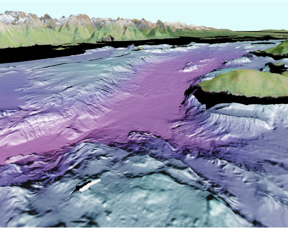
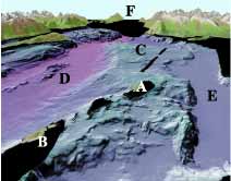
View looking southeast down the main part of
Glacier Bay. The two islands in the center are Drake (A) and
Willoughby (B) Islands. Whidbey Passage (C) runs between Drake
Island and the mainland and extends south along Willoughby Island.
The Main Passage (D) runs east of Drake Island. Whidbey Passage
is a glacially carved passage that varies in water depth from
95 m to 170 m (310 ft to 560 ft) along its axis, while the main
passage varies in water depth from 250 m to 350 m (820 ft to
1150 ft) along its axis in this image. A glacier terminus was
located near Willoughby Island in the mid 1800's (see Fig 1; sheet 1). The distance across the bottom of the image
is about 5 km (3.1 miles) with 2x vertical exaggeration. Larger
View, JPEG (155 kb)
|

|
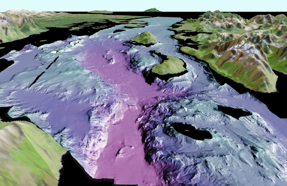
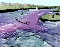
View looking easterly from the West Arm of Glacier
Bay. A bedrock high (A) extends northwest from the Marble Islands
(B). The slope at C to C' drops from about 100 m to 325 m (328
ft to 1070 ft). A part of Drake Island (D) marks the west side
of the main passage. The distance across the bottom of the image
is about 3.3 km (2.0 miles) with 2x vertical exaggeration. Larger
View, JPEG (178 kb) |


|
View looking south from the entrance of West Arm
of Glacier Bay. The two prominent bedrock highs in the foreground
are Geike Rock (A) and Lone Island (B). The two islands toward
the south are Drake (C) and Willoughby (D) Islands. The terminus
of the Little Ice Age glacier was at the approximate location
of (E) in the 1860's (see Fig 1:
sheet 1). The distance across the bottom of the image is about
10 km (6.2 miles) with 2x vertical exaggeration. Larger
View, JPEG (168 kb) |